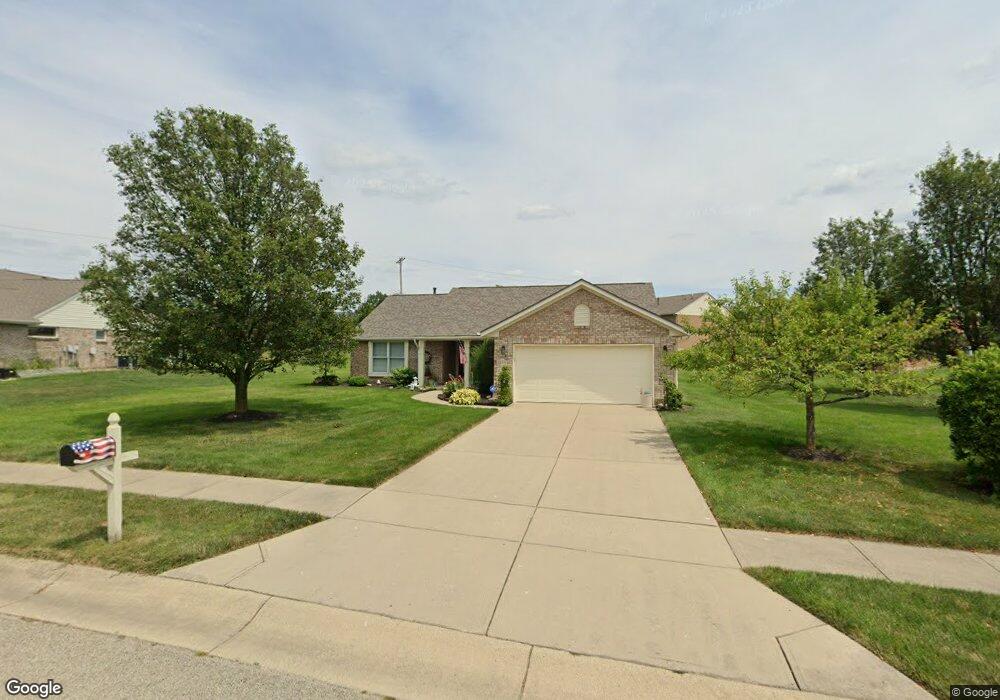
1835 Hambletonian Ct Miamisburg, OH 45342
Estimated Value: $292,476 - $375,000
3
Beds
2
Baths
1,605
Sq Ft
$201/Sq Ft
Est. Value
About This Home
This home is located at 1835 Hambletonian Ct, Miamisburg, OH 45342 and is currently estimated at $322,619, approximately $201 per square foot. 1835 Hambletonian Ct is a home located in Montgomery County with nearby schools including Miamisburg High School and Bethel Baptist School.
Ownership History
Date
Name
Owned For
Owner Type
Purchase Details
Closed on
Dec 18, 2012
Sold by
Gilkison Anna M
Bought by
Berning Michele A
Current Estimated Value
Purchase Details
Closed on
May 17, 2002
Sold by
Brandonhall Development Inc
Bought by
Gilkison Anna M
Home Financials for this Owner
Home Financials are based on the most recent Mortgage that was taken out on this home.
Original Mortgage
$38,600
Interest Rate
7%
Mortgage Type
Purchase Money Mortgage
Create a Home Valuation Report for This Property
The Home Valuation Report is an in-depth analysis detailing your home's value as well as a comparison with similar homes in the area
Home Values in the Area
Average Home Value in this Area
Purchase History
| Date | Buyer | Sale Price | Title Company |
|---|---|---|---|
| Berning Michele A | -- | None Available | |
| Gilkison Anna M | $158,800 | -- |
Source: Public Records
Mortgage History
| Date | Status | Borrower | Loan Amount |
|---|---|---|---|
| Previous Owner | Gilkison Anna M | $38,600 |
Source: Public Records
Tax History Compared to Growth
Tax History
| Year | Tax Paid | Tax Assessment Tax Assessment Total Assessment is a certain percentage of the fair market value that is determined by local assessors to be the total taxable value of land and additions on the property. | Land | Improvement |
|---|---|---|---|---|
| 2024 | $4,244 | $76,010 | $12,810 | $63,200 |
| 2023 | $4,244 | $76,010 | $12,810 | $63,200 |
| 2022 | $4,035 | $62,300 | $10,500 | $51,800 |
| 2021 | $3,568 | $62,300 | $10,500 | $51,800 |
| 2020 | $3,560 | $62,300 | $10,500 | $51,800 |
| 2019 | $3,627 | $58,810 | $10,500 | $48,310 |
| 2018 | $3,639 | $58,810 | $10,500 | $48,310 |
| 2017 | $3,592 | $58,810 | $10,500 | $48,310 |
| 2016 | $2,760 | $45,820 | $10,500 | $35,320 |
| 2015 | $2,705 | $45,820 | $10,500 | $35,320 |
| 2014 | $2,705 | $45,820 | $10,500 | $35,320 |
| 2012 | -- | $50,090 | $12,250 | $37,840 |
Source: Public Records
Map
Nearby Homes
- 00 Benner Rd
- 1734 Rosina Dr
- 2127 Carrington Ln
- 2141 Rosina Dr
- 1157 Bonniebrook Dr
- 736 Decker Dr
- 1035 Woods View Ct
- 712 Decker Dr
- 1 Pendle Point
- 1808 Burnside Dr
- 902 Althea Dr
- 628 Jamestown Dr
- 2279 Rosina Dr
- 1013 S Heincke Rd
- 807 Dunaway St
- 1045 S Linden Ave
- 1984 Cruden Bay Way
- 766 Dunaway St
- 2054 Prestwick Bend
- Hudson Plan at Deer Valley
- 1829 Hambletonian Ct
- 1337 Rosalind Dr
- 1327 Rosalind Dr
- 1823 Hambletonian Ct
- 1840 Hambletonian Ct
- 1822 Hambletonian Ct
- 1846 Hambletonian Ct
- 1297 Rosalind Dr
- 1286 Starting Gate Ct
- 1817 Hambletonian Ct
- 1853 Hambletonian Ct
- 1296 Starting Gate Ct
- 1852 Hambletonian Ct
- 1314 Rosalind Dr
- 1304 Rosalind Dr
- 1324 Rosalind Dr
- 1620 Brandonhall Dr
- 1628 Brandonhall Dr
- 1276 Starting Gate Ct
- 1838 Sulky Trail