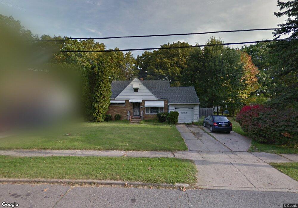
1835 Pontiac Dr Euclid, OH 44117
Estimated Value: $203,000 - $242,000
2
Beds
1
Bath
1,488
Sq Ft
$152/Sq Ft
Est. Value
About This Home
This home is located at 1835 Pontiac Dr, Euclid, OH 44117 and is currently estimated at $225,601, approximately $151 per square foot. 1835 Pontiac Dr is a home located in Cuyahoga County with nearby schools including Bluestone Elementary School, Euclid Middle School, and Euclid High School.
Ownership History
Date
Name
Owned For
Owner Type
Purchase Details
Closed on
Apr 17, 2018
Sold by
Barber Cecelia J and Third Fedreal Savings Fund Loa
Bought by
Mjb Invetmnts Poperties Llc
Current Estimated Value
Purchase Details
Closed on
Aug 4, 1995
Sold by
Weems Robert E
Bought by
Barber Cecelia J and Barber Victoria D
Home Financials for this Owner
Home Financials are based on the most recent Mortgage that was taken out on this home.
Original Mortgage
$84,000
Interest Rate
7.56%
Mortgage Type
New Conventional
Purchase Details
Closed on
Jul 13, 1988
Sold by
Goryanes Paul E and Goryanes Stephaye J
Bought by
Weems Robert E
Purchase Details
Closed on
Jan 24, 1983
Sold by
Goryanes Paul E and Goryanes Stephanye J
Bought by
Goryanes Paul E and Goryanes Stephaye J
Purchase Details
Closed on
Jan 1, 1975
Bought by
Goryanes Paul E and Goryanes Stephanye J
Create a Home Valuation Report for This Property
The Home Valuation Report is an in-depth analysis detailing your home's value as well as a comparison with similar homes in the area
Home Values in the Area
Average Home Value in this Area
Purchase History
| Date | Buyer | Sale Price | Title Company |
|---|---|---|---|
| Mjb Invetmnts Poperties Llc | $59,000 | None Available | |
| Barber Cecelia J | $93,500 | -- | |
| Weems Robert E | $67,000 | -- | |
| Goryanes Paul E | -- | -- | |
| Goryanes Paul E | -- | -- |
Source: Public Records
Mortgage History
| Date | Status | Borrower | Loan Amount |
|---|---|---|---|
| Previous Owner | Barber Cecelia J | $84,000 |
Source: Public Records
Tax History Compared to Growth
Tax History
| Year | Tax Paid | Tax Assessment Tax Assessment Total Assessment is a certain percentage of the fair market value that is determined by local assessors to be the total taxable value of land and additions on the property. | Land | Improvement |
|---|---|---|---|---|
| 2024 | $3,503 | $50,085 | $9,940 | $40,145 |
| 2023 | $3,360 | $38,370 | $8,720 | $29,650 |
| 2022 | $3,284 | $38,360 | $8,720 | $29,650 |
| 2021 | $3,665 | $38,360 | $8,720 | $29,650 |
| 2020 | $3,476 | $33,080 | $7,530 | $25,550 |
| 2019 | $3,134 | $94,500 | $21,500 | $73,000 |
| 2018 | $2,224 | $33,080 | $7,530 | $25,550 |
| 2017 | $2,309 | $28,950 | $5,460 | $23,490 |
| 2016 | $2,314 | $28,950 | $5,460 | $23,490 |
| 2015 | $2,109 | $28,950 | $5,460 | $23,490 |
| 2014 | $2,109 | $28,950 | $5,460 | $23,490 |
Source: Public Records
Map
Nearby Homes
- 1721 Grand Blvd
- 1860 Glenridge Rd
- 19871 Upper Valley Dr
- 2150 Glenridge Rd
- 24 Washington Square
- 19201 Shawnee Rd
- 19201 Genesee Rd
- 209 Greenbriar Ct
- 1524 E 204th St
- 237 Greenbriar Ct Unit F237
- 1477 E 195th St
- 2010 E 221st St
- 22601 Harms Rd
- 1777 Catalpa Rd
- 2075 E 226th St
- 2441 Malden Rd
- 22261 Chardon Rd
- 1707 Catalpa Rd
- 1563 Clermont Rd
- 1517 Larchmont Rd
- 1829 Pontiac Dr
- 1874 Buena Vista Dr
- 1825 Pontiac Dr
- 2070 Glenridge Rd
- 2066 Glenridge Rd
- 1797 Karen Dr
- 1870 Buena Vista Dr
- 1900 Grand Blvd
- 1819 Pontiac Dr
- 1864 Buena Vista Dr
- 2060 Glenridge Rd
- 1799 Karen Dr
- 2076 Glenridge Rd
- 1904 Grand Blvd
- 1815 Pontiac Dr
- 1860 Grand Blvd
- 1910 Grand Blvd
- 1854 Buena Vista Dr
- 1801 Karen Dr
- 1840 Grand Blvd