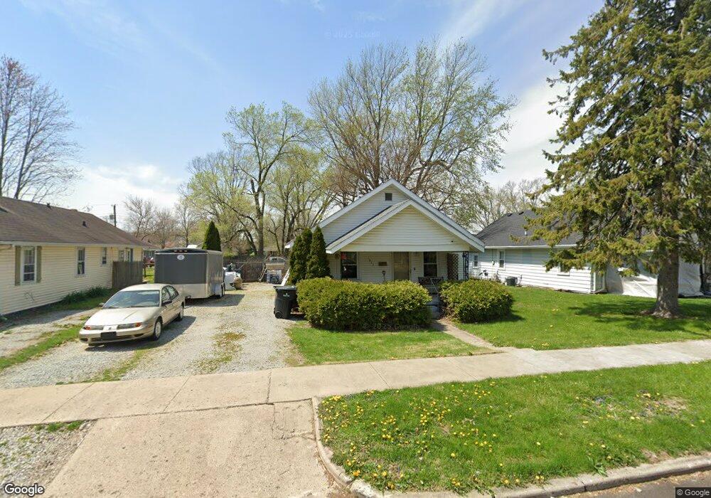
1835 Poplar St Anderson, IN 46012
Estimated Value: $110,000 - $124,000
3
Beds
1
Bath
980
Sq Ft
$119/Sq Ft
Est. Value
About This Home
This home is located at 1835 Poplar St, Anderson, IN 46012 and is currently estimated at $116,915, approximately $119 per square foot. 1835 Poplar St is a home located in Madison County with nearby schools including Eastside Elementary School, Highland Middle School, and Anderson High School.
Ownership History
Date
Name
Owned For
Owner Type
Purchase Details
Closed on
Mar 31, 2005
Sold by
Bank Of New York
Bought by
Ritchhart Clifford E and Ritchhart Wildena C
Current Estimated Value
Home Financials for this Owner
Home Financials are based on the most recent Mortgage that was taken out on this home.
Original Mortgage
$31,500
Outstanding Balance
$16,336
Interest Rate
6.06%
Mortgage Type
New Conventional
Estimated Equity
$100,579
Purchase Details
Closed on
Sep 24, 2004
Sold by
Mccormack Diana M and Piercy Debra Lynn
Bought by
The Bank Of New York
Create a Home Valuation Report for This Property
The Home Valuation Report is an in-depth analysis detailing your home's value as well as a comparison with similar homes in the area
Home Values in the Area
Average Home Value in this Area
Purchase History
| Date | Buyer | Sale Price | Title Company |
|---|---|---|---|
| Ritchhart Clifford E | -- | -- | |
| The Bank Of New York | $47,500 | -- |
Source: Public Records
Mortgage History
| Date | Status | Borrower | Loan Amount |
|---|---|---|---|
| Open | Ritchhart Clifford E | $31,500 |
Source: Public Records
Tax History Compared to Growth
Tax History
| Year | Tax Paid | Tax Assessment Tax Assessment Total Assessment is a certain percentage of the fair market value that is determined by local assessors to be the total taxable value of land and additions on the property. | Land | Improvement |
|---|---|---|---|---|
| 2024 | $1,818 | $81,800 | $9,700 | $72,100 |
| 2023 | $1,676 | $74,700 | $9,200 | $65,500 |
| 2022 | $1,658 | $74,100 | $8,700 | $65,400 |
| 2021 | $1,528 | $67,900 | $8,700 | $59,200 |
| 2020 | $1,459 | $64,600 | $8,300 | $56,300 |
| 2019 | $1,425 | $63,000 | $8,300 | $54,700 |
| 2018 | $1,339 | $58,000 | $8,300 | $49,700 |
| 2017 | $1,140 | $57,000 | $8,300 | $48,700 |
| 2016 | $1,140 | $57,000 | $8,300 | $48,700 |
| 2014 | $1,274 | $63,700 | $8,300 | $55,400 |
| 2013 | $1,274 | $63,700 | $8,300 | $55,400 |
Source: Public Records
Map
Nearby Homes
- 2003 Crystal St
- 2030 Broadway St
- 229 E Mulberry St
- 2132 Poplar St
- 1611 Poplar St
- 2125 State St
- 2334 Poplar St
- 2413 Silver St
- 718 Hawthorne Ave
- 143 E School St
- 1907 Lowell Ave
- 1820 Whittier Ave
- 227 Beech St
- 305 Mohawk St
- 0 W North St
- 917 Hickory St
- 212 Clifford St
- 2717 Apache Dr
- 721 Indiana Ave
- 2722 Dakota Dr
- 1831 Poplar St
- 1839 Poplar St
- 1823 Poplar St
- 1819 Poplar St
- 1834 Broadway St
- 1901 Poplar St
- 1824 Broadway St
- 1834 Poplar St
- 1815 Poplar St
- 1830 Poplar St
- 1838 Poplar St
- 1905 Poplar St
- 1824 Poplar St
- 1814 Broadway St
- 1902 Poplar St
- 20 E Pine St
- 1900 Broadway St Unit B
- 1900 Broadway St
- 1820 Poplar St
- 1910 Broadway St