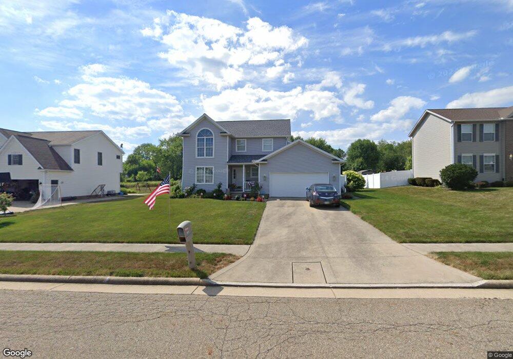
1835 Vantage Dr Louisville, OH 44641
Estimated Value: $315,766 - $327,000
3
Beds
3
Baths
1,796
Sq Ft
$179/Sq Ft
Est. Value
About This Home
This home is located at 1835 Vantage Dr, Louisville, OH 44641 and is currently estimated at $321,692, approximately $179 per square foot. 1835 Vantage Dr is a home located in Stark County with nearby schools including Louisville High School and St. Thomas Aquinas High School & Middle School.
Ownership History
Date
Name
Owned For
Owner Type
Purchase Details
Closed on
May 12, 2011
Sold by
Burgess Robert L
Bought by
Burgess Robert L and The Robert L Burgess Revocable Trust
Current Estimated Value
Purchase Details
Closed on
Jun 29, 2004
Sold by
21St Homes Inc
Bought by
Burgess Robert L
Home Financials for this Owner
Home Financials are based on the most recent Mortgage that was taken out on this home.
Original Mortgage
$135,920
Interest Rate
5.12%
Mortgage Type
Purchase Money Mortgage
Purchase Details
Closed on
Jan 27, 2004
Sold by
Alpine Design & Development Corp
Bought by
21St Homes Inc
Home Financials for this Owner
Home Financials are based on the most recent Mortgage that was taken out on this home.
Original Mortgage
$140,250
Interest Rate
5.91%
Mortgage Type
Construction
Purchase Details
Closed on
Dec 12, 2003
Sold by
C & M Development Inc
Bought by
Alpine Design & Development Corp
Home Financials for this Owner
Home Financials are based on the most recent Mortgage that was taken out on this home.
Original Mortgage
$140,250
Interest Rate
5.91%
Mortgage Type
Construction
Create a Home Valuation Report for This Property
The Home Valuation Report is an in-depth analysis detailing your home's value as well as a comparison with similar homes in the area
Home Values in the Area
Average Home Value in this Area
Purchase History
| Date | Buyer | Sale Price | Title Company |
|---|---|---|---|
| Burgess Robert L | -- | Attorney | |
| Burgess Robert L | $169,900 | -- | |
| 21St Homes Inc | -- | -- | |
| Alpine Design & Development Corp | $1,610,000 | Land America/Lawyers Title |
Source: Public Records
Mortgage History
| Date | Status | Borrower | Loan Amount |
|---|---|---|---|
| Previous Owner | Burgess Robert L | $135,920 | |
| Previous Owner | 21St Homes Inc | $140,250 | |
| Previous Owner | Alpine Design & Development Corp | $1,610,000 |
Source: Public Records
Tax History Compared to Growth
Tax History
| Year | Tax Paid | Tax Assessment Tax Assessment Total Assessment is a certain percentage of the fair market value that is determined by local assessors to be the total taxable value of land and additions on the property. | Land | Improvement |
|---|---|---|---|---|
| 2025 | -- | $102,210 | $16,770 | $85,440 |
| 2024 | -- | $102,210 | $16,770 | $85,440 |
| 2023 | $2,714 | $63,150 | $12,850 | $50,300 |
| 2022 | $1,360 | $63,150 | $12,850 | $50,300 |
| 2021 | $2,727 | $63,150 | $12,850 | $50,300 |
| 2020 | $2,299 | $57,830 | $11,590 | $46,240 |
| 2019 | $2,309 | $59,890 | $11,590 | $48,300 |
| 2018 | $2,382 | $59,890 | $11,590 | $48,300 |
| 2017 | $2,026 | $49,150 | $7,460 | $41,690 |
| 2016 | $2,068 | $49,150 | $7,460 | $41,690 |
| 2015 | $2,074 | $49,150 | $7,460 | $41,690 |
| 2014 | $369 | $52,220 | $7,910 | $44,310 |
| 2013 | $1,188 | $52,220 | $7,910 | $44,310 |
Source: Public Records
Map
Nearby Homes
- 1702 View Pointe Ave
- 1639 Horizon Dr
- 908 Sand Lot Cir
- 822 Sand Lot Cir
- 6969 Georgetown St NE
- 510 S Bauman Ct
- 204 E Broad St
- 107 E Broad St
- 728 E Broad St
- 520 S Silver St
- 641 S Nickelplate St
- 2425 Miday Ave NE
- 201 Indiana Ave
- 8225 Georgetown St
- 4060 Hambleton Ave NE
- 308 Superior St
- 248 Menegay Rd
- 325 Lincoln Ave
- 6416 15th St NE
- 1715 High St
- 1845 Vantage Dr
- 1828 Vantage Dr
- 1825 Vantage Dr
- 9999 Chadsworth St NE
- 1805 Vantage Dr
- 1855 Vantage Dr
- 571 Chadsworth St
- 1808 Vantage Dr
- 0 Vantage Dr NE Unit 3948724
- 574 Chadsworth St
- 1865 Vantage Dr
- 1755 Vantage Dr
- 549 Chadsworth St
- 512 Declaration Ct
- 562 Chadsworth St
- 715 Overlook St
- 552 Chadsworth Ct
- 534 Chadsworth St
- 509 Declaration Ct
- 1984 Liberty Dr NE