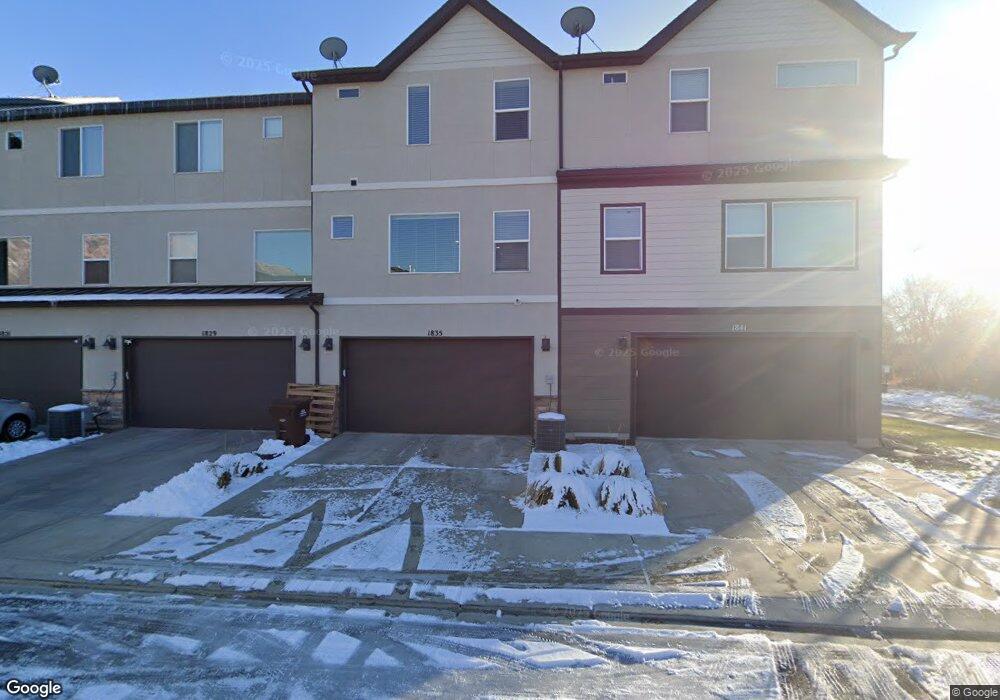
1835 W 20 N Pleasant Grove, UT 84062
Estimated Value: $444,000 - $507,000
4
Beds
3
Baths
2,036
Sq Ft
$228/Sq Ft
Est. Value
About This Home
This home is located at 1835 W 20 N, Pleasant Grove, UT 84062 and is currently estimated at $465,123, approximately $228 per square foot. 1835 W 20 N is a home located in Utah County with nearby schools including Barratt Elementary School, American Fork Junior High School, and American Fork High School.
Ownership History
Date
Name
Owned For
Owner Type
Purchase Details
Closed on
Apr 6, 2022
Sold by
Dayton Michael and Dayton Mckenna
Bought by
Anderson Cole Robert and Anderson Halley Jo
Current Estimated Value
Home Financials for this Owner
Home Financials are based on the most recent Mortgage that was taken out on this home.
Original Mortgage
$378,400
Outstanding Balance
$354,063
Interest Rate
3.89%
Mortgage Type
Balloon
Estimated Equity
$111,060
Purchase Details
Closed on
Oct 20, 2016
Sold by
Dayton Mike
Bought by
Dayton Michael and Dayton Mckenna
Home Financials for this Owner
Home Financials are based on the most recent Mortgage that was taken out on this home.
Original Mortgage
$210,600
Interest Rate
3.5%
Mortgage Type
New Conventional
Purchase Details
Closed on
Jul 14, 2014
Sold by
D R Horton Inc
Bought by
Dayton Mike
Home Financials for this Owner
Home Financials are based on the most recent Mortgage that was taken out on this home.
Original Mortgage
$219,179
Interest Rate
4.07%
Mortgage Type
New Conventional
Create a Home Valuation Report for This Property
The Home Valuation Report is an in-depth analysis detailing your home's value as well as a comparison with similar homes in the area
Home Values in the Area
Average Home Value in this Area
Purchase History
| Date | Buyer | Sale Price | Title Company |
|---|---|---|---|
| Anderson Cole Robert | -- | Truly Title | |
| Dayton Michael | -- | None Available | |
| Dayton Mike | -- | Provo Land Title Co |
Source: Public Records
Mortgage History
| Date | Status | Borrower | Loan Amount |
|---|---|---|---|
| Open | Anderson Cole Robert | $378,400 | |
| Previous Owner | Dayton Michael | $210,600 | |
| Previous Owner | Dayton Mike | $219,179 |
Source: Public Records
Tax History Compared to Growth
Tax History
| Year | Tax Paid | Tax Assessment Tax Assessment Total Assessment is a certain percentage of the fair market value that is determined by local assessors to be the total taxable value of land and additions on the property. | Land | Improvement |
|---|---|---|---|---|
| 2025 | $2,027 | $235,730 | $63,000 | $365,600 |
| 2024 | $2,027 | $241,340 | $0 | $0 |
| 2023 | $1,776 | $217,030 | $0 | $0 |
| 2022 | $1,926 | $234,190 | $0 | $0 |
| 2021 | $1,659 | $307,100 | $46,100 | $261,000 |
| 2020 | $1,538 | $279,100 | $41,900 | $237,200 |
| 2019 | $1,487 | $279,100 | $41,900 | $237,200 |
| 2018 | $1,381 | $245,100 | $36,800 | $208,300 |
| 2017 | $1,339 | $126,500 | $0 | $0 |
| 2016 | $1,387 | $126,500 | $0 | $0 |
| 2015 | $1,465 | $126,500 | $0 | $0 |
Source: Public Records
Map
Nearby Homes
- 29 S 2000 W
- 1795 W 120 S Unit 52
- 1775 W 120 S Unit 54
- The Hastings Plan at Tayside Farm - Townhome
- The Henley A Plan at Tayside Farm - Single Family Home
- The Denton Plan at Tayside Farm - Townhome
- The Henley B Plan at Tayside Farm - Single Family Home
- 128 S 1700 W Unit 12
- 1584 W 110 N
- 1559 W 50 N
- 1542 W 110 N
- 1512 W 50 N
- 1593 W 220 N
- 1541 W 250 N
- 293 N 1630 W
- 1429 W 110 N
- 1406 W 50 N
- 1525 W 300 N
- 1088 E 390 S
- 502 S 1040 E Unit 252
- 1829 W 20 N Unit 177
- 1829 W 20 N
- 1841 W 20 N
- 1821 W 20 N Unit 178
- 1815 W 20 N
- 1809 W 20 N
- 24 S 1800 W
- 28 S 1800 W
- 1826 W 20 N
- 1826 W 20 N Unit 122
- 1816 W 20 N Unit 123
- 34 S 1800 W Unit 203
- 34 S 1800 W
- 1806 W 20 N Unit 124
- 50 S 1800 W Unit 49
- 100 S 1800 W Unit 48
- 188 S 1800 W Unit 1
- 46 S 1800 W
- 56 S 1800 W
- 35 N 1800 W