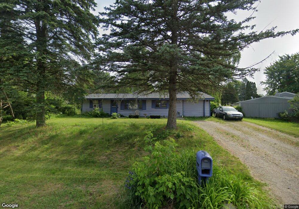
1835 Weir Rd Walled Lake, MI 48390
Estimated Value: $233,000 - $296,000
3
Beds
1
Bath
1,483
Sq Ft
$173/Sq Ft
Est. Value
About This Home
This home is located at 1835 Weir Rd, Walled Lake, MI 48390 and is currently estimated at $256,530, approximately $172 per square foot. 1835 Weir Rd is a home located in Oakland County with nearby schools including Mary Helen Guest Elementary School, James R Geisler Middle School, and Walled Lake Central High School.
Ownership History
Date
Name
Owned For
Owner Type
Purchase Details
Closed on
Sep 9, 1996
Sold by
Austin Brett A
Bought by
Tumminello John J
Current Estimated Value
Home Financials for this Owner
Home Financials are based on the most recent Mortgage that was taken out on this home.
Original Mortgage
$83,500
Outstanding Balance
$7,043
Interest Rate
8%
Estimated Equity
$249,487
Purchase Details
Closed on
Jan 31, 1996
Sold by
Richardson Richard L
Bought by
Austin Brett A
Home Financials for this Owner
Home Financials are based on the most recent Mortgage that was taken out on this home.
Original Mortgage
$86,900
Interest Rate
7.16%
Create a Home Valuation Report for This Property
The Home Valuation Report is an in-depth analysis detailing your home's value as well as a comparison with similar homes in the area
Home Values in the Area
Average Home Value in this Area
Purchase History
| Date | Buyer | Sale Price | Title Company |
|---|---|---|---|
| Tumminello John J | $98,500 | -- | |
| Austin Brett A | $87,300 | -- |
Source: Public Records
Mortgage History
| Date | Status | Borrower | Loan Amount |
|---|---|---|---|
| Open | Tumminello John J | $83,500 | |
| Previous Owner | Austin Brett A | $86,900 |
Source: Public Records
Tax History Compared to Growth
Tax History
| Year | Tax Paid | Tax Assessment Tax Assessment Total Assessment is a certain percentage of the fair market value that is determined by local assessors to be the total taxable value of land and additions on the property. | Land | Improvement |
|---|---|---|---|---|
| 2024 | $1,538 | $102,470 | $0 | $0 |
| 2023 | $1,450 | $95,650 | $0 | $0 |
| 2022 | $1,443 | $87,910 | $0 | $0 |
| 2021 | $1,463 | $84,520 | $0 | $0 |
| 2020 | $1,398 | $80,980 | $0 | $0 |
| 2019 | $2,612 | $73,540 | $0 | $0 |
| 2018 | $2,611 | $64,840 | $0 | $0 |
| 2017 | $2,412 | $63,640 | $0 | $0 |
| 2016 | $2,394 | $59,750 | $0 | $0 |
| 2015 | -- | $48,290 | $0 | $0 |
| 2014 | -- | $35,740 | $0 | $0 |
| 2011 | -- | $41,160 | $0 | $0 |
Source: Public Records
Map
Nearby Homes
- 1904 Meadow Ridge Dr
- 2138 Metzner Rd
- 3101 Cameron Cir
- 568 Woodhaven Dr Unit 89
- 462 Woodhaven Dr Unit 137
- 29204 April Ct Unit 236
- 8204 Alexa Dr Unit 88
- 17102 Caitlin Cir Unit 147
- 30204 Chantel Dr Unit 228
- 18203 Adri Cir Unit 122
- 34202 Emma Cir
- 1128 Annjo St
- 651 Woodhaven Dr
- 1439 Shankin Dr
- 2144 Park Place Dr
- 1700 Big Trail Rd
- 1895 Big Trail Rd
- 1533 Covington Crossing Unit 16
- 1747 Shankin Dr
- 2450 S Commerce Rd