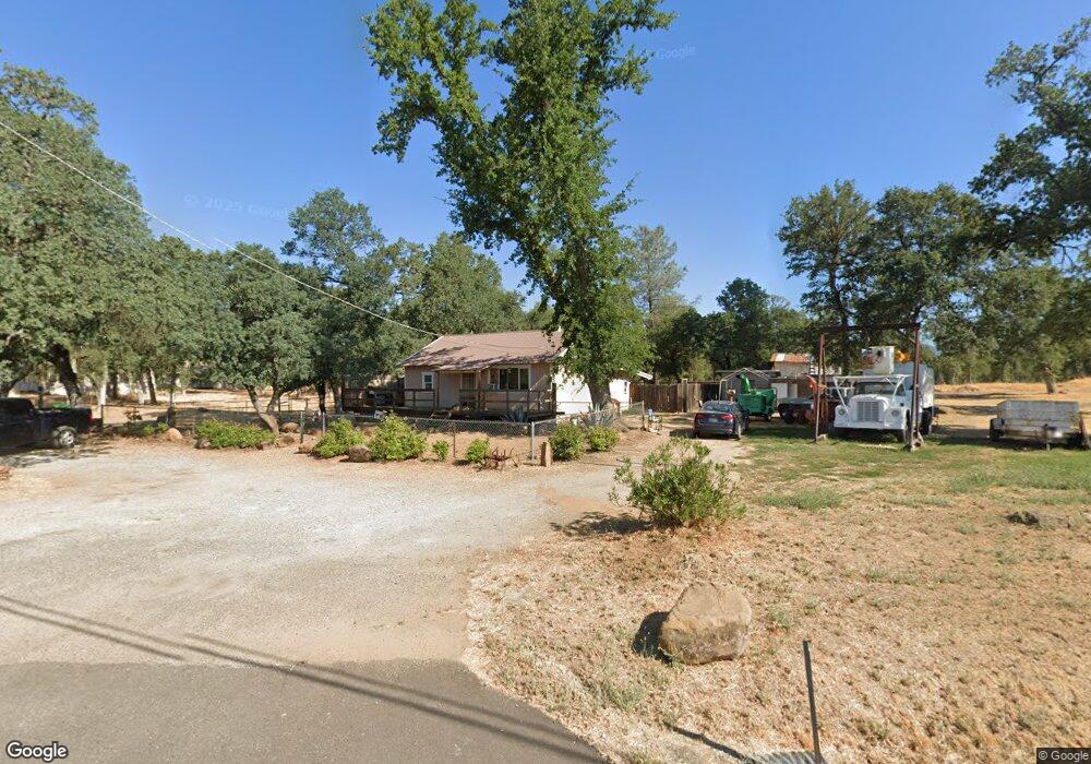
18350 Oasis Rd Redding, CA 96003
Oasis NeighborhoodEstimated Value: $256,000 - $333,000
3
Beds
2
Baths
1,260
Sq Ft
$227/Sq Ft
Est. Value
About This Home
This home is located at 18350 Oasis Rd, Redding, CA 96003 and is currently estimated at $285,843, approximately $226 per square foot. 18350 Oasis Rd is a home located in Shasta County with nearby schools including Redding STEM Academy.
Ownership History
Date
Name
Owned For
Owner Type
Purchase Details
Closed on
Feb 22, 2015
Sold by
Debord Karol Kay
Bought by
Lowe Perry Dean and Lowe Lorena Mae
Current Estimated Value
Purchase Details
Closed on
Aug 25, 2011
Sold by
Hammon Max R and Hammon Marcella V
Bought by
Hammon Max R
Purchase Details
Closed on
Nov 4, 2010
Sold by
Hammon Marcella
Bought by
Hammon Max
Purchase Details
Closed on
Nov 24, 1999
Sold by
Wright Dexter W and Wright Susan R
Bought by
Hammon Max R and Hammon Marcella
Purchase Details
Closed on
Oct 18, 1998
Sold by
Wright Dexter W and Wright Susan R
Bought by
Wright Dexter W and Wright Susan R
Home Financials for this Owner
Home Financials are based on the most recent Mortgage that was taken out on this home.
Original Mortgage
$59,500
Interest Rate
6.71%
Create a Home Valuation Report for This Property
The Home Valuation Report is an in-depth analysis detailing your home's value as well as a comparison with similar homes in the area
Home Values in the Area
Average Home Value in this Area
Purchase History
| Date | Buyer | Sale Price | Title Company |
|---|---|---|---|
| Lowe Perry Dean | $50,000 | Placer Title Company | |
| Hammon Max R | -- | None Available | |
| Hammon Max | -- | None Available | |
| Hammon Max R | $78,000 | Redding Title Co | |
| Wright Dexter W | -- | First American Title Co |
Source: Public Records
Mortgage History
| Date | Status | Borrower | Loan Amount |
|---|---|---|---|
| Previous Owner | Wright Dexter W | $59,500 |
Source: Public Records
Tax History
| Year | Tax Paid | Tax Assessment Tax Assessment Total Assessment is a certain percentage of the fair market value that is determined by local assessors to be the total taxable value of land and additions on the property. | Land | Improvement |
|---|---|---|---|---|
| 2025 | $1,547 | $150,222 | $90,133 | $60,089 |
| 2024 | $1,516 | $147,277 | $88,366 | $58,911 |
| 2023 | $1,516 | $144,390 | $86,634 | $57,756 |
| 2022 | $1,474 | $141,560 | $84,936 | $56,624 |
| 2021 | $1,452 | $138,785 | $83,271 | $55,514 |
| 2020 | $1,445 | $137,363 | $82,418 | $54,945 |
| 2019 | $1,399 | $134,670 | $80,802 | $53,868 |
| 2018 | $1,397 | $132,030 | $79,218 | $52,812 |
| 2017 | $1,372 | $129,442 | $77,665 | $51,777 |
| 2016 | $1,311 | $126,905 | $76,143 | $50,762 |
| 2015 | $1,667 | $152,996 | $76,498 | $76,498 |
| 2014 | $1,100 | $97,781 | $47,636 | $50,145 |
Source: Public Records
Map
Nearby Homes
- 18439 Old Oasis Rd
- 0000 Witch Way
- 12009 Theresa Ln
- 1180 Jaxon Way
- 4753 White River Dr
- 4288 Bradley Dr
- 1112 Yogi Ct
- 1077 Eagle Nest Rd
- 1086 Eagle Nest Rd
- 1059 Eagle Nest Rd
- 1220 Pershing St
- 4521 White River Dr
- 3460 Tomahawk Trail
- 17789 Peterson Ln
- 12125 Lake Blvd Unit 61
- 4576 Hickory Trail
- 12116 Lake Blvd
- 5513 Diamond Ridge Dr
- 977 Tuberose Trail
- 0000 Snavely Dr
- 12084 Tennessee Dr
- 18329 Oasis Rd
- 12088 Tennessee Dr
- 12099 Tennessee Dr
- 18395 Oasis Rd
- 18396 Old Oasis Rd Unit 18437
- 18396 Old Oasis Rd
- 18448 Old Oasis Rd
- 18433 Oasis Rd
- 12053 Oak Leaf Ln
- 18264 Oasis Rd Unit sfd
- 18264 Oasis Rd Unit A&B
- 18264 Oasis Rd
- 12125 Tennessee Dr
- 12115 Oak Leaf Ln
- 12097 Oak Leaf Ln
- 18469 Old Oasis Rd
- 12020 Randolph Rd
- 12062 Oak Leaf Ln
- 12084 Randolph Rd
Your Personal Tour Guide
Ask me questions while you tour the home.