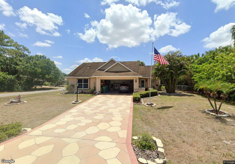
18355 Cortland Ave Port Charlotte, FL 33948
Estimated Value: $249,045 - $360,000
3
Beds
2
Baths
1,487
Sq Ft
$193/Sq Ft
Est. Value
About This Home
This home is located at 18355 Cortland Ave, Port Charlotte, FL 33948 and is currently estimated at $287,261, approximately $193 per square foot. 18355 Cortland Ave is a home located in Charlotte County with nearby schools including Liberty Elementary School, Murdock Middle School, and Port Charlotte High School.
Ownership History
Date
Name
Owned For
Owner Type
Purchase Details
Closed on
Jul 16, 2021
Sold by
Goodwin Wanita Boysen and Goodwin Terry D
Bought by
Goodwin Wanita
Current Estimated Value
Home Financials for this Owner
Home Financials are based on the most recent Mortgage that was taken out on this home.
Original Mortgage
$180,000
Outstanding Balance
$163,472
Interest Rate
2.96%
Mortgage Type
New Conventional
Estimated Equity
$123,789
Purchase Details
Closed on
Dec 4, 1995
Sold by
Boysen Wanita L
Bought by
Boysen Goodwin Terry D and Boysen Goodwin Wanita
Purchase Details
Closed on
May 11, 1994
Sold by
Pritchett Dennis M and Pritchett Tammy L
Bought by
Boyen Richard R and Cox Chris
Create a Home Valuation Report for This Property
The Home Valuation Report is an in-depth analysis detailing your home's value as well as a comparison with similar homes in the area
Home Values in the Area
Average Home Value in this Area
Purchase History
| Date | Buyer | Sale Price | Title Company |
|---|---|---|---|
| Goodwin Wanita | -- | Stewart Title Guaranty Co | |
| Boysen Goodwin Terry D | -- | -- | |
| Boyen Richard R | $49,900 | -- |
Source: Public Records
Mortgage History
| Date | Status | Borrower | Loan Amount |
|---|---|---|---|
| Open | Goodwin Wanita | $180,000 |
Source: Public Records
Tax History Compared to Growth
Tax History
| Year | Tax Paid | Tax Assessment Tax Assessment Total Assessment is a certain percentage of the fair market value that is determined by local assessors to be the total taxable value of land and additions on the property. | Land | Improvement |
|---|---|---|---|---|
| 2023 | $1,165 | $88,526 | $0 | $0 |
| 2022 | $1,191 | $85,948 | $0 | $0 |
| 2021 | $1,180 | $83,445 | $0 | $0 |
| 2020 | $1,340 | $82,293 | $0 | $0 |
| 2019 | $1,257 | $80,443 | $0 | $0 |
| 2018 | $1,140 | $78,943 | $0 | $0 |
| 2017 | $1,120 | $77,319 | $0 | $0 |
| 2016 | $1,105 | $75,729 | $0 | $0 |
| 2015 | $1,087 | $75,203 | $0 | $0 |
| 2014 | $1,066 | $74,606 | $0 | $0 |
Source: Public Records
Map
Nearby Homes
- 18348 Yale Ave
- 18323 Troon Ave
- 18323 Yale Ave
- 2083 Leisure St
- 18316 Monmouth Ave
- 18275 Troon Ave
- 2123 Cannolot Blvd
- 2051 Midnight St
- 2051 Cannolot Blvd
- 2059 Cannolot Blvd
- 18440 Morrisson Ave
- 2072 Barksdale St
- 2067 Midnight St
- 2113 Barksdale St
- 2119 Pellam Blvd
- 18363 Inwood Ave
- 2070 Carpetgreen St
- 2027 Cannolot Blvd
- 18378 Inwood Ave
- 18503 Yarbrough Ave
- 18339 Cortland Ave
- 2142 Taunt St
- 18352 Cortland Ave
- 18360 Cortland Ave
- 18344 Cortland Ave
- 18368 Cortland Ave
- 18332 Troon Ave
- 18331 Cortland Ave
- 18336 Cortland Ave
- 18376 Cortland Ave
- 2150 Taunt St
- 2158 Taunt St
- 2143 Tinker St
- 18355 Troon Ave
- 18351 Shadoway Ave
- 18359 Shadoway Ave
- 18347 Troon Ave
- 18323 Cortland Ave
- 18335 Shadoway Ave
- 18386 Cortland Ave