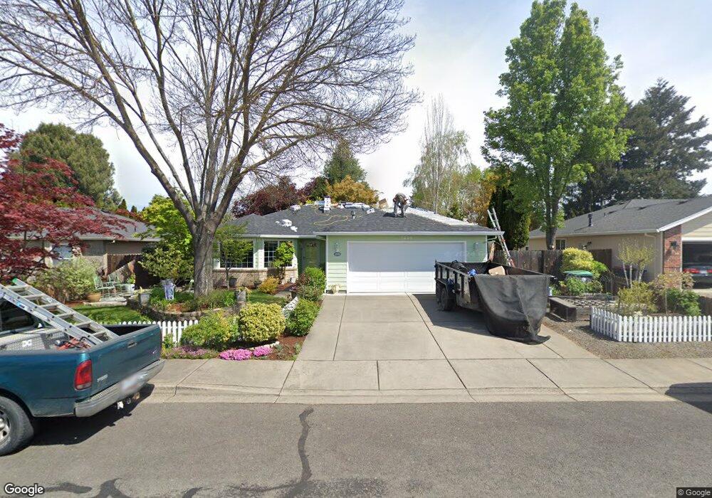
1836 Cottonwood Dr Central Point, OR 97502
Estimated Value: $401,089 - $421,000
3
Beds
2
Baths
1,365
Sq Ft
$301/Sq Ft
Est. Value
About This Home
This home is located at 1836 Cottonwood Dr, Central Point, OR 97502 and is currently estimated at $410,772, approximately $300 per square foot. 1836 Cottonwood Dr is a home located in Jackson County with nearby schools including Jewett Elementary School, Scenic Middle School, and Crater High School.
Ownership History
Date
Name
Owned For
Owner Type
Purchase Details
Closed on
Jun 8, 2004
Sold by
Johnson Wilton D and Johnson Janice M
Bought by
Clark Janet
Current Estimated Value
Home Financials for this Owner
Home Financials are based on the most recent Mortgage that was taken out on this home.
Original Mortgage
$55,000
Outstanding Balance
$26,868
Interest Rate
5.99%
Mortgage Type
Purchase Money Mortgage
Estimated Equity
$383,904
Purchase Details
Closed on
May 12, 1999
Sold by
Pactrend Inc
Bought by
Johnson Wilton D and Johnson Janice M
Home Financials for this Owner
Home Financials are based on the most recent Mortgage that was taken out on this home.
Original Mortgage
$88,000
Interest Rate
6.94%
Create a Home Valuation Report for This Property
The Home Valuation Report is an in-depth analysis detailing your home's value as well as a comparison with similar homes in the area
Home Values in the Area
Average Home Value in this Area
Purchase History
| Date | Buyer | Sale Price | Title Company |
|---|---|---|---|
| Clark Janet | $200,000 | Lawyers Title Ins | |
| Johnson Wilton D | $117,900 | Jackson County Title |
Source: Public Records
Mortgage History
| Date | Status | Borrower | Loan Amount |
|---|---|---|---|
| Open | Clark Janet | $55,000 | |
| Previous Owner | Johnson Wilton D | $88,000 |
Source: Public Records
Tax History Compared to Growth
Tax History
| Year | Tax Paid | Tax Assessment Tax Assessment Total Assessment is a certain percentage of the fair market value that is determined by local assessors to be the total taxable value of land and additions on the property. | Land | Improvement |
|---|---|---|---|---|
| 2025 | $4,109 | $247,160 | $114,000 | $133,160 |
| 2024 | $4,109 | $239,970 | $110,680 | $129,290 |
| 2023 | $3,977 | $232,990 | $107,450 | $125,540 |
| 2022 | $3,884 | $232,990 | $107,450 | $125,540 |
| 2021 | $3,774 | $226,210 | $104,320 | $121,890 |
| 2020 | $3,664 | $219,630 | $101,280 | $118,350 |
| 2019 | $3,573 | $207,030 | $95,460 | $111,570 |
| 2018 | $3,464 | $201,000 | $92,680 | $108,320 |
| 2017 | $3,377 | $201,000 | $92,680 | $108,320 |
| 2016 | $3,279 | $189,470 | $87,360 | $102,110 |
| 2015 | $3,141 | $189,470 | $87,360 | $102,110 |
| 2014 | $3,029 | $178,610 | $82,340 | $96,270 |
Source: Public Records
Map
Nearby Homes
- 335 Applewood Dr
- 356 Marian Ave Unit 40
- 327 Brookhaven Dr
- 426 Bridge Creek Dr
- 4626 N Pacific Hwy
- 4035 Rock Way
- 413 Sand Pointe Dr
- 422 Castle Rock Dr
- 1167 Boulder Ridge St
- 905 Comet Ave
- 526 Stone Pointe Dr
- 629 Bridge Creek Dr
- 1317 River Run St
- 1159 Rustler Peak St
- 1010 N 3rd St
- 920 N 10th St
- 55 Crater Ln
- 1135 Shake Dr
- 626 Griffin Oaks Dr
- 342 Hazel St
- 1846 Cottonwood Dr
- 1828 Cottonwood Dr Unit 1
- 1841 Marys Way
- 1833 Marys Way
- 1854 Cottonwood Dr Unit 1
- 1818 Cottonwood Dr Unit 1
- 1843 Marys Way
- 1835 Cottonwood Dr
- 1827 Marys Way
- 1847 Cottonwood Dr
- 1825 Cottonwood Dr
- 1810 Cottonwood Dr
- 1860 Cottonwood Dr
- 1851 Marys Way
- 1855 Cottonwood Dr
- 1817 Cottonwood Dr
- 1815 Marys Way
- 1865 Cottonwood Dr
- 1868 Cottonwood Dr
- 1804 Cottonwood Dr Unit 1