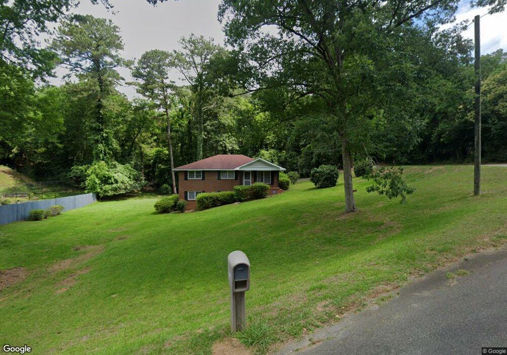
1836 Lullwater Cir Macon, GA 31211
Shirley Hills Historic District NeighborhoodEstimated Value: $157,000 - $195,000
3
Beds
2
Baths
1,419
Sq Ft
$124/Sq Ft
Est. Value
About This Home
This home is located at 1836 Lullwater Cir, Macon, GA 31211 and is currently estimated at $176,353, approximately $124 per square foot. 1836 Lullwater Cir is a home located in Bibb County with nearby schools including Martin Luther King Jr. Elementary School, Appling Middle School, and Northeast High School.
Ownership History
Date
Name
Owned For
Owner Type
Purchase Details
Closed on
Sep 27, 2022
Sold by
Clarke Patricia
Bought by
Hickman Beverly
Current Estimated Value
Home Financials for this Owner
Home Financials are based on the most recent Mortgage that was taken out on this home.
Original Mortgage
$120,000
Outstanding Balance
$114,371
Interest Rate
5.13%
Mortgage Type
New Conventional
Estimated Equity
$61,982
Purchase Details
Closed on
Feb 21, 2018
Sold by
Clarke Tol
Bought by
Clarke Tol and Clarke Patricia
Home Financials for this Owner
Home Financials are based on the most recent Mortgage that was taken out on this home.
Original Mortgage
$33,770
Interest Rate
3.99%
Mortgage Type
New Conventional
Purchase Details
Closed on
Dec 17, 1999
Sold by
Clarke Patricia L
Bought by
Clarke Tol
Create a Home Valuation Report for This Property
The Home Valuation Report is an in-depth analysis detailing your home's value as well as a comparison with similar homes in the area
Home Values in the Area
Average Home Value in this Area
Purchase History
| Date | Buyer | Sale Price | Title Company |
|---|---|---|---|
| Hickman Beverly | $138,500 | -- | |
| Clarke Tol | -- | None Available | |
| Clarke Tol | -- | -- |
Source: Public Records
Mortgage History
| Date | Status | Borrower | Loan Amount |
|---|---|---|---|
| Open | Hickman Beverly | $120,000 | |
| Previous Owner | Clarke Tol | $33,770 |
Source: Public Records
Tax History Compared to Growth
Tax History
| Year | Tax Paid | Tax Assessment Tax Assessment Total Assessment is a certain percentage of the fair market value that is determined by local assessors to be the total taxable value of land and additions on the property. | Land | Improvement |
|---|---|---|---|---|
| 2025 | $1,585 | $64,508 | $10,400 | $54,108 |
| 2024 | $1,577 | $62,108 | $8,000 | $54,108 |
| 2023 | $1,398 | $55,050 | $8,000 | $47,050 |
| 2022 | $1,550 | $44,773 | $8,354 | $36,419 |
| 2021 | $1,555 | $40,931 | $6,270 | $34,661 |
| 2020 | $1,414 | $36,410 | $6,270 | $30,140 |
| 2019 | $1,364 | $34,840 | $5,956 | $28,884 |
| 2018 | $2,148 | $32,827 | $6,455 | $26,372 |
| 2017 | $1,230 | $32,827 | $6,455 | $26,372 |
| 2016 | $1,162 | $33,587 | $7,214 | $26,372 |
| 2015 | $1,645 | $33,587 | $7,214 | $26,372 |
| 2014 | $1,984 | $35,222 | $7,594 | $27,628 |
Source: Public Records
Map
Nearby Homes
- 1964 Woodland Dr
- 1485 Lone Oak Dr
- 1728 Waverland Cir
- 1916 Flintwood Dr
- 1831 Upper River Rd
- 1755 Waverland Cir
- 1575 Briarcliff Rd
- 1735 Foster Place
- 1957 Deerwood Place
- 1949 Deerwood Place
- 1715 Foster Place
- 1746 Upper River Rd
- 1965 Deerwood Place
- 1615 Engle Dr
- 1435 Twin Pines Dr
- 1464 Twin Pines Dr
- 1346 Waverland Dr
- 1815 Lullwater Cir
- 1845 Lullwater Cir
- 1831 Lullwater Cir Unit 2
- 1819 Lullwater Place
- 1821 Waverland Dr
- 1837 Waverland Dr
- 1806 Lullwater Place
- 1807 Waverland Dr Unit 15
- 1807 Waverland Dr
- 1824 Twin Pines Dr
- 1832 Twin Pines Dr
- 1816 Twin Pines Dr
- 1849 Waverland Dr
- 1840 Twin Pines Dr
- 1808 Twin Pines Dr
- 1858 Twin Pines Dr
- 1855 Waverland Dr
- 1792 Twin Pines Dr
- 1791 Waverland Dr
- 1944 Woodland Dr