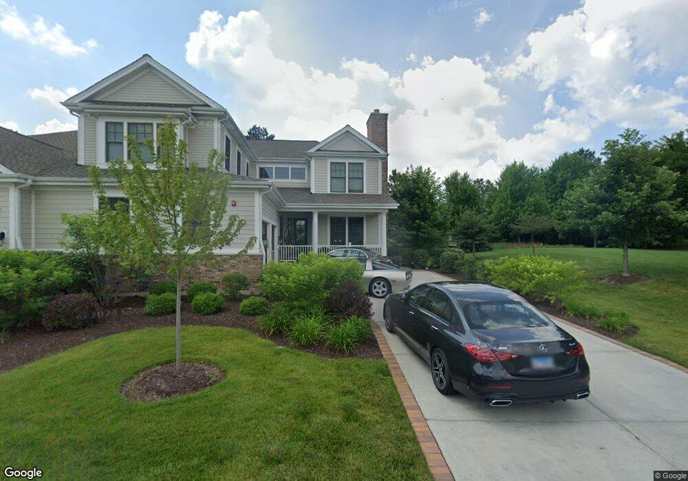
1836 Westbridge Cir Lake Forest, IL 60045
Estimated Value: $1,160,585 - $1,358,000
4
Beds
3
Baths
3,408
Sq Ft
$367/Sq Ft
Est. Value
About This Home
This home is located at 1836 Westbridge Cir, Lake Forest, IL 60045 and is currently estimated at $1,252,396, approximately $367 per square foot. 1836 Westbridge Cir is a home located in Lake County with nearby schools including Deer Path Middle School East, Everett Elementary School, and Lake Forest High School.
Ownership History
Date
Name
Owned For
Owner Type
Purchase Details
Closed on
Jul 31, 2019
Sold by
Foxford 12 Llc
Bought by
Carter Michael L and Carter Leila H
Current Estimated Value
Home Financials for this Owner
Home Financials are based on the most recent Mortgage that was taken out on this home.
Original Mortgage
$656,910
Outstanding Balance
$587,115
Interest Rate
4.75%
Mortgage Type
New Conventional
Estimated Equity
$665,281
Purchase Details
Closed on
Feb 2, 2018
Sold by
Redus Illinois Llc
Bought by
Foxford 12 Llc
Create a Home Valuation Report for This Property
The Home Valuation Report is an in-depth analysis detailing your home's value as well as a comparison with similar homes in the area
Home Values in the Area
Average Home Value in this Area
Purchase History
| Date | Buyer | Sale Price | Title Company |
|---|---|---|---|
| Carter Michael L | $730,000 | Chicago Title | |
| Foxford 12 Llc | $2,138,300 | None Available |
Source: Public Records
Mortgage History
| Date | Status | Borrower | Loan Amount |
|---|---|---|---|
| Open | Carter Michael L | $656,910 |
Source: Public Records
Tax History Compared to Growth
Tax History
| Year | Tax Paid | Tax Assessment Tax Assessment Total Assessment is a certain percentage of the fair market value that is determined by local assessors to be the total taxable value of land and additions on the property. | Land | Improvement |
|---|---|---|---|---|
| 2024 | $18,611 | $326,429 | $104,497 | $221,932 |
| 2023 | $21,227 | $301,079 | $96,382 | $204,697 |
| 2022 | $21,227 | $354,357 | $92,638 | $261,719 |
| 2021 | $20,376 | $346,729 | $90,644 | $256,085 |
| 2020 | $19,471 | $340,900 | $89,120 | $251,780 |
| 2019 | $18,864 | $337,659 | $88,273 | $249,386 |
| 2018 | $735 | $13,707 | $13,707 | $0 |
| 2017 | $702 | $13,274 | $13,274 | $0 |
| 2016 | $672 | $12,586 | $12,586 | $0 |
| 2015 | $657 | $11,764 | $11,764 | $0 |
Source: Public Records
Map
Nearby Homes
- 95 S Canterbury Ct
- 1761 Stanford Ct
- 1685 Cornell Ct
- 1845 W North Pond Ln
- 195 S Bradford Ct
- 289 S South Shore Ln
- 300 N Bradley Rd
- 2200 W Saunders Rd
- 500 Andover Ct
- 1515 Sage Ct
- 480 Saunders Rd
- 470 Stablewood Ln
- 570 Hathaway Cir
- 1241 Ashlawn Dr
- 980 Mellody Rd
- 985 W Deerpath
- 660 S Buckingham Ct
- 535 N Waukegan Rd
- 275 Sussex Ln
- 1130 Gavin Ct
- 1836 Westbridge Cir Unit 35
- 1830 Westbridge Cir Unit 34
- 1830 Westbridge Cir
- 1826 Westbridge Cir Unit 33
- 1820 Westbridge Cir Unit 32
- 1825 Westbridge Cir
- 1825 Westbridge Cir Unit 26L
- 1821 Westbridge Cir Unit 26R
- 1821 Westbridge Cir Unit 26L
- 1821 Westbridge Cir
- 1711 Westbridge Cir Unit 36
- 1700 Westbridge Cir Unit 4R
- 1700 Westbridge Cir Unit 2
- 1700 Westbridge Cir
- 1816 Westbridge Cir Unit 31
- 1815 Westbridge Cir
- 1815 Westbridge Cir Unit 25L
- 1715 Westbridge Cir Unit 18L
- 1715 Westbridge Cir Unit 37
- 1715 Westbridge Cir