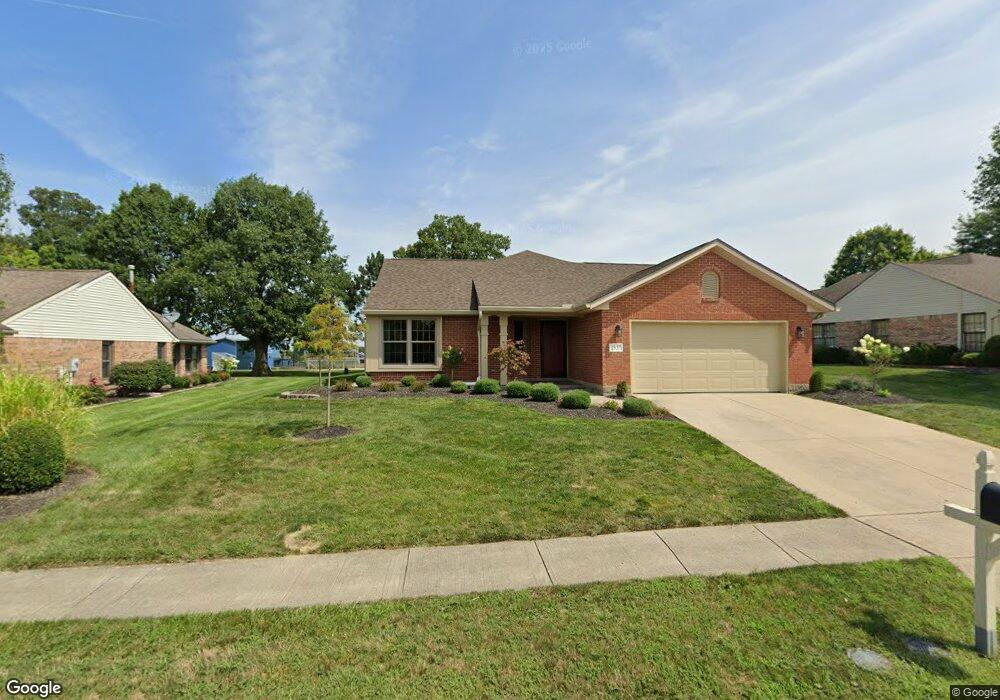
1837 Brandonhall Dr Miamisburg, OH 45342
Estimated Value: $264,946 - $427,000
2
Beds
2
Baths
1,563
Sq Ft
$202/Sq Ft
Est. Value
About This Home
This home is located at 1837 Brandonhall Dr, Miamisburg, OH 45342 and is currently estimated at $315,737, approximately $202 per square foot. 1837 Brandonhall Dr is a home located in Montgomery County with nearby schools including Miamisburg High School and Bethel Baptist School.
Ownership History
Date
Name
Owned For
Owner Type
Purchase Details
Closed on
Aug 5, 2025
Sold by
Gentry Anthony
Bought by
Caupp Merlyn G and Caupp Linda L
Current Estimated Value
Purchase Details
Closed on
Aug 4, 2023
Sold by
Spaulding Margaret N
Bought by
Gentry Anthony
Home Financials for this Owner
Home Financials are based on the most recent Mortgage that was taken out on this home.
Original Mortgage
$183,150
Interest Rate
6.71%
Mortgage Type
New Conventional
Create a Home Valuation Report for This Property
The Home Valuation Report is an in-depth analysis detailing your home's value as well as a comparison with similar homes in the area
Home Values in the Area
Average Home Value in this Area
Purchase History
| Date | Buyer | Sale Price | Title Company |
|---|---|---|---|
| Caupp Merlyn G | $340,000 | Safe Harbor Title | |
| Gentry Anthony | $203,500 | None Listed On Document |
Source: Public Records
Mortgage History
| Date | Status | Borrower | Loan Amount |
|---|---|---|---|
| Previous Owner | Gentry Anthony | $183,150 |
Source: Public Records
Tax History Compared to Growth
Tax History
| Year | Tax Paid | Tax Assessment Tax Assessment Total Assessment is a certain percentage of the fair market value that is determined by local assessors to be the total taxable value of land and additions on the property. | Land | Improvement |
|---|---|---|---|---|
| 2024 | $4,496 | $69,230 | $12,810 | $56,420 |
| 2023 | $4,496 | $69,230 | $12,810 | $56,420 |
| 2022 | $4,369 | $56,740 | $10,500 | $46,240 |
| 2021 | $3,879 | $56,740 | $10,500 | $46,240 |
| 2020 | $3,192 | $56,740 | $10,500 | $46,240 |
| 2019 | $3,256 | $53,660 | $10,500 | $43,160 |
| 2018 | $3,267 | $53,660 | $10,500 | $43,160 |
| 2017 | $3,244 | $53,660 | $10,500 | $43,160 |
| 2016 | $2,479 | $41,760 | $10,500 | $31,260 |
| 2015 | $2,431 | $41,760 | $10,500 | $31,260 |
| 2014 | $2,431 | $41,760 | $10,500 | $31,260 |
| 2012 | -- | $48,510 | $12,250 | $36,260 |
Source: Public Records
Map
Nearby Homes
- 1131 Castleton Ct
- 1734 Rosina Dr
- 2141 Rosina Dr
- 1808 Burnside Dr
- 2127 Carrington Ln
- 902 Althea Dr
- 1035 Woods View Ct
- 807 Dunaway St
- 766 Dunaway St
- 736 Decker Dr
- 00 Benner Rd
- 712 Decker Dr
- 628 Jamestown Dr
- 1013 S Heincke Rd
- 615 Burnside Dr
- 1157 Bonniebrook Dr
- 1826 Ashley Dr
- 1045 S Linden Ave
- 1786 Ashley Dr
- 2279 Rosina Dr
- 1843 Brandonhall Dr
- 1831 Brandonhall Dr
- 1849 Brandonhall Dr
- 1825 Brandonhall Dr
- 1836 Brandonhall Dr
- 1830 Brandonhall Dr
- 1842 Brandonhall Dr
- 1824 Brandonhall Dr
- 1855 Brandonhall Dr
- 1819 Brandonhall Dr
- 1848 Brandonhall Dr
- 1818 Brandonhall Dr
- 1847 Rosina Dr
- 1841 Rosina Dr
- 1861 Brandonhall Dr
- 1813 Brandonhall Dr
- 1853 Rosina Dr
- 1854 Brandonhall Dr
- 1835 Rosina Dr
- 1812 Brandonhall Dr