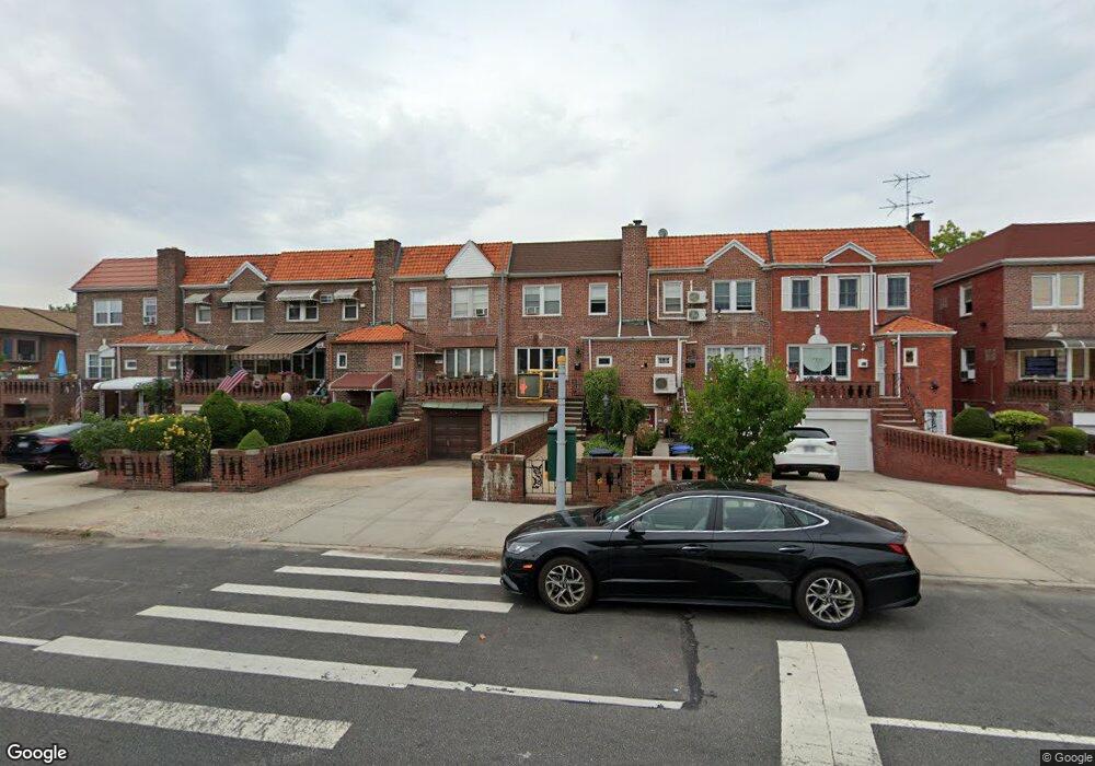
1837 Gerritsen Ave Brooklyn, NY 11229
Marine Park NeighborhoodEstimated Value: $846,890 - $933,000
--
Bed
--
Bath
1,620
Sq Ft
$541/Sq Ft
Est. Value
About This Home
This home is located at 1837 Gerritsen Ave, Brooklyn, NY 11229 and is currently estimated at $876,473, approximately $541 per square foot. 1837 Gerritsen Ave is a home located in Kings County with nearby schools including PS 222 Katherine R Snyder, J.H.S. 278 Marine Park, and James Madison High School.
Ownership History
Date
Name
Owned For
Owner Type
Purchase Details
Closed on
Mar 11, 2014
Sold by
Mcdonald Mary M
Bought by
Mcdonald Mary M
Current Estimated Value
Purchase Details
Closed on
Jun 8, 1994
Sold by
Milano Theresa
Bought by
Bocchino Mary Mcdonald and Mcdonald Joseph T
Home Financials for this Owner
Home Financials are based on the most recent Mortgage that was taken out on this home.
Original Mortgage
$121,500
Interest Rate
8.74%
Create a Home Valuation Report for This Property
The Home Valuation Report is an in-depth analysis detailing your home's value as well as a comparison with similar homes in the area
Home Values in the Area
Average Home Value in this Area
Purchase History
| Date | Buyer | Sale Price | Title Company |
|---|---|---|---|
| Mcdonald Mary M | -- | -- | |
| Bocchino Mary Mcdonald | -- | -- |
Source: Public Records
Mortgage History
| Date | Status | Borrower | Loan Amount |
|---|---|---|---|
| Previous Owner | Bocchino Mary Mcdonald | $121,500 |
Source: Public Records
Tax History Compared to Growth
Tax History
| Year | Tax Paid | Tax Assessment Tax Assessment Total Assessment is a certain percentage of the fair market value that is determined by local assessors to be the total taxable value of land and additions on the property. | Land | Improvement |
|---|---|---|---|---|
| 2025 | $7,556 | $50,640 | $9,840 | $40,800 |
| 2024 | $7,556 | $52,200 | $9,840 | $42,360 |
| 2023 | $7,636 | $45,840 | $9,840 | $36,000 |
| 2022 | $7,367 | $46,320 | $9,840 | $36,480 |
| 2021 | $7,327 | $50,820 | $9,840 | $40,980 |
| 2020 | $5,495 | $42,480 | $9,840 | $32,640 |
| 2019 | $6,558 | $45,060 | $9,840 | $35,220 |
| 2018 | $6,387 | $31,334 | $7,881 | $23,453 |
| 2017 | $6,269 | $30,752 | $8,910 | $21,842 |
| 2016 | $5,800 | $29,012 | $8,827 | $20,185 |
| 2015 | $3,499 | $27,370 | $7,919 | $19,451 |
| 2014 | $3,499 | $26,126 | $9,074 | $17,052 |
Source: Public Records
Map
Nearby Homes
- 2622 Fillmore Ave
- 1837 Burnett St
- 1746 Gerritsen Ave
- 3165 Nostrand Ave Unit 1N
- 3165 Nostrand Ave Unit 2L
- 3165 Nostrand Ave Unit 4P
- 3165 Nostrand Ave Unit 4V
- 3165 Nostrand Ave Unit 1G
- 3165 Nostrand Ave Unit 1S
- 3165 Nostrand Ave Unit 1P
- 1908 Gerritsen Ave
- 1848 Haring St
- 3178 Nostrand Ave Unit 1C
- 3178 Nostrand Ave Unit 1M
- 1882 Batchelder St
- 3203 Nostrand Ave Unit 4H
- 3203 Nostrand Ave Unit LB
- 1747 Stuart St
- 1711 Gerritsen Ave
- 1817 Madison Place
- 1839 Gerritsen Ave
- 1843 Gerritsen Ave
- 1835 Gerritsen Ave
- 1845 Gerritsen Ave
- 1833 Gerritsen Ave
- 1847 Gerritsen Ave
- 1829 Gerritsen Ave
- 1851 Gerritsen Ave
- 1827 Gerritsen Ave
- 1842 Stuart St
- 1840 Stuart St
- 1844 Stuart St
- 1838 Stuart St
- 1853 Gerritsen Ave
- 1846 Stuart St
- 1836 Stuart St
- 1848 Stuart St
- 1834 Stuart St
- 1850 Stuart St
- 1855 Gerritsen Ave