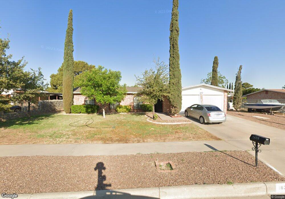
1837 Pete Brown Dr El Paso, TX 79936
Vista Del Sol NeighborhoodEstimated Value: $236,000 - $278,000
--
Bed
2
Baths
1,720
Sq Ft
$146/Sq Ft
Est. Value
About This Home
This home is located at 1837 Pete Brown Dr, El Paso, TX 79936 and is currently estimated at $251,979, approximately $146 per square foot. 1837 Pete Brown Dr is a home located in El Paso County with nearby schools including Tierra Del Sol Elementary School, J M Hanks High School, and EL PASO LEADERSHIP ACADEMY - MIDDLE EAST.
Ownership History
Date
Name
Owned For
Owner Type
Purchase Details
Closed on
Aug 25, 2023
Sold by
Boyd Phillip M and Boyd Brenda C
Bought by
Gonzalez Eduardo Ruben
Current Estimated Value
Home Financials for this Owner
Home Financials are based on the most recent Mortgage that was taken out on this home.
Original Mortgage
$166,500
Outstanding Balance
$54,600
Interest Rate
6.96%
Mortgage Type
New Conventional
Estimated Equity
$197,379
Create a Home Valuation Report for This Property
The Home Valuation Report is an in-depth analysis detailing your home's value as well as a comparison with similar homes in the area
Home Values in the Area
Average Home Value in this Area
Purchase History
| Date | Buyer | Sale Price | Title Company |
|---|---|---|---|
| Gonzalez Eduardo Ruben | -- | None Listed On Document |
Source: Public Records
Mortgage History
| Date | Status | Borrower | Loan Amount |
|---|---|---|---|
| Open | Gonzalez Eduardo Ruben | $166,500 |
Source: Public Records
Tax History Compared to Growth
Tax History
| Year | Tax Paid | Tax Assessment Tax Assessment Total Assessment is a certain percentage of the fair market value that is determined by local assessors to be the total taxable value of land and additions on the property. | Land | Improvement |
|---|---|---|---|---|
| 2025 | $6,554 | $237,589 | $45,534 | $192,055 |
| 2024 | $6,554 | $238,635 | $31,216 | $207,419 |
| 2023 | $3,825 | $197,469 | $0 | $0 |
| 2022 | $5,575 | $179,517 | $0 | $0 |
| 2021 | $5,305 | $163,197 | $31,216 | $131,981 |
| 2020 | $4,972 | $157,425 | $28,334 | $129,091 |
| 2018 | $4,793 | $154,130 | $28,334 | $125,796 |
| 2017 | $4,429 | $144,888 | $28,334 | $116,554 |
| 2016 | $4,033 | $131,937 | $28,334 | $103,603 |
| 2015 | $3,175 | $131,937 | $28,334 | $103,603 |
| 2014 | $3,175 | $132,742 | $28,334 | $104,408 |
Source: Public Records
Map
Nearby Homes
- 1817 Hugh Royer Place
- 1868 Tom Bolt Dr
- 1901 Bobby Jones Dr
- 2001 Bobby Jones Dr Unit A
- 2009 Bobby Jones Dr Unit B
- 1913 Seagull Dr
- 11016 Bob Stone Dr
- 11012 Bob Stone Dr
- 11013 Bob Stone Dr
- 1844 Jack Nicklaus Dr Unit 1846
- 11204 Bob Mitchell Dr
- 1804 Jerry Abbott St
- 1739 Jerry Abbott St
- 2604 Anise Dr
- 11157 Leo Collins Dr
- 11008 Johnny Miller Dr
- 1703 Robert Wynn St
- 2308 Tom Watson Ct
- 1617 Tommy Aaron Dr
- 2201 Trawood Dr
- 1837 Pete Brown Place
- 1833 Pete Brown Dr
- 1841 Pete Brown Dr
- 1841 Pete Brown Place
- 1841 Pete Brown Place
- 1836 Pete Brown Dr
- 1845 Pete Brown Dr
- 1840 Pete Brown Dr
- 1832 Pete Brown Dr
- 1829 Pete Brown Dr
- 1844 Pete Brown Dr
- 1804 Hugh Royer Place
- 1828 Pete Brown Place
- 1828 Pete Brown Dr
- 1849 Pete Brown Dr
- 1800 Hugh Royer Place
- 1841 Mike Hill Dr
- 1841 Mike Hill Dr Unit 1
- 1848 Pete Brown Dr
- 1837 Mike Hill Dr