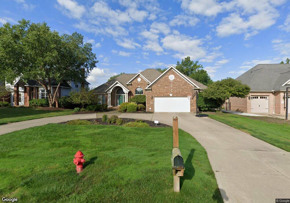
1838 Cedarhurst Dr Wickliffe, OH 44092
Estimated Value: $392,464 - $485,000
3
Beds
3
Baths
3,170
Sq Ft
$133/Sq Ft
Est. Value
About This Home
This home is located at 1838 Cedarhurst Dr, Wickliffe, OH 44092 and is currently estimated at $422,616, approximately $133 per square foot. 1838 Cedarhurst Dr is a home located in Lake County with nearby schools including Wickliffe Elementary School, Wickliffe Middle School, and Wickliffe High School.
Ownership History
Date
Name
Owned For
Owner Type
Purchase Details
Closed on
Oct 15, 2015
Sold by
Foster Leigh A
Bought by
Porcello Marcellino A and Porcello Leah A
Current Estimated Value
Home Financials for this Owner
Home Financials are based on the most recent Mortgage that was taken out on this home.
Original Mortgage
$235,653
Outstanding Balance
$187,145
Interest Rate
4.4%
Mortgage Type
FHA
Estimated Equity
$235,471
Purchase Details
Closed on
Jul 21, 2010
Sold by
Stonebrook Donald G and Stonebrook Mary
Bought by
Foster Thomas D and Foster Leigh A
Home Financials for this Owner
Home Financials are based on the most recent Mortgage that was taken out on this home.
Original Mortgage
$220,000
Interest Rate
4.74%
Mortgage Type
Purchase Money Mortgage
Purchase Details
Closed on
Nov 14, 1991
Bought by
Stonebrook Donald G
Create a Home Valuation Report for This Property
The Home Valuation Report is an in-depth analysis detailing your home's value as well as a comparison with similar homes in the area
Home Values in the Area
Average Home Value in this Area
Purchase History
| Date | Buyer | Sale Price | Title Company |
|---|---|---|---|
| Porcello Marcellino A | $240,000 | None Available | |
| Foster Thomas D | $275,000 | Enterprise Title Agency Inc | |
| Stonebrook Donald G | $72,500 | -- |
Source: Public Records
Mortgage History
| Date | Status | Borrower | Loan Amount |
|---|---|---|---|
| Open | Porcello Marcellino A | $235,653 | |
| Closed | Foster Thomas D | $220,000 |
Source: Public Records
Tax History Compared to Growth
Tax History
| Year | Tax Paid | Tax Assessment Tax Assessment Total Assessment is a certain percentage of the fair market value that is determined by local assessors to be the total taxable value of land and additions on the property. | Land | Improvement |
|---|---|---|---|---|
| 2025 | -- | $119,080 | $32,930 | $86,150 |
| 2024 | -- | $119,080 | $32,930 | $86,150 |
| 2023 | $12,471 | $101,410 | $27,900 | $73,510 |
| 2022 | $7,342 | $101,410 | $27,900 | $73,510 |
| 2021 | $7,359 | $101,410 | $27,900 | $73,510 |
| 2020 | $7,047 | $83,130 | $22,870 | $60,260 |
| 2019 | $7,100 | $83,130 | $22,870 | $60,260 |
| 2018 | $6,216 | $81,220 | $34,050 | $47,170 |
| 2017 | $6,171 | $81,220 | $34,050 | $47,170 |
| 2016 | $5,694 | $81,220 | $34,050 | $47,170 |
| 2015 | $5,594 | $81,220 | $34,050 | $47,170 |
| 2014 | $4,928 | $81,220 | $34,050 | $47,170 |
| 2013 | $4,925 | $81,220 | $34,050 | $47,170 |
Source: Public Records
Map
Nearby Homes
- 30350 Twin Lakes Dr
- 30705 Grant St
- 30530 Grant St
- 1842 Eldon Dr
- 1677 Mapledale Rd
- 30185 Overlook Dr
- 1648 Douglas Rd
- 1671 Eldon Dr
- 1590 Dennis Dr
- 5551 Ivy Ct
- 1624 Douglas Rd
- 30200 Ridge Rd
- 5520 Bretton Ct Unit A
- 1616 Ridgewick Dr Unit 6B
- 1589 Lee Terrace Dr Unit F7
- 34840 Aspen Wood Ln
- 35005 Lisle Ct
- 1719 E 300th St
- 5218 Liberty Ln Unit A
- 34345 Giovanni Ave
- 1830 Cedarhurst Dr
- 1846 Cedarhurst Dr
- 1820 Cedarhurst Dr
- 1854 Cedarhurst Dr
- 1862 Cedarhurst Dr
- 1808 Cedarhurst Dr
- 1837 Cedarhurst Dr
- 1847 Cedarhurst Dr
- 1831 Cedarhurst Dr
- 1855 Cedarhurst Dr
- 1821 Cedarhurst Dr
- 1870 Cedarhurst Dr
- 1861 Cedarhurst Dr
- 1800 Cedarhurst Dr
- 1809 Cedarhurst Dr
- 1801 Cedarhurst Dr
- 1886 Cedarhurst Dr
- 1805 Cedarhurst Dr
- 1894 Cedarhurst Dr
- 1900 Cedarhurst Dr
