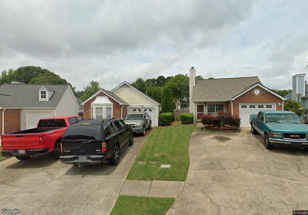
1838 Commonwealth Dr Unit 2 Woodstock, GA 30188
Estimated Value: $301,000 - $307,279
2
Beds
2
Baths
988
Sq Ft
$308/Sq Ft
Est. Value
About This Home
This home is located at 1838 Commonwealth Dr Unit 2, Woodstock, GA 30188 and is currently estimated at $304,140, approximately $307 per square foot. 1838 Commonwealth Dr Unit 2 is a home located in Cherokee County with nearby schools including Little River Elementary, Mill Creek Middle School, and River Ridge High School.
Ownership History
Date
Name
Owned For
Owner Type
Purchase Details
Closed on
Sep 17, 2002
Sold by
Loudermilk Sheran
Bought by
Loudermilk Mike J and Loudermilk Sherant
Current Estimated Value
Purchase Details
Closed on
Aug 27, 1999
Sold by
Dye Freda A
Bought by
Crawford John A and Crawford Geneva C
Home Financials for this Owner
Home Financials are based on the most recent Mortgage that was taken out on this home.
Original Mortgage
$98,900
Interest Rate
7.91%
Mortgage Type
FHA
Create a Home Valuation Report for This Property
The Home Valuation Report is an in-depth analysis detailing your home's value as well as a comparison with similar homes in the area
Home Values in the Area
Average Home Value in this Area
Purchase History
| Date | Buyer | Sale Price | Title Company |
|---|---|---|---|
| Loudermilk Mike J | -- | -- | |
| Crawford John A | $99,000 | -- |
Source: Public Records
Mortgage History
| Date | Status | Borrower | Loan Amount |
|---|---|---|---|
| Previous Owner | Crawford John A | $98,900 |
Source: Public Records
Tax History Compared to Growth
Tax History
| Year | Tax Paid | Tax Assessment Tax Assessment Total Assessment is a certain percentage of the fair market value that is determined by local assessors to be the total taxable value of land and additions on the property. | Land | Improvement |
|---|---|---|---|---|
| 2025 | $3,470 | $121,328 | $25,600 | $95,728 |
| 2024 | $3,197 | $112,768 | $23,200 | $89,568 |
| 2023 | $588 | $104,408 | $20,000 | $84,408 |
| 2022 | $2,865 | $97,084 | $20,000 | $77,084 |
| 2021 | $1,839 | $73,076 | $14,000 | $59,076 |
| 2020 | $2,133 | $66,272 | $11,600 | $54,672 |
| 2019 | $1,527 | $60,720 | $11,600 | $49,120 |
| 2018 | $1,394 | $55,040 | $11,600 | $43,440 |
| 2017 | $1,347 | $132,000 | $11,600 | $41,200 |
| 2016 | $1,254 | $121,800 | $10,000 | $38,720 |
| 2015 | $1,089 | $104,900 | $10,000 | $31,960 |
| 2014 | $894 | $85,900 | $8,000 | $26,360 |
Source: Public Records
Map
Nearby Homes
- 1351 Yorkshire Ln
- 226 Hames Rd Unit 405
- 226 Hames Rd Unit 225
- 204 Magnolia Creek Way
- 201 Jonquil Spring Rd
- 615 Bedford Ct
- 532 Walton Dr
- 338 Cherryhill Ln
- 139 Village Trail
- 776 Woodstock Grove Dr
- 778 Woodstock Grove Dr
- 179 Village Trail
- 403 Village View
- 11511 Highway 92
- 505 Radford Ct
- 419 Creekside Ln
- 156 W Oaks Place
- 421 Creek Valley Dr
- 1244 Hickory Wood Dr NE
- 137 Creekview Dr
- 1840 Commonwealth Dr
- 1836 Commonwealth Dr Unit 2
- 1840 Commonweath
- 1834 Commonwealth Dr
- 2007 Brittania Cir Unit 3
- 1327 Yorkshire Ln Unit 4
- 1329 Yorkshire Ln
- 2009 Brittania Cir
- 1323 Yorkshire Ln
- 1832 Commonwealth Dr
- 2005 Brittania Cir
- 1331 Yorkshire Ln
- 1830 Commonwealth Dr
- 1837 Commonwealth Dr
- 2003 Brittania Cir Unit 3
- 1333 Yorkshire Ln
- 1833 Commonwealth Dr
- 1319 Yorkshire Ln
- 2011 Brittania Cir Unit 2
- 1828 Commonwealth Dr