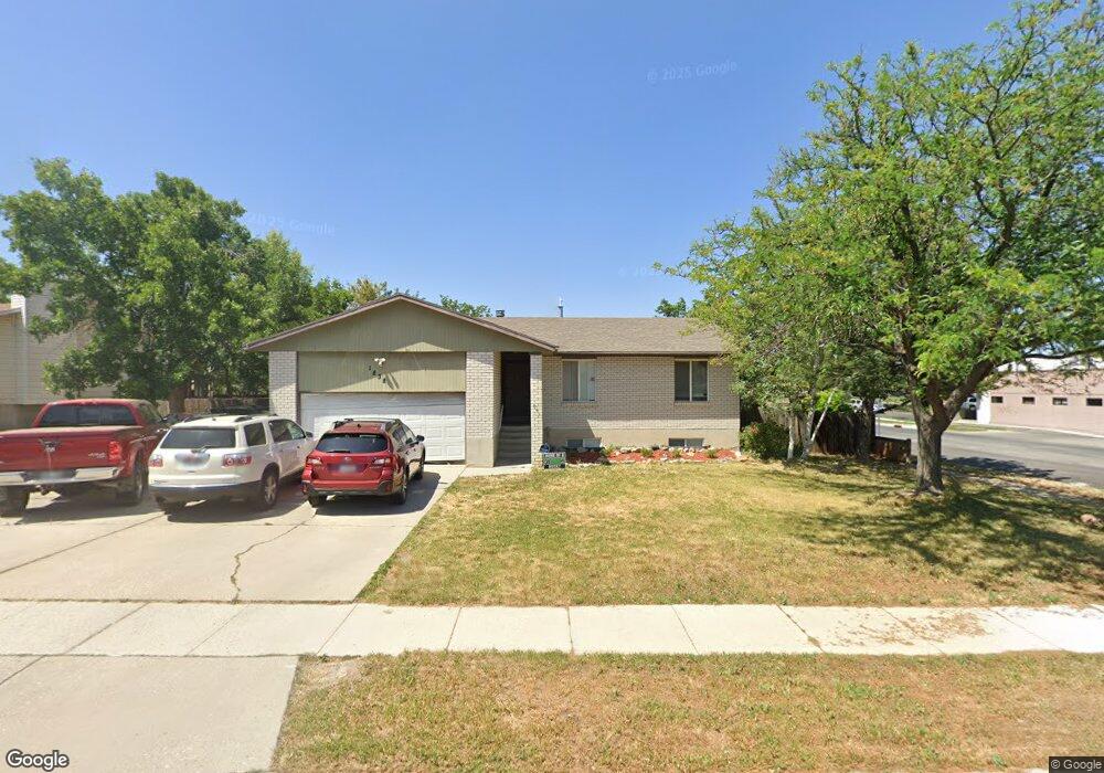
1838 W Executive Cir West Jordan, UT 84084
Estimated Value: $528,000 - $590,000
5
Beds
3
Baths
2,490
Sq Ft
$227/Sq Ft
Est. Value
About This Home
This home is located at 1838 W Executive Cir, West Jordan, UT 84084 and is currently estimated at $564,109, approximately $226 per square foot. 1838 W Executive Cir is a home located in Salt Lake County with nearby schools including Majestic Elementary Arts Academy, West Jordan Middle School, and West Jordan High School.
Ownership History
Date
Name
Owned For
Owner Type
Purchase Details
Closed on
Dec 13, 2011
Sold by
Brown Jonathan and Schiffman Lance
Bought by
Schift Investments Llc
Current Estimated Value
Purchase Details
Closed on
Dec 9, 2011
Sold by
Tyler Lavone
Bought by
Chase John L and Chase Melodie S
Purchase Details
Closed on
Mar 18, 2010
Sold by
Chase Melodie S
Bought by
Tyler Lavone
Create a Home Valuation Report for This Property
The Home Valuation Report is an in-depth analysis detailing your home's value as well as a comparison with similar homes in the area
Home Values in the Area
Average Home Value in this Area
Purchase History
| Date | Buyer | Sale Price | Title Company |
|---|---|---|---|
| Schift Investments Llc | -- | Mountain View Title & Escrow | |
| Brown Jonathan | -- | Mountain View Title & Escrow | |
| Chase John L | -- | Mountain View Title & Escrow | |
| Tyler Lavone | -- | None Available | |
| Tyler Lavone | -- | None Available |
Source: Public Records
Tax History Compared to Growth
Tax History
| Year | Tax Paid | Tax Assessment Tax Assessment Total Assessment is a certain percentage of the fair market value that is determined by local assessors to be the total taxable value of land and additions on the property. | Land | Improvement |
|---|---|---|---|---|
| 2025 | $2,780 | $560,800 | $130,900 | $429,900 |
| 2024 | $2,780 | $534,800 | $123,500 | $411,300 |
| 2023 | $2,774 | $503,000 | $114,300 | $388,700 |
| 2022 | $2,829 | $504,700 | $112,100 | $392,600 |
| 2021 | $2,316 | $376,100 | $87,600 | $288,500 |
| 2020 | $2,171 | $330,900 | $87,600 | $243,300 |
| 2019 | $2,136 | $319,200 | $87,600 | $231,600 |
| 2018 | $1,958 | $290,300 | $84,800 | $205,500 |
| 2017 | $1,814 | $267,700 | $84,800 | $182,900 |
| 2016 | $1,689 | $234,200 | $80,500 | $153,700 |
| 2015 | $1,782 | $240,900 | $85,900 | $155,000 |
| 2014 | $1,711 | $227,700 | $82,000 | $145,700 |
Source: Public Records
Map
Nearby Homes
- 7149 S Camelot Way
- 1951 W 7125 S
- 7150 Camelot Way
- 6925 S Lexington Dr
- 7279 S Kenadi Ct
- 1718 W Trey Way Unit 2
- 1607 W Beamon St
- 7118 S Equator Ln Unit 14 B
- 6924 S 2160 W
- 7165 Callie Dr
- 7174 S 1380 W
- 7194 S 1380 W
- 2178 W Arthur Dr
- 2312 W Hidden Bend Cove Unit 107
- 1384 W 7290 S
- 1678 Leland Dr
- 2421 W 6900 S
- 1516 W 7470 S
- 1817 W 7600 S Unit I204
- 1801 W 7600 S Unit C201
- 1838 Executive Cir
- 1852 Executive Cir
- 7018 Executive Dr
- 1855 W 7000 S
- 1837 Executive Cir
- 1837 W Executive Cir
- 1867 W 7000 S
- 1866 Executive Cir
- 1851 Executive Cir
- 7068 S Executive Dr
- 7068 Executive Dr
- 1872 Executive Cir
- 1885 W 7000 S
- 1865 Executive Cir
- 1865 W Executive Cir
- 1852 Silverton Cir
- 1838 Silverton Cir
- 1838 W Silverton Cir
- 7046 S Redwood Rd Unit C
- 1891 W 7000 S