
Seller's Agent in 2026
Cory Allen
Keynote Realty
(513) 722-6307
195 Total Sales
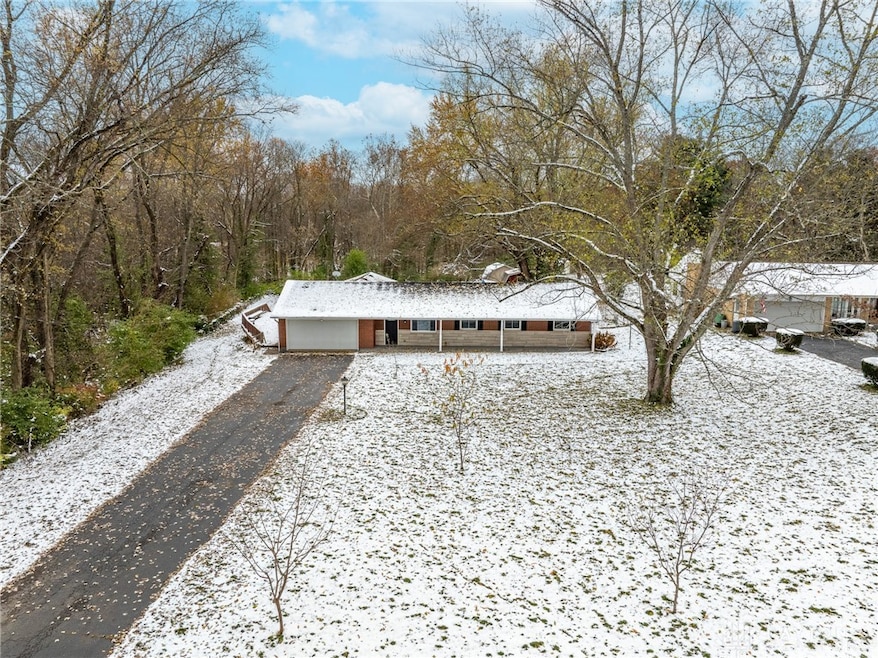
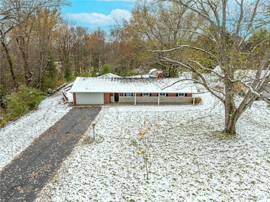
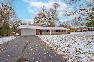
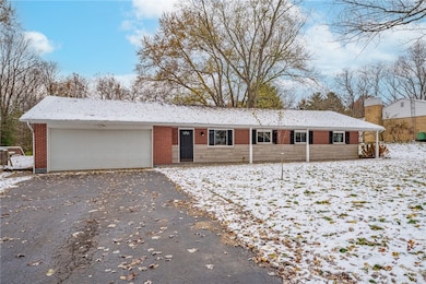
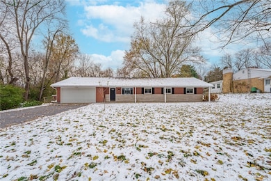
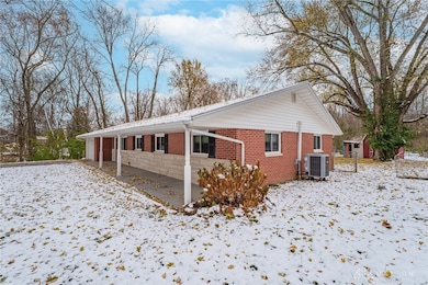
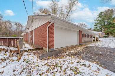
Welcome home to this spacious brick ranch in Xenia schools! Located on a quiet street, this home is perfect for those that love to entertain or those that just want to enjoy their peace and quiet. Step outside on the long, covered front porch to enjoy your morning coffee! New LVP and wall to wall carpet throughout the entire home! New light fixtures and paint throughout! Completely remodeled kitchen, complete with new cabinets, SS appliances, and granite counters! New tankless water heater! Completely remodeled bathrooms, including the primary en suite. Home has what seems like an endless amount of spacious rooms to enjoy! Large wood deck off the left side of the house that walks down into the vast, flat back yard! So much to love about this home! Schedule a showing today!
Last Agent to Sell the Property
Keynote Realty Brokerage Phone: (513) 424-9400 License #2016000601 Listed on: 11/14/2025
| Date | Type | Sale Price | Title Company |
|---|---|---|---|
| Warranty Deed | $304,077 | M & M Title | |
| Sheriffs Deed | $190,200 | None Listed On Document | |
| Warranty Deed | -- | None Listed On Document | |
| Warranty Deed | $175,000 | Attorney |
| Date | Status | Loan Amount | Loan Type |
|---|---|---|---|
| Open | $300,530 | New Conventional | |
| Previous Owner | $260,000 | New Conventional | |
| Previous Owner | $180,750 | VA |
| Date | Event | Price | List to Sale | Price per Sq Ft |
|---|---|---|---|---|
| 02/04/2026 02/04/26 | Sold | $304,077 | -4.9% | $133 / Sq Ft |
| 01/07/2026 01/07/26 | Pending | -- | -- | -- |
| 12/13/2025 12/13/25 | Price Changed | $319,900 | -1.5% | $140 / Sq Ft |
| 11/14/2025 11/14/25 | For Sale | $324,900 | -- | $142 / Sq Ft |
| Year | Tax Paid | Tax Assessment Tax Assessment Total Assessment is a certain percentage of the fair market value that is determined by local assessors to be the total taxable value of land and additions on the property. | Land | Improvement |
|---|---|---|---|---|
| 2025 | $4,724 | $92,020 | $9,930 | $82,090 |
| 2024 | $4,724 | $92,020 | $9,930 | $82,090 |
| 2023 | $4,687 | $92,020 | $9,930 | $82,090 |
| 2022 | $3,933 | $68,220 | $8,940 | $59,280 |
| 2021 | $3,980 | $68,220 | $8,940 | $59,280 |
| 2020 | $3,646 | $68,220 | $8,940 | $59,280 |
| 2019 | $3,341 | $58,590 | $8,690 | $49,900 |
| 2018 | $3,295 | $58,590 | $8,690 | $49,900 |
| 2017 | $3,149 | $58,590 | $8,690 | $49,900 |
| 2016 | $3,093 | $56,210 | $8,690 | $47,520 |
| 2015 | $3,101 | $56,210 | $8,690 | $47,520 |
| 2014 | $2,975 | $56,210 | $8,690 | $47,520 |
Seller's Agent in 2026
Cory Allen
Keynote Realty
(513) 722-6307
195 Total Sales
Buyer's Agent in 2026
Jill Aldineh
RE/MAX
(937) 303-1888
291 Total Sales
Source: Dayton REALTORS®
MLS Number: 947837
APN: K28-0001-0008-1-0009-00
Disclaimer: Certain information contained herein is derived from information provided by parties other than Homes.com. All information provided is deemed reliable, but is not guaranteed to be accurate and should be independently verified.
![]() The information is being provided by Dayton Area Board of Realtors MLS. Information deemed reliable but not guaranteed. Information is provided for the consumer's personal, non-commercial use, and may not be used for any purpose other than the identification of potential properties for purchase. Copyright 2026 Dayton Area Board of Realtors MLS. All Rights Reserved.
The information is being provided by Dayton Area Board of Realtors MLS. Information deemed reliable but not guaranteed. Information is provided for the consumer's personal, non-commercial use, and may not be used for any purpose other than the identification of potential properties for purchase. Copyright 2026 Dayton Area Board of Realtors MLS. All Rights Reserved.
Ask me questions while you tour the home.