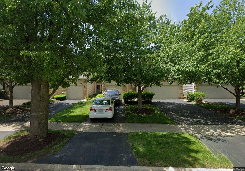
1839 Wisteria Dr Unit 3 Aurora, IL 60503
Far Southeast NeighborhoodEstimated Value: $263,000 - $279,000
2
Beds
3
Baths
1,448
Sq Ft
$189/Sq Ft
Est. Value
About This Home
This home is located at 1839 Wisteria Dr Unit 3, Aurora, IL 60503 and is currently estimated at $273,455, approximately $188 per square foot. 1839 Wisteria Dr Unit 3 is a home located in Kendall County with nearby schools including The Wheatlands Elementary School, Bednarcik Jr. High School, and Oswego East High School.
Ownership History
Date
Name
Owned For
Owner Type
Purchase Details
Closed on
Aug 30, 2005
Sold by
Chepkwony Elizabeth
Bought by
Rayford Angela L
Current Estimated Value
Home Financials for this Owner
Home Financials are based on the most recent Mortgage that was taken out on this home.
Original Mortgage
$118,000
Outstanding Balance
$63,249
Interest Rate
5.88%
Mortgage Type
Fannie Mae Freddie Mac
Estimated Equity
$210,206
Purchase Details
Closed on
Jun 21, 2002
Sold by
Mfllc Wheatland
Bought by
Chepkwony Elizabeth M
Home Financials for this Owner
Home Financials are based on the most recent Mortgage that was taken out on this home.
Original Mortgage
$142,000
Interest Rate
6.23%
Create a Home Valuation Report for This Property
The Home Valuation Report is an in-depth analysis detailing your home's value as well as a comparison with similar homes in the area
Home Values in the Area
Average Home Value in this Area
Purchase History
| Date | Buyer | Sale Price | Title Company |
|---|---|---|---|
| Rayford Angela L | $168,000 | -- | |
| Chepkwony Elizabeth M | $149,500 | Ticor Title Insurance Compan |
Source: Public Records
Mortgage History
| Date | Status | Borrower | Loan Amount |
|---|---|---|---|
| Open | Rayford Angela L | $118,000 | |
| Previous Owner | Chepkwony Elizabeth M | $142,000 |
Source: Public Records
Tax History Compared to Growth
Tax History
| Year | Tax Paid | Tax Assessment Tax Assessment Total Assessment is a certain percentage of the fair market value that is determined by local assessors to be the total taxable value of land and additions on the property. | Land | Improvement |
|---|---|---|---|---|
| 2024 | $5,780 | $71,051 | $12,421 | $58,630 |
| 2023 | $5,203 | $62,877 | $10,992 | $51,885 |
| 2022 | $5,203 | $57,685 | $10,084 | $47,601 |
| 2021 | $4,856 | $52,441 | $9,167 | $43,274 |
| 2020 | $4,914 | $52,441 | $9,167 | $43,274 |
| 2019 | $4,870 | $50,978 | $9,167 | $41,811 |
| 2018 | $4,485 | $46,369 | $8,338 | $38,031 |
| 2017 | $4,336 | $42,737 | $7,685 | $35,052 |
| 2016 | $4,140 | $40,509 | $7,284 | $33,225 |
| 2015 | $4,057 | $38,216 | $6,872 | $31,344 |
| 2014 | -- | $37,103 | $6,672 | $30,431 |
| 2013 | -- | $37,477 | $6,739 | $30,738 |
Source: Public Records
Map
Nearby Homes
- 1875 Keating Dr
- 1871 Keating Dr
- 1855 Keating Dr
- Bellamy Plan at Wheatland Crossing
- Henley Plan at Wheatland Crossing
- Ashton Plan at Wheatland Crossing
- Coventry Plan at Wheatland Crossing
- 1870 Canyon Creek Dr
- 1830 Canyon Creek Dr
- 1880 Canyon Creek Dr
- 1966 Congrove Dr
- 2047 James Leigh Dr
- 1751 Baler Ave
- 1738 Baler Ave
- 1740 Baler Ave
- 1757 Baler Ave
- 1776 Stable Ln
- 1764 Stable Ln
- 1745 Baler Ave
- 1739 Baler Ave
- 1835 Wisteria Dr Unit 284
- 1843 Wisteria Dr Unit 62
- 1831 Wisteria Dr Unit 285
- 1847 Wisteria Dr Unit 281
- 1911 Keating Dr Unit 4
- 1917 Keating Dr Unit 3
- 1905 Keating Dr Unit 5
- 1929 Keating Dr Unit 1
- 1923 Keating Dr Unit 2
- 1917 Keating Dr Unit 1917
- 1851 Wisteria Dr Unit 6
- 1859 Wisteria Dr Unit 274
- 1855 Wisteria Dr Unit 275
- 1871 Wisteria Dr Unit 271
- 1867 Wisteria Dr Unit 272
- 1863 Wisteria Dr Unit 273
- 1850 Wisteria Dr Unit 343
- 1854 Wisteria Dr Unit 344
- 1858 Wisteria Dr Unit 345
- 1842 Wisteria Dr Unit 341