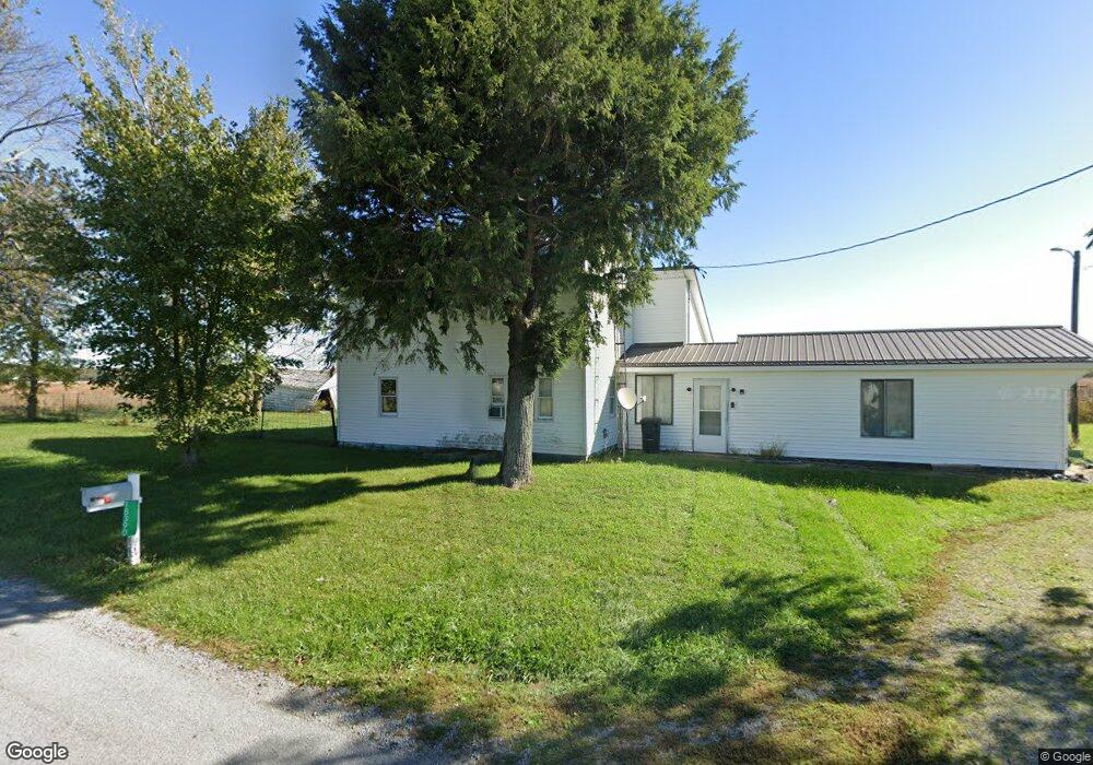
18390 Andrews Rd Waynesfield, OH 45896
Estimated Value: $158,000 - $254,000
3
Beds
1
Bath
1,524
Sq Ft
$136/Sq Ft
Est. Value
About This Home
This home is located at 18390 Andrews Rd, Waynesfield, OH 45896 and is currently estimated at $207,384, approximately $136 per square foot. 18390 Andrews Rd is a home located in Auglaize County with nearby schools including Waynesfield-Goshen Local Elementary School and Waynesfield-Goshen Local High School.
Ownership History
Date
Name
Owned For
Owner Type
Purchase Details
Closed on
Jun 26, 1995
Sold by
Ganser Milton
Bought by
Ganser Milton D
Current Estimated Value
Purchase Details
Closed on
Aug 1, 1990
Create a Home Valuation Report for This Property
The Home Valuation Report is an in-depth analysis detailing your home's value as well as a comparison with similar homes in the area
Home Values in the Area
Average Home Value in this Area
Purchase History
| Date | Buyer | Sale Price | Title Company |
|---|---|---|---|
| Ganser Milton D | -- | -- | |
| -- | $25,000 | -- |
Source: Public Records
Tax History Compared to Growth
Tax History
| Year | Tax Paid | Tax Assessment Tax Assessment Total Assessment is a certain percentage of the fair market value that is determined by local assessors to be the total taxable value of land and additions on the property. | Land | Improvement |
|---|---|---|---|---|
| 2024 | $2,464 | $39,170 | $8,450 | $30,720 |
| 2023 | $1,363 | $38,570 | $8,450 | $30,120 |
| 2022 | $1,188 | $28,250 | $7,880 | $20,370 |
| 2021 | $1,179 | $28,250 | $7,880 | $20,370 |
| 2020 | $587 | $28,249 | $7,875 | $20,374 |
| 2019 | $939 | $23,542 | $6,563 | $16,979 |
| 2018 | $915 | $23,542 | $6,563 | $16,979 |
| 2017 | $919 | $23,542 | $6,563 | $16,979 |
| 2016 | $832 | $21,952 | $6,251 | $15,701 |
| 2015 | $827 | $21,952 | $6,251 | $15,701 |
| 2014 | $828 | $21,952 | $6,251 | $15,701 |
| 2013 | $918 | $21,952 | $6,251 | $15,701 |
Source: Public Records
Map
Nearby Homes
- 202 W Mulberry St
- 105 Guthrie St
- 25836 Ohio 67
- 8150 Amherst Rd
- 5065 Amherst Rd
- 22275 Buckland Holden Rd
- 7165 Faulkner Rd
- 6616 Bellefontaine Rd
- 6381 McPheron Rd
- 0 Ohio 235
- 20630 State Route 67
- 200 S Main St
- 5600 E Hanthorn Rd
- E Hanthorn Rd
- 1855 S Cool Rd
- 4160 E Hanthorn Rd
- 13793 Ohio 235 Unit 75
- 2444 County Road 200
- 11352 N Township Road 88
- 0 Ohio 67