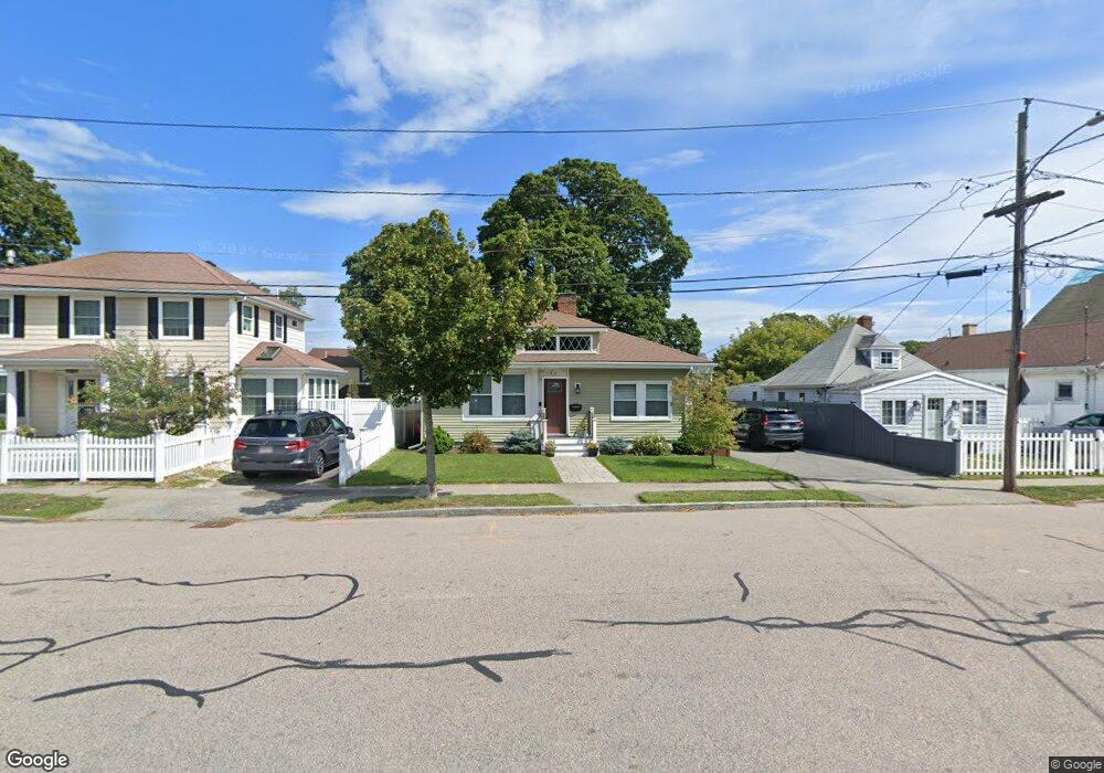
184 Albatross Rd Quincy, MA 02169
Adams Shore NeighborhoodEstimated Value: $608,000 - $709,000
3
Beds
2
Baths
1,407
Sq Ft
$481/Sq Ft
Est. Value
About This Home
This home is located at 184 Albatross Rd, Quincy, MA 02169 and is currently estimated at $676,168, approximately $480 per square foot. 184 Albatross Rd is a home located in Norfolk County with nearby schools including Merrymount Elementary School, Broad Meadows Middle School, and Quincy High School.
Ownership History
Date
Name
Owned For
Owner Type
Purchase Details
Closed on
Mar 31, 2008
Sold by
Hennigan Lisa M and Palladino Lisa
Bought by
Dennehy Michael J and Dennehy Sharon R
Current Estimated Value
Home Financials for this Owner
Home Financials are based on the most recent Mortgage that was taken out on this home.
Original Mortgage
$334,000
Outstanding Balance
$209,247
Interest Rate
5.76%
Mortgage Type
Purchase Money Mortgage
Estimated Equity
$466,921
Purchase Details
Closed on
Oct 31, 2003
Sold by
Pepdjonovic Petar and Pepdjonovic Prena
Bought by
Hennigan Lisa M and Palladino Serge
Home Financials for this Owner
Home Financials are based on the most recent Mortgage that was taken out on this home.
Original Mortgage
$233,600
Interest Rate
6.05%
Mortgage Type
Purchase Money Mortgage
Create a Home Valuation Report for This Property
The Home Valuation Report is an in-depth analysis detailing your home's value as well as a comparison with similar homes in the area
Home Values in the Area
Average Home Value in this Area
Purchase History
| Date | Buyer | Sale Price | Title Company |
|---|---|---|---|
| Dennehy Michael J | $334,000 | -- | |
| Hennigan Lisa M | $292,000 | -- |
Source: Public Records
Mortgage History
| Date | Status | Borrower | Loan Amount |
|---|---|---|---|
| Open | Dennehy Michael J | $334,000 | |
| Previous Owner | Hennigan Lisa M | $233,600 | |
| Previous Owner | Hennigan Lisa M | $58,400 |
Source: Public Records
Tax History Compared to Growth
Tax History
| Year | Tax Paid | Tax Assessment Tax Assessment Total Assessment is a certain percentage of the fair market value that is determined by local assessors to be the total taxable value of land and additions on the property. | Land | Improvement |
|---|---|---|---|---|
| 2025 | $6,879 | $596,600 | $280,800 | $315,800 |
| 2024 | $6,512 | $577,800 | $272,600 | $305,200 |
| 2023 | $6,069 | $545,300 | $237,100 | $308,200 |
| 2022 | $6,165 | $514,600 | $215,500 | $299,100 |
| 2021 | $5,326 | $438,700 | $215,500 | $223,200 |
| 2020 | $5,111 | $411,200 | $207,200 | $204,000 |
| 2019 | $4,818 | $383,900 | $193,700 | $190,200 |
| 2018 | $4,602 | $345,000 | $168,400 | $176,600 |
| 2017 | $4,598 | $324,500 | $168,400 | $156,100 |
| 2016 | $4,532 | $315,600 | $168,400 | $147,200 |
| 2015 | $4,253 | $291,300 | $158,900 | $132,400 |
| 2014 | $4,003 | $269,400 | $151,300 | $118,100 |
Source: Public Records
Map
Nearby Homes
- 503 Sea St
- 73 Albatross Rd
- 599 Sea St
- 599 Sea St Unit 1
- 12 Quentin St
- 10 Forbush Ave
- 37 Hobomack Rd
- 7 Manet Ave
- 200 Cove Way Unit 614
- 188 Samoset Ave
- 18 Allerton St
- 105 Sea St Unit 301
- 105 Sea St Unit 203
- 105 Sea St Unit 105
- 1421 Quincy Shore Dr
- 1427 Quincy Shore Dr
- 7-11 Lenox St
- 82 Lenox St
- 966 Sea St
- 101 Babcock St
- 188 Albatross Rd
- 180 Albatross Rd
- 190 Albatross Rd
- 27 Gannett Rd
- 29 Gannett Rd
- 23 Gannett Rd
- 23 Gannett Rd Unit 23
- 192 Albatross Rd
- 174 Albatross Rd
- 35 Gannett Rd
- 87 Pelican Rd
- 21 Gannett Rd
- 191 Albatross Rd
- 39 Gannett Rd
- 170 Albatross Rd
- 89 Pelican Rd
- 15 Gannett Rd
- 83 Pelican Rd
- 30 Gannett Rd
- 43 Gannett Rd