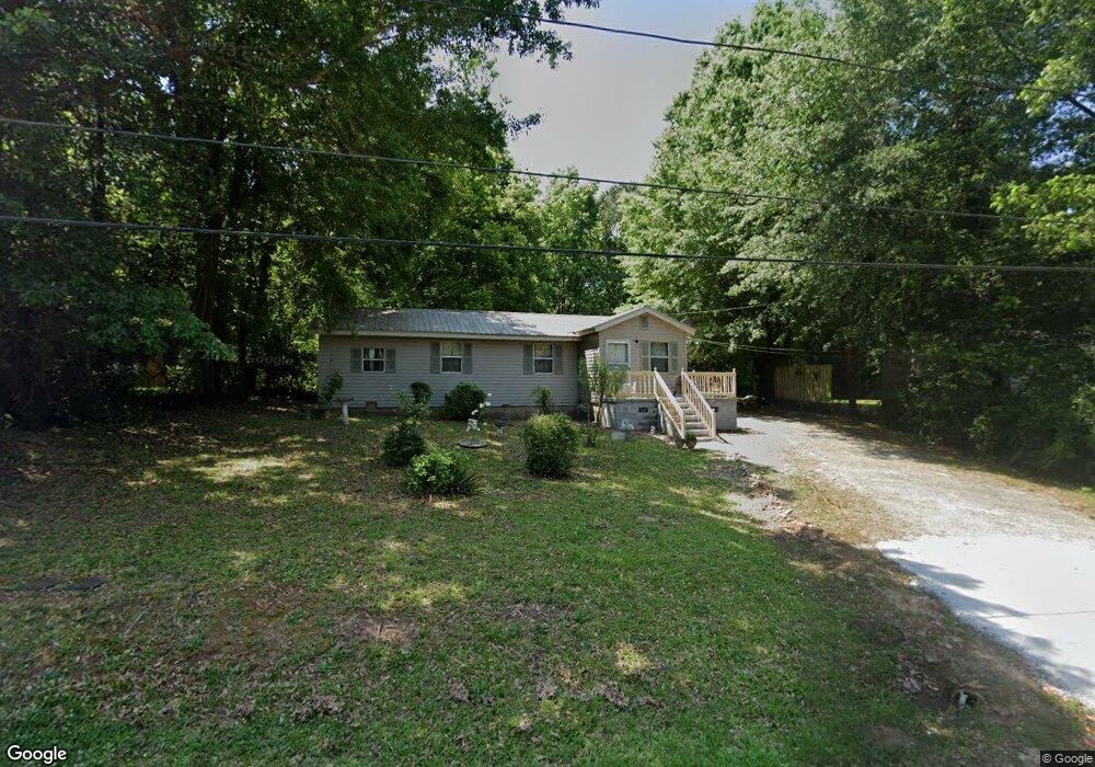
184 Anderson St Tignall, GA 30668
Estimated Value: $81,733 - $132,000
3
Beds
1
Bath
976
Sq Ft
$112/Sq Ft
Est. Value
About This Home
This home is located at 184 Anderson St, Tignall, GA 30668 and is currently estimated at $108,933, approximately $111 per square foot. 184 Anderson St is a home with nearby schools including Washington-Wilkes Elementary School, Washington-Wilkes Primary School, and Washington-Wilkes Middle School.
Ownership History
Date
Name
Owned For
Owner Type
Purchase Details
Closed on
Jul 1, 1996
Sold by
Roebuck John and Roebuck Mary
Bought by
Roebuck John
Current Estimated Value
Purchase Details
Closed on
Jun 1, 1985
Bought by
Roebuck John and Roebuck Mary
Purchase Details
Closed on
Jan 1, 1983
Purchase Details
Closed on
Jan 1, 1974
Purchase Details
Closed on
Jan 1, 1901
Create a Home Valuation Report for This Property
The Home Valuation Report is an in-depth analysis detailing your home's value as well as a comparison with similar homes in the area
Home Values in the Area
Average Home Value in this Area
Purchase History
| Date | Buyer | Sale Price | Title Company |
|---|---|---|---|
| Roebuck John | -- | -- | |
| Roebuck John | $1,800 | -- | |
| -- | $1,000 | -- | |
| -- | -- | -- | |
| -- | -- | -- |
Source: Public Records
Tax History Compared to Growth
Tax History
| Year | Tax Paid | Tax Assessment Tax Assessment Total Assessment is a certain percentage of the fair market value that is determined by local assessors to be the total taxable value of land and additions on the property. | Land | Improvement |
|---|---|---|---|---|
| 2025 | $604 | $15,231 | $1,274 | $13,957 |
| 2024 | $610 | $15,231 | $1,274 | $13,957 |
| 2023 | $545 | $15,231 | $1,274 | $13,957 |
| 2022 | $383 | $15,231 | $1,274 | $13,957 |
| 2021 | $393 | $15,231 | $1,274 | $13,957 |
| 2020 | $397 | $15,231 | $1,274 | $13,957 |
| 2019 | $399 | $15,231 | $1,274 | $13,957 |
| 2018 | $611 | $15,231 | $1,274 | $13,957 |
| 2017 | $611 | $15,231 | $1,274 | $13,957 |
| 2016 | $389 | $15,231 | $1,274 | $13,957 |
| 2015 | -- | $1,274 | $1,274 | $13,957 |
| 2014 | -- | $15,230 | $1,274 | $13,957 |
| 2013 | -- | $15,302 | $1,273 | $14,028 |
Source: Public Records
Map
Nearby Homes
- 1046 Eagles Nest Trail
- 420 W Wooten St
- 525 S Hulin Ave
- 6556 Elberton Rd
- 819 Jane Hill Rd
- 3 Bunch Rd
- 1 Bunch Rd
- 2 Bunch Rd
- 4 Bunch Rd
- 191 Bunch Rd
- 2221 Sandtown Rd
- Lot D Newtown Rd
- Lot C Newtown Rd
- Lot B Newtown Rd
- Lot E Newtown Rd
- 0 Oscar Walton Rd Unit 24714036
- 2132 Henry Hill Rd
- 0 Pete Johnson Rd Unit 24300768
- 0 Pete Johnson Rd Unit 24300767
- 732 Hilliard Station Rd
- 174 Anderson St
- 194 Anderson St
- 160 Anderson St
- 187 Anderson St
- 204 Anderson St
- 148 Anderson St
- 148 Independence St
- 164 Independence St
- 190 Independence St
- 154 Independence St
- 130 Independence St
- 163 S Hulin Ave
- 175 S Hulin Ave
- 1046 Eagles Nesy Trail
- 126 Independence St
- 139 S Hulin Ave
- 199 S Hulin Ave
- 179 Independence St
- 211 S Hulin Ave
- 109 S Hulin Ave