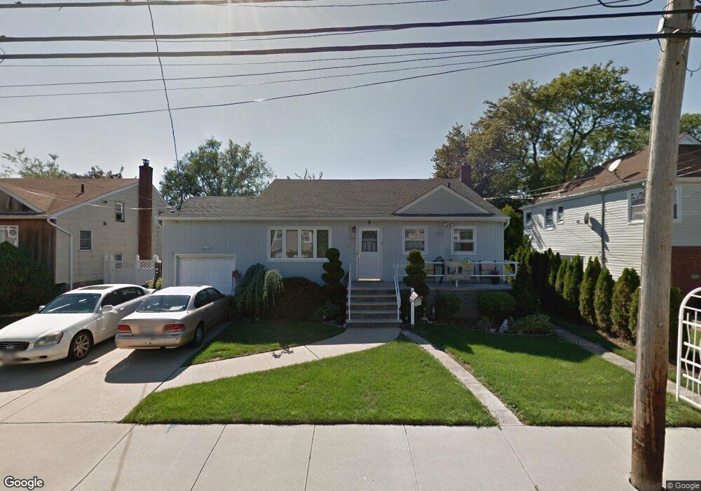
184 Branch Ave Freeport, NY 11520
Estimated Value: $660,722 - $680,000
Studio
2
Baths
952
Sq Ft
$704/Sq Ft
Est. Value
About This Home
This home is located at 184 Branch Ave, Freeport, NY 11520 and is currently estimated at $670,361, approximately $704 per square foot. 184 Branch Ave is a home located in Nassau County with nearby schools including Columbus Avenue School, Caroline G. Atkinson Intermediate School, and John W Dodd Middle School.
Ownership History
Date
Name
Owned For
Owner Type
Purchase Details
Closed on
Nov 30, 2009
Sold by
Persaud Nandranie
Bought by
Daniels Lawrence E and Daniels Melissa N
Current Estimated Value
Home Financials for this Owner
Home Financials are based on the most recent Mortgage that was taken out on this home.
Original Mortgage
$284,900
Outstanding Balance
$186,969
Interest Rate
5.02%
Mortgage Type
FHA
Estimated Equity
$483,392
Purchase Details
Closed on
Nov 4, 2008
Sold by
Edouard Roseline
Bought by
Persaud Nandranie
Purchase Details
Closed on
May 25, 2005
Sold by
Dieujuste Jacqueline
Purchase Details
Closed on
Feb 13, 1998
Sold by
Ricciuto Anthony
Bought by
Dieujuste Jacqueline
Create a Home Valuation Report for This Property
The Home Valuation Report is an in-depth analysis detailing your home's value as well as a comparison with similar homes in the area
Home Values in the Area
Average Home Value in this Area
Purchase History
| Date | Buyer | Sale Price | Title Company |
|---|---|---|---|
| Daniels Lawrence E | $295,000 | -- | |
| Persaud Nandranie | $325,000 | Old Public National Title | |
| -- | -- | -- | |
| Dieujuste Jacqueline | $158,000 | -- |
Source: Public Records
Mortgage History
| Date | Status | Borrower | Loan Amount |
|---|---|---|---|
| Open | Daniels Lawrence E | $284,900 |
Source: Public Records
Tax History
| Year | Tax Paid | Tax Assessment Tax Assessment Total Assessment is a certain percentage of the fair market value that is determined by local assessors to be the total taxable value of land and additions on the property. | Land | Improvement |
|---|---|---|---|---|
| 2025 | $7,599 | $394 | $165 | $229 |
| 2024 | $896 | $394 | $165 | $229 |
Source: Public Records
Map
Nearby Homes
- 587 S Bayview Ave
- 226 Westside Ave Unit B
- 51 Irving Ave
- 292 Westside Ave
- 160 Saint Marks Ave
- 55 Lester Ave
- 210 Westend Ave Unit 8B
- 210 Westend Ave Unit 8A
- 28 Florence Ave
- 300 Branch Ave
- 711 S Bayview Ave
- 8 Florence Ave Unit 16C
- 12 Florence Ave Unit 29A
- 14 Florence Ave Unit 25B
- 59 Hampton Place Unit 20D
- 77 Hampton Place
- 153 Westend Ave
- 463 S Bayview Ave
- 173 Cedar St
- 209 Nassau Ave
- 176 Branch Ave
- 188 Branch Ave
- 589 S Bayview Ave
- 194 Branch Ave
- 603 S Bayview Ave
- 170 Branch Ave
- 1 Branch Ave
- 183 Branch Ave
- 57 Lewis St
- 61 Lewis St
- 181 Branch Ave
- 189 Branch Ave
- 193 Branch Ave
- 200 Branch Ave
- 609 S Bayview Ave
- 35 Lewis St
- 203 Branch Ave
- 579 S Bayview Ave
- 617 S Bayview Ave
- 218 Saint Marks Ave
Your Personal Tour Guide
Ask me questions while you tour the home.