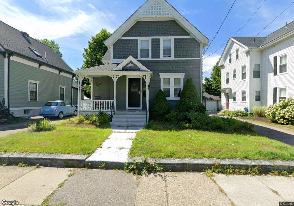
184 Broad St North Attleboro, MA 02760
North Attleboro NeighborhoodEstimated Value: $501,000 - $559,000
3
Beds
2
Baths
1,581
Sq Ft
$334/Sq Ft
Est. Value
About This Home
This home is located at 184 Broad St, North Attleboro, MA 02760 and is currently estimated at $527,521, approximately $333 per square foot. 184 Broad St is a home located in Bristol County with nearby schools including North Attleboro High School and Cadence Academy Preschool - North Attleborough.
Ownership History
Date
Name
Owned For
Owner Type
Purchase Details
Closed on
Aug 28, 1992
Sold by
Rickard Stephen and Rickard Teresa
Bought by
Davis Brent M and Davis Suzanne
Current Estimated Value
Create a Home Valuation Report for This Property
The Home Valuation Report is an in-depth analysis detailing your home's value as well as a comparison with similar homes in the area
Home Values in the Area
Average Home Value in this Area
Purchase History
| Date | Buyer | Sale Price | Title Company |
|---|---|---|---|
| Davis Brent M | $119,000 | -- |
Source: Public Records
Mortgage History
| Date | Status | Borrower | Loan Amount |
|---|---|---|---|
| Open | Davis Brent M | $124,000 | |
| Closed | Davis Brent M | $125,000 | |
| Closed | Davis Brent M | $125,000 |
Source: Public Records
Tax History Compared to Growth
Tax History
| Year | Tax Paid | Tax Assessment Tax Assessment Total Assessment is a certain percentage of the fair market value that is determined by local assessors to be the total taxable value of land and additions on the property. | Land | Improvement |
|---|---|---|---|---|
| 2025 | $5,650 | $479,200 | $119,500 | $359,700 |
| 2024 | $5,381 | $466,300 | $119,500 | $346,800 |
| 2023 | $5,308 | $415,000 | $119,500 | $295,500 |
| 2022 | $5,242 | $376,300 | $119,500 | $256,800 |
| 2021 | $4,444 | $311,400 | $119,500 | $191,900 |
| 2020 | $4,404 | $306,900 | $119,500 | $187,400 |
| 2019 | $4,107 | $288,400 | $108,600 | $179,800 |
| 2018 | $3,731 | $273,200 | $108,600 | $164,600 |
| 2017 | $3,411 | $258,000 | $108,600 | $149,400 |
| 2016 | $3,230 | $244,300 | $120,700 | $123,600 |
| 2015 | $3,092 | $235,300 | $126,800 | $108,500 |
| 2014 | $3,129 | $236,300 | $117,200 | $119,100 |
Source: Public Records
Map
Nearby Homes
- 20 South St
- 35-R Whiting St
- 64 Smith St
- 45 Moran St
- 68 Fisher St
- 8 Al Pace Dr Unit 8
- 188 Smith St
- 19 Church St Unit A5
- 16 Elizabeth St
- 212 Fisher St Unit A5
- 1066 Mount Hope St
- 85 Richards Ave
- 16 Richards Ave Unit 106
- 217 Fisher St
- 93 Bank St
- 0 Landry 2nd Unit 73350867
- 880 Landry Ave Unit 2
- 42 2nd Ave Unit 24
- 99 Arnold Rd
- 145 W Bacon St
- 180 Broad St
- 188 Broad St
- 188 Broad St Unit 1
- 188 Broad St Unit 2
- 188 Broad St Unit 3
- 192 Broad St
- 176 Broad St
- 50 West St
- 172 Broad St
- 183 Broad St
- 185 Broad St
- 189 Broad St
- 189 Broad St Unit 2
- 189 Broad St Unit 1
- 189 Broad St Unit 3
- 177 Broad St
- 193 Broad St
- 195 Broad St
- 193 Broad St Unit 2
- 193 Broad St Unit 1