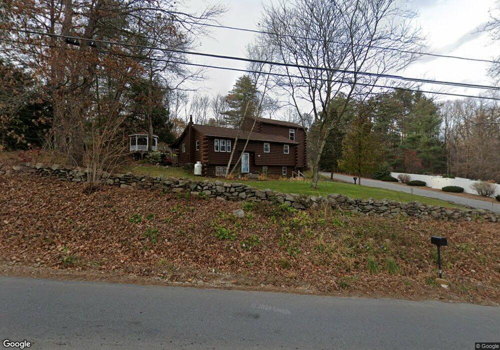
184 Brookfield Rd Charlton, MA 01507
Estimated Value: $398,000 - $505,000
2
Beds
3
Baths
1,573
Sq Ft
$295/Sq Ft
Est. Value
About This Home
This home is located at 184 Brookfield Rd, Charlton, MA 01507 and is currently estimated at $463,412, approximately $294 per square foot. 184 Brookfield Rd is a home located in Worcester County with nearby schools including Shepherd Hill Regional High School.
Ownership History
Date
Name
Owned For
Owner Type
Purchase Details
Closed on
Sep 26, 2003
Sold by
Derry-Neely Elaine C and Jaeger Elaine C
Bought by
Derry-Neely Elaine C and Neely Michael J
Current Estimated Value
Home Financials for this Owner
Home Financials are based on the most recent Mortgage that was taken out on this home.
Original Mortgage
$116,200
Outstanding Balance
$53,656
Interest Rate
6.29%
Mortgage Type
Purchase Money Mortgage
Estimated Equity
$409,756
Create a Home Valuation Report for This Property
The Home Valuation Report is an in-depth analysis detailing your home's value as well as a comparison with similar homes in the area
Home Values in the Area
Average Home Value in this Area
Purchase History
| Date | Buyer | Sale Price | Title Company |
|---|---|---|---|
| Derry-Neely Elaine C | -- | -- | |
| Derry-Neely Elaine C | -- | -- | |
| Derry-Neely Elaine C | -- | -- |
Source: Public Records
Mortgage History
| Date | Status | Borrower | Loan Amount |
|---|---|---|---|
| Open | Derry-Neely Elaine C | $116,200 | |
| Closed | Derry-Neely Elaine C | $116,200 | |
| Previous Owner | Derry-Neely Elaine C | $31,500 |
Source: Public Records
Tax History Compared to Growth
Tax History
| Year | Tax Paid | Tax Assessment Tax Assessment Total Assessment is a certain percentage of the fair market value that is determined by local assessors to be the total taxable value of land and additions on the property. | Land | Improvement |
|---|---|---|---|---|
| 2025 | $4,269 | $383,600 | $69,200 | $314,400 |
| 2024 | $4,149 | $365,900 | $66,600 | $299,300 |
| 2023 | $4,055 | $333,200 | $64,100 | $269,100 |
| 2022 | $3,566 | $268,300 | $63,000 | $205,300 |
| 2021 | $3,541 | $235,900 | $61,500 | $174,400 |
| 2020 | $3,061 | $204,900 | $56,400 | $148,500 |
| 2019 | $3,026 | $204,900 | $56,400 | $148,500 |
| 2018 | $2,766 | $204,900 | $56,400 | $148,500 |
| 2017 | $2,483 | $176,100 | $51,300 | $124,800 |
| 2016 | $2,427 | $176,100 | $51,300 | $124,800 |
| 2015 | $2,363 | $176,100 | $51,300 | $124,800 |
| 2014 | $2,322 | $183,400 | $56,400 | $127,000 |
Source: Public Records
Map
Nearby Homes
- 45 Jennings Rd
- 204 Brookfield Rd
- 216 Brookfield Rd
- 49 Jennings Rd
- Lot 3 0 N Sullivan Rd
- Lot 6 0 N Sullivan Rd
- Lot 5 0 N Sullivan Rd
- Lot 4 0 N Sullivan Rd
- 38 N Sullivan Rd
- Lot 0 N Sturbridge Rd
- 208 Sunset Dr
- 6 S Sullivan Rd
- 68 - 74 Sturbridge Rd
- 38 Stevens Park Rd
- 29, 31, 33 Ladd Rd
- 3 Cranberry Meadow Shore Rd
- 0 Worcester Rd
- 28 Southbridge Rd Unit 402
- 5 Carpenter Hill Rd
- 86 Jolicoeur Ave
- 3 Jennings Dr
- 186 Brookfield Rd
- Lot4 Jennings Rd (Drive)
- 7 Jennings Dr
- 4 Jennings Dr
- 2 Jennings Dr
- 180 Brookfield Rd
- 181 Brookfield Rd
- 8 Jennings Dr
- 33 Jennings Dr
- 9 Jennings Dr
- 176 Brookfield Rd
- 1 Sydney Cir
- 179 Brookfield Rd
- 10 Jennings Dr
- 11 Jennings Dr
- 3 Sydney Cir
- 174 Brookfield Rd
- 12 Jennings Dr
- 5 Sydney Cir