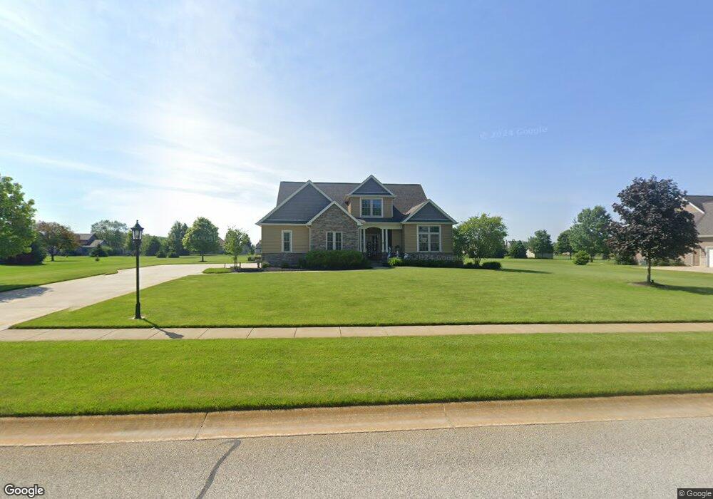
184 Buckskin Ln Valparaiso, IN 46383
Porter County NeighborhoodEstimated Value: $579,589 - $820,000
3
Beds
3
Baths
2,036
Sq Ft
$325/Sq Ft
Est. Value
About This Home
This home is located at 184 Buckskin Ln, Valparaiso, IN 46383 and is currently estimated at $661,897, approximately $325 per square foot. 184 Buckskin Ln is a home located in Porter County with nearby schools including Morgan Township Elementary School, Morgan Township Middle/High School, and Victory Christian Academy.
Ownership History
Date
Name
Owned For
Owner Type
Purchase Details
Closed on
Jul 5, 2013
Sold by
Schneider Builders Inc
Bought by
Ziulkowski Ronald J and Ziulkowski Sheryl A
Current Estimated Value
Home Financials for this Owner
Home Financials are based on the most recent Mortgage that was taken out on this home.
Original Mortgage
$278,400
Interest Rate
3.83%
Mortgage Type
New Conventional
Create a Home Valuation Report for This Property
The Home Valuation Report is an in-depth analysis detailing your home's value as well as a comparison with similar homes in the area
Home Values in the Area
Average Home Value in this Area
Purchase History
| Date | Buyer | Sale Price | Title Company |
|---|---|---|---|
| Ziulkowski Ronald J | -- | Fidelity National Title Comp |
Source: Public Records
Mortgage History
| Date | Status | Borrower | Loan Amount |
|---|---|---|---|
| Closed | Ziulkowski Ronald J | $278,400 |
Source: Public Records
Tax History Compared to Growth
Tax History
| Year | Tax Paid | Tax Assessment Tax Assessment Total Assessment is a certain percentage of the fair market value that is determined by local assessors to be the total taxable value of land and additions on the property. | Land | Improvement |
|---|---|---|---|---|
| 2024 | $3,514 | $523,400 | $84,300 | $439,100 |
| 2023 | $3,374 | $487,600 | $76,700 | $410,900 |
| 2022 | $3,767 | $498,300 | $76,700 | $421,600 |
| 2021 | $3,439 | $427,300 | $76,700 | $350,600 |
| 2020 | $3,143 | $394,900 | $69,700 | $325,200 |
| 2019 | $3,120 | $379,000 | $69,700 | $309,300 |
| 2018 | $2,998 | $371,200 | $69,700 | $301,500 |
| 2017 | $2,970 | $373,200 | $69,700 | $303,500 |
| 2016 | $2,881 | $373,300 | $72,400 | $300,900 |
| 2014 | $3,004 | $361,700 | $70,000 | $291,700 |
| 2013 | -- | $2,000 | $2,000 | $0 |
Source: Public Records
Map
Nearby Homes
- 197 Appaloosa Ln
- 239 Bayberry Ct
- 323 E 124 S
- 232 E 250 S
- 3353 Field Hawk Dr
- 279 S State Road 49
- 3251 Mockingbird Ln
- 1206 Meadow Glen Dr
- 3359 Blue Jay Dr
- 48 E Division Rd
- 0 Smoke Rd
- 501 Eagle Ct
- 372 Radcliff Dr
- 421 Amy Rose Ln
- 355 E 300 S
- 0 Parcel A 325 E
- 0 Parcel B 325 E
- 2054 Lawndale Dr
- 168 Jamestown Ave
- 1954 Lawndale Dr
- 182 Buckskin Ln
- 186 Buckskin Ln
- 180 Buckskin Ln
- 187 Appaloosa Ln
- 188 Buckskin Ln
- 185 Appaloosa Ln
- 179 Buckskin Ln
- 189 Appaloosa Ln
- 181 Buckskin Ln
- 191 Appaloosa Ln
- 183 Appaloosa Ln
- 177 Buckskin Ln
- 190 Buckskin Ln
- 183 Buckskin Ln
- 193 Appaloosa Ln
- 182 Arthur Ln
- 178 Arthur Ln
- 180 Arthur Ln
- 190 Appaloosa Ln
- 192 Buckskin Ln