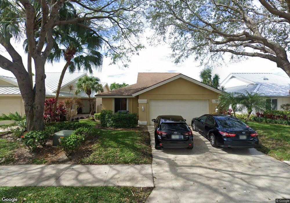
184 Cape Pointe Cir Jupiter, FL 33477
The Bluffs NeighborhoodEstimated Value: $898,000 - $1,237,000
3
Beds
2
Baths
1,889
Sq Ft
$567/Sq Ft
Est. Value
About This Home
This home is located at 184 Cape Pointe Cir, Jupiter, FL 33477 and is currently estimated at $1,070,891, approximately $566 per square foot. 184 Cape Pointe Cir is a home located in Palm Beach County with nearby schools including William T. Dwyer High School, Lighthouse Elementary School, and Beacon Cove Intermediate School.
Ownership History
Date
Name
Owned For
Owner Type
Purchase Details
Closed on
Oct 26, 2004
Sold by
Nicholson Michael and Pierino Donna
Bought by
Nicholson Michael L and Pierino Donna
Current Estimated Value
Purchase Details
Closed on
Jun 26, 1998
Sold by
Butler Barry and Butler Judy
Bought by
Icholson Michael N and Pierino Donna
Home Financials for this Owner
Home Financials are based on the most recent Mortgage that was taken out on this home.
Original Mortgage
$50,000
Outstanding Balance
$9,583
Interest Rate
7.21%
Mortgage Type
New Conventional
Estimated Equity
$1,061,308
Create a Home Valuation Report for This Property
The Home Valuation Report is an in-depth analysis detailing your home's value as well as a comparison with similar homes in the area
Home Values in the Area
Average Home Value in this Area
Purchase History
| Date | Buyer | Sale Price | Title Company |
|---|---|---|---|
| Nicholson Michael L | -- | -- | |
| Icholson Michael N | $187,000 | -- |
Source: Public Records
Mortgage History
| Date | Status | Borrower | Loan Amount |
|---|---|---|---|
| Open | Icholson Michael N | $50,000 |
Source: Public Records
Tax History
| Year | Tax Paid | Tax Assessment Tax Assessment Total Assessment is a certain percentage of the fair market value that is determined by local assessors to be the total taxable value of land and additions on the property. | Land | Improvement |
|---|---|---|---|---|
| 2025 | $12,282 | $719,839 | -- | -- |
| 2024 | $12,282 | $654,399 | -- | -- |
| 2023 | $11,716 | $594,908 | $0 | $0 |
| 2022 | $10,444 | $540,825 | $0 | $0 |
| 2021 | $9,236 | $491,659 | $264,000 | $227,659 |
| 2020 | $8,983 | $470,585 | $169,950 | $300,635 |
| 2019 | $8,541 | $441,078 | $0 | $441,078 |
| 2018 | $8,208 | $435,862 | $0 | $435,862 |
| 2017 | $8,010 | $424,862 | $0 | $0 |
| 2016 | $4,105 | $373,827 | $0 | $0 |
| 2015 | $6,966 | $339,843 | $0 | $0 |
| 2014 | $6,550 | $308,948 | $0 | $0 |
Source: Public Records
Map
Nearby Homes
- 181 Cape Pointe Cir
- 125 Cape Pointe Cir
- 126 Cape Pointe Cir
- 238 River Park Dr
- 246 Ridge Rd
- 101 Cape Pointe Cir
- 228 Ridge Rd
- 125 Seashore Dr
- 3071 30th Ct
- 119 Beach Summit Ct
- 216 Ridge Rd
- 3038 30th Ct
- 316 River Edge Rd
- 125 Sand Pine Dr
- 121 Landward Dr
- 150 Beach Summit Ct
- 438 River Edge Rd
- 401 Ocean Bluffs Blvd Unit 2050
- 401 Ocean Bluffs Blvd Unit 4020
- 197 Ridge Rd
- 186 Cape Pointe Cir
- 182 Cape Pointe Cir
- 188 Cape Pointe Cir
- 149 Cape Pointe Cir
- 147 Cape Pointe Cir
- 178 Cape Pointe Cir
- 190 Cape Pointe Cir
- 145 Cape Pointe Cir
- 183 Cape Pointe Cir
- 185 Cape Pointe Cir
- 187 Cape Pointe Cir
- 179 Cape Pointe Cir
- 143 Cape Pointe Cir
- 192 Cape Pointe Cir
- 189 Cape Pointe Cir
- 177 Cape Pointe Cir
- 191 Cape Pointe Cir
- 141 Cape Pointe Cir
- 194 Cape Pointe Cir
- 152 Cape Pointe Cir
Your Personal Tour Guide
Ask me questions while you tour the home.