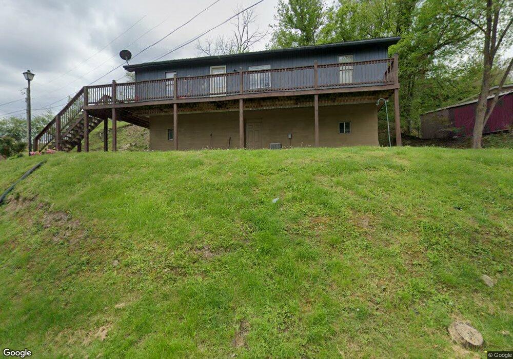
184 Cole Ave Hazard, KY 41701
Estimated Value: $88,000 - $131,000
3
Beds
2
Baths
1,176
Sq Ft
$98/Sq Ft
Est. Value
About This Home
This home is located at 184 Cole Ave, Hazard, KY 41701 and is currently estimated at $115,458, approximately $98 per square foot. 184 Cole Ave is a home with nearby schools including Roy G. Eversole Elementary School, Hazard Middle School, and Hazard High School.
Ownership History
Date
Name
Owned For
Owner Type
Purchase Details
Closed on
Nov 7, 2018
Sold by
First Fsla Of Hazard
Bought by
Biallas Darryl and Biallas Barbara
Current Estimated Value
Home Financials for this Owner
Home Financials are based on the most recent Mortgage that was taken out on this home.
Original Mortgage
$35,000
Outstanding Balance
$11,634
Interest Rate
4.7%
Mortgage Type
New Conventional
Estimated Equity
$103,825
Create a Home Valuation Report for This Property
The Home Valuation Report is an in-depth analysis detailing your home's value as well as a comparison with similar homes in the area
Home Values in the Area
Average Home Value in this Area
Purchase History
| Date | Buyer | Sale Price | Title Company |
|---|---|---|---|
| Biallas Darryl | $27,000 | None Available |
Source: Public Records
Mortgage History
| Date | Status | Borrower | Loan Amount |
|---|---|---|---|
| Open | Biallas Darryl | $35,000 |
Source: Public Records
Tax History
| Year | Tax Paid | Tax Assessment Tax Assessment Total Assessment is a certain percentage of the fair market value that is determined by local assessors to be the total taxable value of land and additions on the property. | Land | Improvement |
|---|---|---|---|---|
| 2025 | $885 | $78,000 | $0 | $0 |
| 2024 | $885 | $78,000 | $0 | $0 |
| 2023 | $885 | $78,000 | $18,000 | $60,000 |
| 2022 | $865 | $78,000 | $18,000 | $60,000 |
| 2021 | $865 | $78,000 | $18,000 | $60,000 |
| 2020 | $299 | $27,000 | $27,000 | $0 |
| 2019 | $291 | $27,000 | $27,000 | $0 |
| 2018 | $730 | $70,000 | $70,000 | $0 |
| 2017 | $70,000 | $70,000 | $70,000 | $0 |
| 2016 | $70,000 | $70,000 | $70,000 | $0 |
| 2015 | $70,000 | $70,000 | $70,000 | $0 |
| 2013 | $677 | $70,000 | $70,000 | $0 |
Source: Public Records
Map
Nearby Homes
- 2517 N Main St
- 157 Alto St
- 272 Chimney Rock Rd
- 540 Skyline Dr
- 300 Perry Circle Rd
- 208 Eversole St
- 148 Combs St
- 141 Eversole St
- 362 Poplar St
- 270 Rockaway St
- 131 Oak St
- 219 Perry Ave
- 0 E Main St
- 21 Adams Ridge Rd
- 105 Stewart Ct
- 187 Meadow Brook Terrace
- 215 Argyll Cir
- 207 Rock Ridge Rd
- 172 Falcon Crest Ct
- 0000 Commerce Dr
Your Personal Tour Guide
Ask me questions while you tour the home.