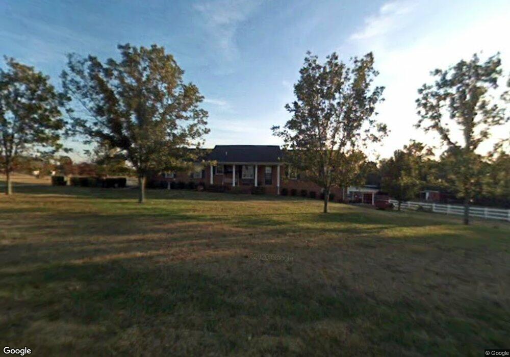
184 Holman Rd Harvest, AL 35749
Harvest-Cluttsville NeighborhoodEstimated Value: $207,000 - $271,000
--
Bed
--
Bath
1,742
Sq Ft
$136/Sq Ft
Est. Value
About This Home
This home is located at 184 Holman Rd, Harvest, AL 35749 and is currently estimated at $237,113, approximately $136 per square foot. 184 Holman Rd is a home with nearby schools including Harvest Elementary School, Sparkman Middle School, and Sparkman High School.
Ownership History
Date
Name
Owned For
Owner Type
Purchase Details
Closed on
Mar 21, 2025
Sold by
Pearson Rita Jane
Bought by
West Mark E and West Julia White
Current Estimated Value
Home Financials for this Owner
Home Financials are based on the most recent Mortgage that was taken out on this home.
Original Mortgage
$206,250
Outstanding Balance
$205,198
Interest Rate
6.89%
Mortgage Type
New Conventional
Estimated Equity
$31,915
Purchase Details
Closed on
Aug 31, 2023
Sold by
Pearson Talmage
Bought by
Moon Beverly Ann
Purchase Details
Closed on
May 12, 2011
Sold by
Pearson Talmage J and Pearson Mary S
Bought by
Pearson Steven
Create a Home Valuation Report for This Property
The Home Valuation Report is an in-depth analysis detailing your home's value as well as a comparison with similar homes in the area
Home Values in the Area
Average Home Value in this Area
Purchase History
| Date | Buyer | Sale Price | Title Company |
|---|---|---|---|
| West Mark E | $275,000 | None Listed On Document | |
| Moon Beverly Ann | $250,000 | None Listed On Document | |
| Moon Beverly Ann | $250,000 | None Listed On Document | |
| Pearson Steven | -- | None Listed On Document | |
| Pearson Steven | -- | None Listed On Document | |
| Moon Beverly | -- | None Listed On Document | |
| Pearson Sandra Diane | -- | None Listed On Document | |
| Moon Beverly | -- | None Listed On Document |
Source: Public Records
Mortgage History
| Date | Status | Borrower | Loan Amount |
|---|---|---|---|
| Open | West Mark E | $206,250 |
Source: Public Records
Tax History Compared to Growth
Tax History
| Year | Tax Paid | Tax Assessment Tax Assessment Total Assessment is a certain percentage of the fair market value that is determined by local assessors to be the total taxable value of land and additions on the property. | Land | Improvement |
|---|---|---|---|---|
| 2024 | $1,207 | $8,080 | $7,200 | $880 |
| 2023 | $221 | $22,560 | $3,420 | $19,140 |
| 2022 | $566 | $19,360 | $2,360 | $17,000 |
| 2021 | $529 | $18,140 | $2,360 | $15,780 |
| 2020 | $490 | $27,200 | $12,520 | $14,680 |
| 2019 | $474 | $26,670 | $12,520 | $14,150 |
| 2018 | $439 | $15,600 | $0 | $0 |
| 2017 | $439 | $15,600 | $0 | $0 |
| 2016 | $439 | $15,600 | $0 | $0 |
| 2015 | $439 | $15,600 | $0 | $0 |
| 2014 | $435 | $15,460 | $0 | $0 |
Source: Public Records
Map
Nearby Homes
- 105 Oak Terrace Ln
- 103 Oak Path Ln
- 105 Oak Path Ln
- 3713 Old Railroad Bed Rd
- 9.7 acres Yarbrough Rd
- 265 Dorning Rd
- 125 Grey Mare St
- 122 Grey Mare St
- 106 Bent Saddle St
- 200 Wild Berry Ln
- 14709 Ravenel Dr
- 129 Bridge Crest Dr
- 100 Coriander Ln
- Cali Plan at Trestle Point
- Freeport Plan at Trestle Point
- Aldridge Plan at Trestle Point
- Kerry Plan at Trestle Point
- Poppy-Frnt V/B&B w/3s V/Lap Plan at Trestle Point
- 204 Trestle Cove Cir
- 105 Starview Ct
- 168 Holman Rd
- 134 Holman Rd
- 230 Holman Rd
- 106 Holman Rd
- 3644 Old Railroad Bed Rd
- 3679 Old Railroad Bed Rd
- 3699 Old Railroad Bed Rd
- 3665 Old Railroad Bed Rd
- 3622 Old Railroad Bed Rd
- 3612 Old Railroad Bed Rd
- 1435 Oak Brook Dr
- 100 Oak Terrace Ln
- 3623 Old Railroad Bed Rd
- 101 Oak Terrace Ln
- 3604 Old Railroad Bed Rd
- 77 Oak Fletcher Dr
- 0 Oak Terrace Ln Unit 312185
- 0 Oak Terrace Ln Unit 312184
- 0 Oak Terrace Ln Unit 312183
- 0 Oak Terrace Ln Unit 312182