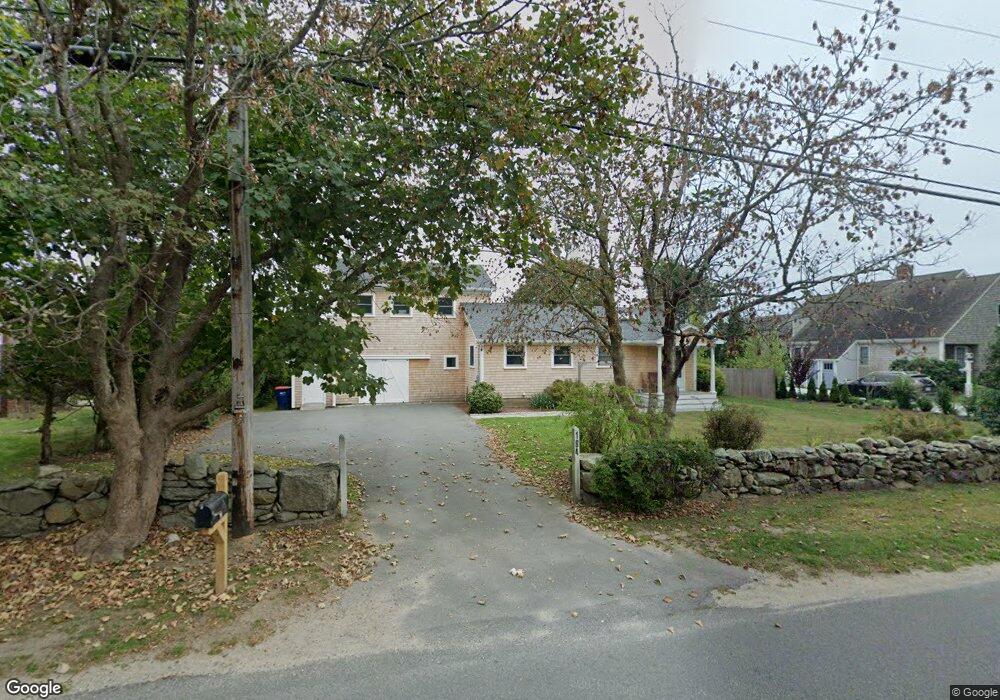
184 Howland Rd Westport, MA 02790
Acoaxet NeighborhoodEstimated Value: $1,086,000 - $1,396,000
3
Beds
1
Bath
1,560
Sq Ft
$814/Sq Ft
Est. Value
About This Home
This home is located at 184 Howland Rd, Westport, MA 02790 and is currently estimated at $1,269,724, approximately $813 per square foot. 184 Howland Rd is a home located in Bristol County with nearby schools including Alice A. Macomber Primary School, Westport Elementary School, and Westport Middle-High School.
Ownership History
Date
Name
Owned For
Owner Type
Purchase Details
Closed on
Feb 26, 2003
Sold by
Linnell Barbara C and Linnell John W
Bought by
Gower Kristen C
Current Estimated Value
Purchase Details
Closed on
Jan 8, 1997
Sold by
Carter Francis C and Carter Isabella W
Bought by
Linnell Barbara C and Linnell John W
Create a Home Valuation Report for This Property
The Home Valuation Report is an in-depth analysis detailing your home's value as well as a comparison with similar homes in the area
Home Values in the Area
Average Home Value in this Area
Purchase History
| Date | Buyer | Sale Price | Title Company |
|---|---|---|---|
| Gower Kristen C | -- | -- | |
| Linnell Barbara C | $258,000 | -- |
Source: Public Records
Tax History Compared to Growth
Tax History
| Year | Tax Paid | Tax Assessment Tax Assessment Total Assessment is a certain percentage of the fair market value that is determined by local assessors to be the total taxable value of land and additions on the property. | Land | Improvement |
|---|---|---|---|---|
| 2025 | $6,826 | $916,300 | $551,300 | $365,000 |
| 2024 | $6,385 | $826,000 | $466,000 | $360,000 |
| 2023 | $6,328 | $775,500 | $443,800 | $331,700 |
| 2022 | $6,153 | $725,600 | $443,800 | $281,800 |
| 2021 | $5,907 | $685,300 | $403,500 | $281,800 |
| 2020 | $4,009 | $611,600 | $387,400 | $224,200 |
| 2019 | $4,974 | $601,400 | $392,700 | $208,700 |
| 2018 | $3,700 | $612,000 | $421,200 | $190,800 |
| 2017 | $4,832 | $606,300 | $421,200 | $185,100 |
| 2016 | $4,735 | $598,600 | $421,200 | $177,400 |
| 2015 | $4,597 | $579,700 | $432,500 | $147,200 |
Source: Public Records
Map
Nearby Homes
- 189 Brayton Point Rd
- 304 Brayton Point Rd
- 19 Seabury Ln
- 255 John Dyer Rd
- 18 Old Barn Rd
- 1881 Main Rd
- 1749 Main Rd
- 128 Maple Ave
- 0 Reed Rd (Ss)
- 245 John Dyer Rd
- 1580 Main Rd
- 505 Long Hwy
- 1702J Drift Rd
- 1702 Drift Rd
- 141 S Of Commons Rd
- 1346 Main Rd Unit B
- 0 Willow Ave
- 17 Quail Trail
- 116 Amy Hart Path
- 83 Long Hwy