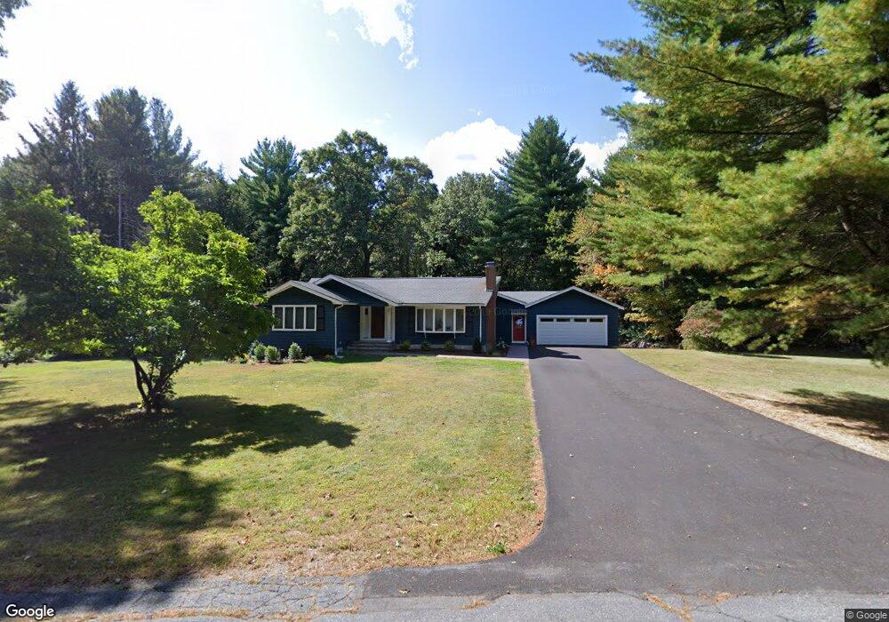
184 Littlefield Rd Boxborough, MA 01719
Estimated Value: $778,000 - $856,000
3
Beds
3
Baths
1,879
Sq Ft
$436/Sq Ft
Est. Value
About This Home
This home is located at 184 Littlefield Rd, Boxborough, MA 01719 and is currently estimated at $819,367, approximately $436 per square foot. 184 Littlefield Rd is a home located in Middlesex County with nearby schools including Acton-Boxborough Regional High School and Oak Meadow Montessori School.
Ownership History
Date
Name
Owned For
Owner Type
Purchase Details
Closed on
Jul 29, 1998
Sold by
Walonis Michael A and Farrington Faye M
Bought by
Malakian A Karl and Finnerty Heather F
Current Estimated Value
Create a Home Valuation Report for This Property
The Home Valuation Report is an in-depth analysis detailing your home's value as well as a comparison with similar homes in the area
Home Values in the Area
Average Home Value in this Area
Purchase History
| Date | Buyer | Sale Price | Title Company |
|---|---|---|---|
| Malakian A Karl | $296,000 | -- | |
| Finnerty Malakian A | $296,000 | -- |
Source: Public Records
Mortgage History
| Date | Status | Borrower | Loan Amount |
|---|---|---|---|
| Open | Finnerty Malakian A | $307,500 | |
| Closed | Finnerty Malakian A | $288,000 |
Source: Public Records
Tax History
| Year | Tax Paid | Tax Assessment Tax Assessment Total Assessment is a certain percentage of the fair market value that is determined by local assessors to be the total taxable value of land and additions on the property. | Land | Improvement |
|---|---|---|---|---|
| 2025 | $11,638 | $768,700 | $283,500 | $485,200 |
| 2024 | $11,350 | $757,200 | $272,000 | $485,200 |
| 2023 | $10,647 | $686,000 | $233,700 | $452,300 |
| 2022 | $10,478 | $601,500 | $233,700 | $367,800 |
| 2020 | $8,537 | $510,600 | $233,700 | $276,900 |
| 2019 | $8,384 | $510,600 | $233,700 | $276,900 |
| 2018 | $5,569 | $495,600 | $222,800 | $272,800 |
| 2017 | $7,546 | $448,900 | $222,800 | $226,100 |
| 2016 | $7,337 | $448,500 | $222,800 | $225,700 |
| 2015 | $7,229 | $434,200 | $200,600 | $233,600 |
| 2014 | $6,938 | $392,200 | $194,700 | $197,500 |
Source: Public Records
Map
Nearby Homes
- 4 Littlefield Rd
- 60 Nashoba Rd
- 8 Algonquin Rd
- 5 Perkins Ln
- 4 Omega Way
- 235 Arlington St
- 285 Central St Unit 285
- 20 Joseph Reed Ln
- 79 Charter Rd
- 305 Harwood Ave
- 36 Leonard Rd
- 959 Hill Rd
- 79 Old Orchard Ln
- 92 Willow St Unit 3
- 92 Willow St Unit 2
- 90 Willow St Unit 1
- 146 Tahattawan Rd
- 18 Hayward Rd
- 246 Main St Unit 2
- 77 Wheeler Dr Unit 77
- 170 Littlefield Rd
- 152 Littlefield Rd
- 214 Littlefield Rd
- 134 Littlefield Rd
- 35 Sargent Rd
- 232 Littlefield Rd
- 265 Littlefield Rd
- 55 Sargent Rd
- 239 Littlefield Rd
- 252 Littlefield Rd
- 36 Sargent Rd
- 270 Littlefield Rd
- 80 Littlefield Rd
- 148 Sargent Rd
- 22 Littlefield Rd
- 201 Sargent Rd
- 200 Sargent Rd
- 221 Sargent Rd
- 455 Central St
- 440 Central St
Your Personal Tour Guide
Ask me questions while you tour the home.