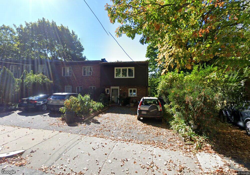
184 Rawson Rd Brookline, MA 02445
Washington Square NeighborhoodEstimated Value: $1,805,000 - $1,998,000
5
Beds
4
Baths
2,460
Sq Ft
$785/Sq Ft
Est. Value
About This Home
This home is located at 184 Rawson Rd, Brookline, MA 02445 and is currently estimated at $1,932,077, approximately $785 per square foot. 184 Rawson Rd is a home located in Norfolk County with nearby schools including John D. Runkle School, Brookline High School, and Torah Academy.
Ownership History
Date
Name
Owned For
Owner Type
Purchase Details
Closed on
Jan 19, 2007
Sold by
Mathiowitz Edith and Mathiowitz George
Bought by
Mathiowitz Edith
Current Estimated Value
Purchase Details
Closed on
Jun 5, 1989
Sold by
Erba Giuseppe
Bought by
Mathiowitz George
Home Financials for this Owner
Home Financials are based on the most recent Mortgage that was taken out on this home.
Original Mortgage
$217,500
Interest Rate
10.92%
Mortgage Type
Purchase Money Mortgage
Create a Home Valuation Report for This Property
The Home Valuation Report is an in-depth analysis detailing your home's value as well as a comparison with similar homes in the area
Home Values in the Area
Average Home Value in this Area
Purchase History
| Date | Buyer | Sale Price | Title Company |
|---|---|---|---|
| Mathiowitz Edith | -- | -- | |
| Mathiowitz George | $290,000 | -- |
Source: Public Records
Mortgage History
| Date | Status | Borrower | Loan Amount |
|---|---|---|---|
| Previous Owner | Mathiowitz George | $181,000 | |
| Previous Owner | Mathiowitz George | $188,000 | |
| Previous Owner | Mathiowitz George | $217,500 |
Source: Public Records
Tax History
| Year | Tax Paid | Tax Assessment Tax Assessment Total Assessment is a certain percentage of the fair market value that is determined by local assessors to be the total taxable value of land and additions on the property. | Land | Improvement |
|---|---|---|---|---|
| 2025 | $16,412 | $1,662,800 | $1,138,000 | $524,800 |
| 2024 | $15,631 | $1,599,900 | $1,094,300 | $505,600 |
| 2023 | $13,990 | $1,403,200 | $904,200 | $499,000 |
| 2022 | $13,617 | $1,336,300 | $861,100 | $475,200 |
| 2021 | $12,593 | $1,285,000 | $828,000 | $457,000 |
| 2020 | $11,378 | $1,204,000 | $752,700 | $451,300 |
| 2019 | $10,745 | $1,146,700 | $716,900 | $429,800 |
| 2018 | $9,250 | $977,800 | $567,100 | $410,700 |
| 2017 | $9,061 | $917,100 | $535,000 | $382,100 |
| 2016 | $8,931 | $857,100 | $500,000 | $357,100 |
| 2015 | $8,101 | $758,500 | $424,800 | $333,700 |
| 2014 | $8,383 | $736,000 | $386,100 | $349,900 |
Source: Public Records
Map
Nearby Homes
- 315 Tappan St Unit 4
- 20 Claflin Rd Unit A
- 90 Addington Rd Unit 1
- 90 Addington Rd Unit 2
- 323 Clark Rd
- 195 Winthrop Rd Unit 1
- 57 University Rd Unit 3
- 135 Beaconsfield Rd Unit 2
- 15 Colbourne Crescent Unit 2
- 89 University Rd
- 84 Winthrop Rd Unit 1
- 84 Winthrop Rd
- 1620 Beacon St
- 1618 Beacon St Unit 1
- 4 Fairbanks St Unit 2
- 24 Blake Rd
- 115 Clark Rd
- 43 Druce St
- 1778 Beacon St Unit 302
- 19 Westbourne Terrace Unit 2
- 182 Rawson Rd
- 180 Rawson Rd
- 188 Rawson Rd Unit B
- 188 Rawson Rd Unit A
- 188 Rawson Rd Unit 1
- 176 Rawson Rd
- 277 Tappan St
- 275 Tappan St
- 275 Tappan St Unit 1
- 275 Tappan St Unit 2
- 267 Tappan St Unit 2
- 267 Tappan St Unit A
- 185 Rawson Rd Unit 3
- 185 Rawson Rd Unit 2
- 185 Rawson Rd Unit 1
- 179 Rawson Rd
- 261 Tappan St
- 261 Tappan St Unit 2
- 261 Tappan St Unit B
- 261 Tappan St Unit A
Your Personal Tour Guide
Ask me questions while you tour the home.