Estimated Value: $549,255 - $637,000
4
Beds
3
Baths
2,184
Sq Ft
$273/Sq Ft
Est. Value
About This Home
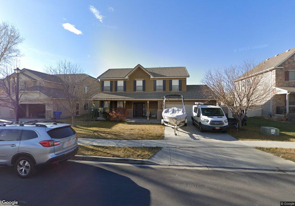
This home is located at 184 S 2035 W, Lehi, UT 84043 and is currently estimated at $595,814, approximately $272 per square foot. 184 S 2035 W is a home located in Utah County with nearby schools including Snow Springs Elementary, Willowcreek Middle School, and Lehi High School.
Ownership History
Date
Name
Owned For
Owner Type
Purchase Details
Closed on
May 27, 2008
Sold by
Richmond American Homes Of Utah Inc
Bought by
Carlson Robert B and Law Yuet Ching
Current Estimated Value
Home Financials for this Owner
Home Financials are based on the most recent Mortgage that was taken out on this home.
Original Mortgage
$196,400
Outstanding Balance
$124,864
Interest Rate
5.87%
Mortgage Type
Purchase Money Mortgage
Estimated Equity
$470,950
Create a Home Valuation Report for This Property
The Home Valuation Report is an in-depth analysis detailing your home's value as well as a comparison with similar homes in the area
Home Values in the Area
Average Home Value in this Area
Purchase History
| Date | Buyer | Sale Price | Title Company |
|---|---|---|---|
| Carlson Robert B | -- | First American Union Heig |
Source: Public Records
Mortgage History
| Date | Status | Borrower | Loan Amount |
|---|---|---|---|
| Open | Carlson Robert B | $196,400 |
Source: Public Records
Tax History Compared to Growth
Tax History
| Year | Tax Paid | Tax Assessment Tax Assessment Total Assessment is a certain percentage of the fair market value that is determined by local assessors to be the total taxable value of land and additions on the property. | Land | Improvement |
|---|---|---|---|---|
| 2025 | $2,222 | $276,045 | $206,300 | $295,600 |
| 2024 | $2,222 | $260,040 | $0 | $0 |
| 2023 | $2,072 | $263,340 | $0 | $0 |
| 2022 | $2,173 | $267,685 | $0 | $0 |
| 2021 | $1,935 | $360,400 | $119,400 | $241,000 |
| 2020 | $1,824 | $335,800 | $110,600 | $225,200 |
| 2019 | $1,656 | $316,900 | $110,600 | $206,300 |
| 2018 | $1,573 | $284,500 | $95,800 | $188,700 |
| 2017 | $1,551 | $149,160 | $0 | $0 |
| 2016 | $1,539 | $137,335 | $0 | $0 |
| 2015 | $1,504 | $127,380 | $0 | $0 |
| 2014 | $1,490 | $125,510 | $0 | $0 |
Source: Public Records
Map
Nearby Homes
- 202 S 2035 W
- 2162 W Main St Unit E303
- 2178 W Main St Unit D301
- 131 S 1900 W Unit 2
- 210 S Tamarak Cir
- 41 N 2150 W
- 1784 W Grays Place
- 1743 W Grays Place
- 105 N 2430 W
- 122 N 2430 W Unit 1
- The Roslyn Plan at Carla's Cove
- The Tracie Plan at Carla's Cove
- The Brooke Plan at Carla's Cove
- The Jackie Plan at Carla's Cove
- 603 S 2500 W
- 380 S 1500 W
- 161 S 1475 W
- 811 S 2300 W
- 581 S 1500 W
- 928 Gander Way