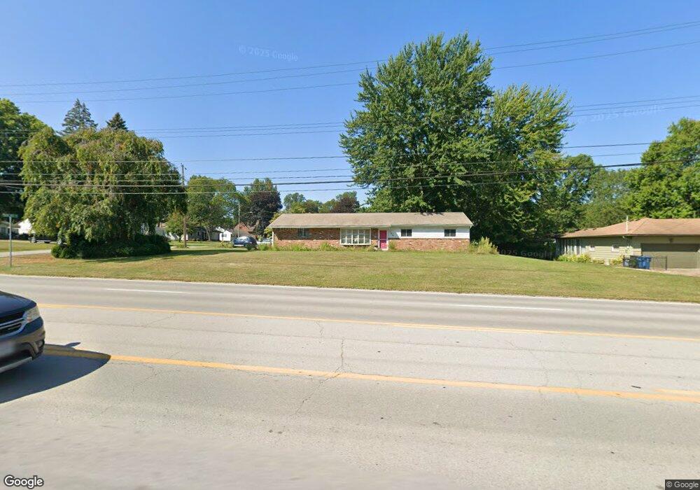
184 S Leavitt Rd Amherst, OH 44001
Estimated Value: $204,000 - $253,000
3
Beds
2
Baths
1,612
Sq Ft
$139/Sq Ft
Est. Value
About This Home
This home is located at 184 S Leavitt Rd, Amherst, OH 44001 and is currently estimated at $224,872, approximately $139 per square foot. 184 S Leavitt Rd is a home located in Lorain County with nearby schools including Powers Elementary School, Walter G. Nord Middle School, and Amherst Junior High School.
Ownership History
Date
Name
Owned For
Owner Type
Purchase Details
Closed on
Dec 11, 2003
Sold by
Gilbert Dorothy M
Bought by
Gilbert Whitcomb Barbara
Current Estimated Value
Purchase Details
Closed on
Nov 20, 2003
Sold by
Pledged Property Ii Llc
Bought by
Gilbert Dorothy
Purchase Details
Closed on
Aug 25, 2003
Sold by
Godfrey Earl T
Bought by
Pledged Property Ii Llc
Purchase Details
Closed on
Aug 28, 2000
Sold by
Guidicelli Herold S and Guidicelli Stauroula G
Bought by
Godfrey Earl T
Home Financials for this Owner
Home Financials are based on the most recent Mortgage that was taken out on this home.
Original Mortgage
$120,000
Interest Rate
10.75%
Create a Home Valuation Report for This Property
The Home Valuation Report is an in-depth analysis detailing your home's value as well as a comparison with similar homes in the area
Home Values in the Area
Average Home Value in this Area
Purchase History
| Date | Buyer | Sale Price | Title Company |
|---|---|---|---|
| Gilbert Whitcomb Barbara | -- | -- | |
| Gilbert Dorothy | $98,000 | Magee Title Agency | |
| Pledged Property Ii Llc | $90,000 | -- | |
| Godfrey Earl T | $110,000 | First Service Title Agency I |
Source: Public Records
Mortgage History
| Date | Status | Borrower | Loan Amount |
|---|---|---|---|
| Previous Owner | Godfrey Earl T | $120,000 |
Source: Public Records
Tax History Compared to Growth
Tax History
| Year | Tax Paid | Tax Assessment Tax Assessment Total Assessment is a certain percentage of the fair market value that is determined by local assessors to be the total taxable value of land and additions on the property. | Land | Improvement |
|---|---|---|---|---|
| 2024 | $1,683 | $51,461 | $19,495 | $31,966 |
| 2023 | $1,506 | $40,614 | $7,340 | $33,275 |
| 2022 | $1,463 | $40,614 | $7,340 | $33,275 |
| 2021 | $1,467 | $40,614 | $7,340 | $33,275 |
| 2020 | $1,309 | $33,990 | $6,140 | $27,850 |
| 2019 | $1,283 | $33,990 | $6,140 | $27,850 |
| 2018 | $1,290 | $33,990 | $6,140 | $27,850 |
| 2017 | $1,286 | $32,370 | $10,210 | $22,160 |
| 2016 | $1,296 | $32,370 | $10,210 | $22,160 |
| 2015 | $1,767 | $32,370 | $10,210 | $22,160 |
| 2014 | $1,849 | $33,720 | $10,630 | $23,090 |
| 2013 | $1,855 | $33,720 | $10,630 | $23,090 |
Source: Public Records
Map
Nearby Homes
- 1140 Woodside Dr
- 891 Park Ave
- 135 Ridgeland Dr
- 179 Jackson St
- 105 N Woodhill Dr
- 825 Cleveland Ave
- 7475 S Dewey Rd
- 2176 Myla Way
- 653 Brennan Dr
- 726 Sunrise Dr
- 0 Middle Ridge Rd Unit 5102632
- 0 Middle Ridge Rd Unit 5160578
- 6394 Balsam Dr
- 574 Fieldstone Dr
- 8 Riviera Ave
- 7325 Hidden Glen Dr
- 60 Flamingo Ave
- 357 Rockridge Dr
- 707 Greenlawn Dr
- 117 Caesars Cir
- 61 Hume Hill Dr
- 180 S Leavitt Rd
- 194 S Leavitt Rd
- 185 S Leavitt Rd
- 55 Hume Hill Dr
- 183 S Leavitt Rd
- 1190 Woodside Dr
- 189 S Leavitt Rd
- 60 Hume Hill Dr
- 1180 Woodside Dr
- 179 S Leavitt Rd
- 51 Hume Hill Dr
- 58 Hume Hill Dr
- 191 S Leavitt Rd
- 198 S Leavitt Rd
- 1170 Woodside Dr
- 1175 Park Ave
- 54 Hume Hill Dr
- 190 Butternut Dr
- 186 Butternut Dr