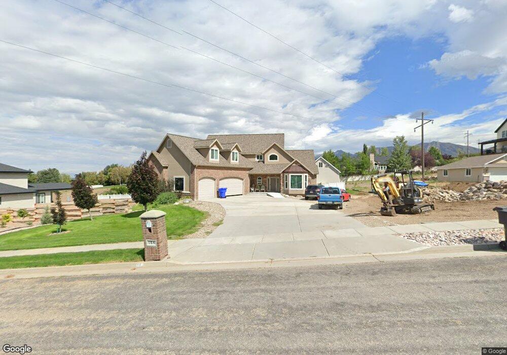
184 W 2050 S Brigham City, UT 84302
Estimated Value: $617,000 - $896,000
3
Beds
3
Baths
5,646
Sq Ft
$140/Sq Ft
Est. Value
About This Home
This home is located at 184 W 2050 S, Brigham City, UT 84302 and is currently estimated at $792,182, approximately $140 per square foot. 184 W 2050 S is a home located in Box Elder County with nearby schools including Three Mile Creek School, Adele C. Young Intermediate School, and Box Elder Middle School.
Ownership History
Date
Name
Owned For
Owner Type
Purchase Details
Closed on
Aug 12, 2008
Sold by
Wilkinson Brad
Bought by
Conover Michael and Conover Melissa
Current Estimated Value
Home Financials for this Owner
Home Financials are based on the most recent Mortgage that was taken out on this home.
Original Mortgage
$305,000
Outstanding Balance
$200,474
Interest Rate
6.36%
Mortgage Type
Adjustable Rate Mortgage/ARM
Estimated Equity
$591,708
Create a Home Valuation Report for This Property
The Home Valuation Report is an in-depth analysis detailing your home's value as well as a comparison with similar homes in the area
Home Values in the Area
Average Home Value in this Area
Purchase History
| Date | Buyer | Sale Price | Title Company |
|---|---|---|---|
| Conover Michael | -- | -- |
Source: Public Records
Mortgage History
| Date | Status | Borrower | Loan Amount |
|---|---|---|---|
| Open | Conover Michael | $305,000 |
Source: Public Records
Tax History Compared to Growth
Tax History
| Year | Tax Paid | Tax Assessment Tax Assessment Total Assessment is a certain percentage of the fair market value that is determined by local assessors to be the total taxable value of land and additions on the property. | Land | Improvement |
|---|---|---|---|---|
| 2025 | $5,115 | $803,681 | $165,000 | $638,681 |
| 2024 | $4,451 | $773,759 | $160,000 | $613,759 |
| 2023 | $4,367 | $814,113 | $160,000 | $654,113 |
| 2022 | $4,266 | $409,192 | $35,750 | $373,442 |
| 2021 | $3,700 | $495,381 | $65,000 | $430,381 |
| 2020 | $3,246 | $495,381 | $65,000 | $430,381 |
| 2019 | $2,750 | $223,157 | $33,000 | $190,157 |
| 2018 | $2,630 | $198,354 | $33,000 | $165,354 |
| 2017 | $2,715 | $360,643 | $33,000 | $300,643 |
| 2016 | $2,682 | $190,480 | $33,000 | $157,480 |
| 2015 | $2,436 | $176,163 | $33,000 | $143,163 |
| 2014 | $2,436 | $169,346 | $32,010 | $137,336 |
| 2013 | -- | $156,861 | $32,010 | $124,851 |
Source: Public Records
Map
Nearby Homes
- 2023 S 150 W
- 2051 S Eskelsen Ln
- 2049 S 100 W Unit 8
- 295 W 2000 S
- 2021 S 100 W Unit 13
- 300 W 2000 S
- 1873 S 300 W Unit 19
- 1795 S 225 W
- 409 W 2100 S
- 1769 S 100 W
- 39 E 1800 S
- 2245 S 450 W
- 140 W Hill Haven Dr
- 1568 S 125 W
- 165 1600 S
- 2230 S 635 W Unit C
- 2230 S 635 W Unit D
- 2475 S 450 W
- 314 W 1550 S
- 1542 Valley View Dr
- 184 W 2050 S Unit 21
- 170 W 2050 S
- 204 W 2050 S
- 2030 S 100 W Unit 19
- 2030 S 100 W
- 2030 S 150 W Unit 19
- 185 W 2000 S
- 197 W 2050 S
- 197 W 2050 S Unit 15
- 175 W 2050 S
- 219 W 2050 S
- 219 W 2050 S Unit 14
- 173 W 2000 S
- 2033 S 150 W Unit 10
- 234 W 2050 S
- 234 W 2050 S
- 234 W 2050 S
- 234 W 2050 S Unit 23
- 2023 S 150 W Unit 22
- 2023 S 150 W Unit 19