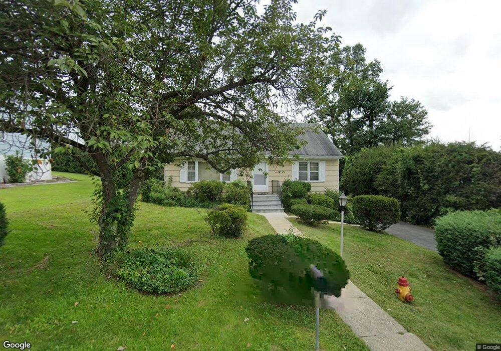
184 Weed Ave Hawthorne, NY 10532
Estimated Value: $711,000 - $862,000
--
Bed
--
Bath
--
Sq Ft
9,583
Sq Ft Lot
About This Home
This home is located at 184 Weed Ave, Hawthorne, NY 10532 and is currently estimated at $769,175. 184 Weed Ave is a home located in Westchester County with nearby schools including Hawthorne Elementary School, Columbus Elementary School, and Westlake Middle School.
Ownership History
Date
Name
Owned For
Owner Type
Purchase Details
Closed on
Jun 6, 2024
Sold by
Roberto Ralph R and Roberto Daniel
Bought by
Daniel Roberto Irrevocable Trust and Ralph Roberto Irrevocable Trust
Current Estimated Value
Purchase Details
Closed on
Feb 4, 2019
Sold by
Roberto Ralph and Roberto Daniel
Bought by
Roberto Daniel and Roberto Ralph R
Home Financials for this Owner
Home Financials are based on the most recent Mortgage that was taken out on this home.
Original Mortgage
$697,500
Interest Rate
4.4%
Mortgage Type
FHA
Purchase Details
Closed on
Nov 7, 2017
Sold by
Roberto Ronald and Roberto Ralph
Bought by
Roberto Ralph and Roberto Daniel
Purchase Details
Closed on
Jun 24, 2010
Sold by
Castaldo Lucy and Roberto Lucy
Bought by
Roberto Ronald and Roberto Ralph
Create a Home Valuation Report for This Property
The Home Valuation Report is an in-depth analysis detailing your home's value as well as a comparison with similar homes in the area
Home Values in the Area
Average Home Value in this Area
Purchase History
| Date | Buyer | Sale Price | Title Company |
|---|---|---|---|
| Daniel Roberto Irrevocable Trust | -- | None Listed On Document | |
| Roberto Daniel | -- | Fnc Title Services Llc | |
| Roberto Ralph | -- | None Available | |
| Roberto Ronald | -- | None Available |
Source: Public Records
Mortgage History
| Date | Status | Borrower | Loan Amount |
|---|---|---|---|
| Previous Owner | Roberto Daniel | $697,500 |
Source: Public Records
Tax History Compared to Growth
Tax History
| Year | Tax Paid | Tax Assessment Tax Assessment Total Assessment is a certain percentage of the fair market value that is determined by local assessors to be the total taxable value of land and additions on the property. | Land | Improvement |
|---|---|---|---|---|
| 2024 | $4,885 | $6,400 | $1,350 | $5,050 |
| 2023 | $4,742 | $6,400 | $1,350 | $5,050 |
| 2022 | $4,603 | $6,400 | $1,350 | $5,050 |
| 2021 | $4,459 | $6,400 | $1,350 | $5,050 |
| 2020 | $4,316 | $6,400 | $1,350 | $5,050 |
| 2019 | $12,756 | $6,400 | $1,350 | $5,050 |
| 2018 | $15,014 | $6,400 | $1,350 | $5,050 |
| 2017 | $0 | $6,400 | $1,350 | $5,050 |
| 2016 | $11,479 | $6,400 | $1,350 | $5,050 |
| 2015 | -- | $6,400 | $1,350 | $5,050 |
| 2014 | -- | $6,400 | $1,350 | $5,050 |
| 2013 | -- | $6,400 | $1,350 | $5,050 |
Source: Public Records
Map
Nearby Homes
- 324 Tuxedo Place
- 32 Weed Ave
- 233 Brady Ave
- 237 Brady Ave
- 317 Elwood Ave
- 350 Commerce St
- 404 Manhattan Ave
- 00 Belleview Ave
- 14 Aspen Way
- 16 Highclere Ln Unit A
- 48 Raafenberg Rd
- 538 Bedford Rd
- 116 Rolling Hills Rd
- 66 Leroy Ave
- 18 Park St
- 179A Lakeview Ave
- 7 Fountain Dr
- 24 Burnsdale Ave
- 7 Elsa Ave
- 1 Eunice Ln