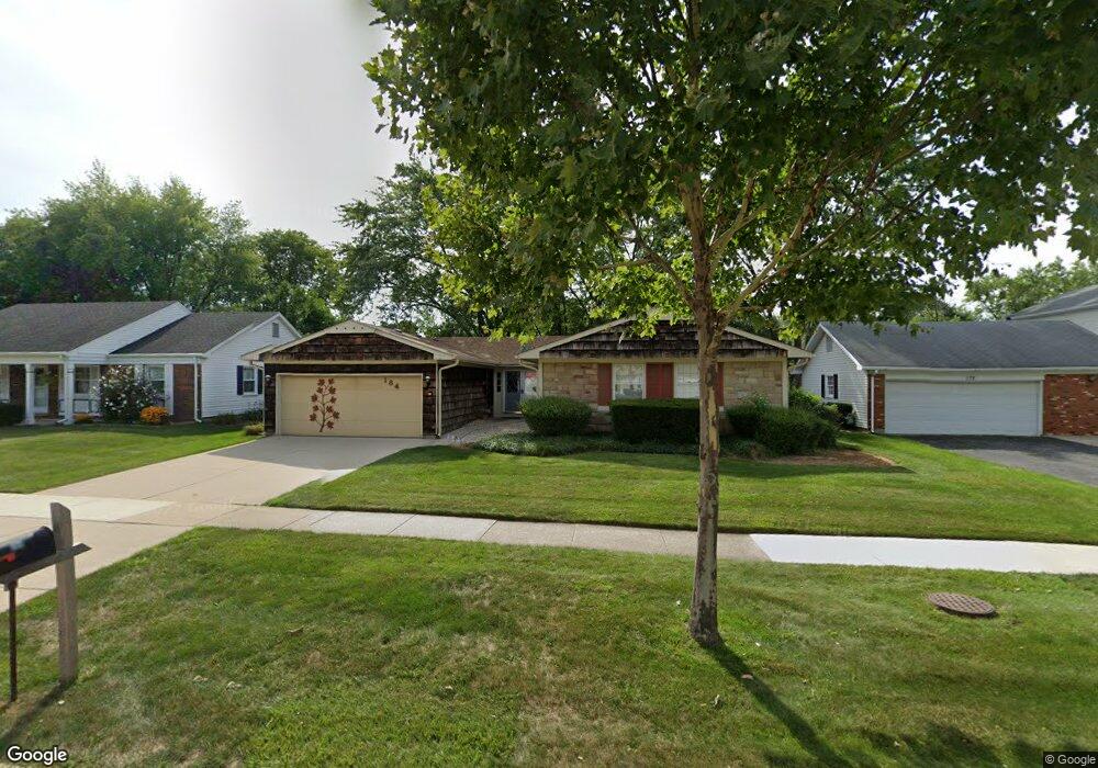
184 Weidner Rd Buffalo Grove, IL 60089
South Buffalo Grove NeighborhoodEstimated Value: $454,000 - $502,000
4
Beds
2
Baths
2,001
Sq Ft
$234/Sq Ft
Est. Value
About This Home
This home is located at 184 Weidner Rd, Buffalo Grove, IL 60089 and is currently estimated at $467,811, approximately $233 per square foot. 184 Weidner Rd is a home located in Cook County with nearby schools including Henry W Longfellow Elementary School, Cooper Middle School, and Buffalo Grove High School.
Ownership History
Date
Name
Owned For
Owner Type
Purchase Details
Closed on
May 18, 1995
Sold by
Drugoff Barbara L and Tomany Barbara L
Bought by
Shulman Gerald H and Shulman Neena J
Current Estimated Value
Home Financials for this Owner
Home Financials are based on the most recent Mortgage that was taken out on this home.
Original Mortgage
$91,000
Interest Rate
8.42%
Create a Home Valuation Report for This Property
The Home Valuation Report is an in-depth analysis detailing your home's value as well as a comparison with similar homes in the area
Home Values in the Area
Average Home Value in this Area
Purchase History
| Date | Buyer | Sale Price | Title Company |
|---|---|---|---|
| Shulman Gerald H | $182,000 | Ticor Title Insurance |
Source: Public Records
Mortgage History
| Date | Status | Borrower | Loan Amount |
|---|---|---|---|
| Closed | Shulman Gerald H | $91,000 |
Source: Public Records
Tax History
| Year | Tax Paid | Tax Assessment Tax Assessment Total Assessment is a certain percentage of the fair market value that is determined by local assessors to be the total taxable value of land and additions on the property. | Land | Improvement |
|---|---|---|---|---|
| 2025 | $5,680 | $43,001 | $8,306 | $34,695 |
| 2024 | $5,680 | $36,000 | $7,119 | $28,881 |
| 2023 | $5,638 | $36,000 | $7,119 | $28,881 |
| 2022 | $5,638 | $36,000 | $7,119 | $28,881 |
| 2021 | $6,298 | $30,226 | $4,548 | $25,678 |
| 2020 | $5,710 | $30,226 | $4,548 | $25,678 |
| 2019 | $5,684 | $33,510 | $4,548 | $28,962 |
| 2018 | $8,637 | $31,951 | $3,955 | $27,996 |
| 2017 | $6,108 | $31,951 | $3,955 | $27,996 |
| 2016 | $6,670 | $31,951 | $3,955 | $27,996 |
| 2015 | $7,579 | $26,870 | $3,361 | $23,509 |
| 2014 | $7,298 | $26,870 | $3,361 | $23,509 |
| 2013 | $6,907 | $26,870 | $3,361 | $23,509 |
Source: Public Records
Map
Nearby Homes
- 170 Cherrywood Rd
- 915 Plum Grove Cir
- 267 Timber Hill Rd
- 610 Maple Dr
- 462 Longwood Dr
- 571 Estate Dr
- 612 White Pine Rd
- 252 Appletree Ct
- 632 Weidner Rd
- 1096 Beechwood Rd
- 858 Old Checker Rd Unit C4
- 225 Thornapple Ct Unit 225
- 876 Stradford Cir Unit A1
- 800 Weidner Rd Unit 208
- 4210 N Walnut Ave
- 760 Weidner Rd Unit 107
- 170 Manchester Dr Unit 306
- 820 Weidner Rd Unit 4013
- 820 Weidner Rd Unit 409
- 232 Manor Dr Unit 12C
- 194 Weidner Rd
- 172 Weidner Rd
- 181 Timber Hill Rd
- 171 Timber Hill Rd
- 206 Weidner Rd
- 160 Weidner Rd
- 193 Timber Hill Rd
- 159 Timber Hill Rd
- 179 Weidner Rd
- 191 Weidner Rd
- 167 Weidner Rd
- 203 Timber Hill Rd
- 203 Weidner Rd
- 155 Weidner Rd
- 213 Weidner Rd
- 174 Timber Hill Rd
- 230 Weidner Rd Unit 1
- 188 Timber Hill Rd
- 211 Timber Hill Rd