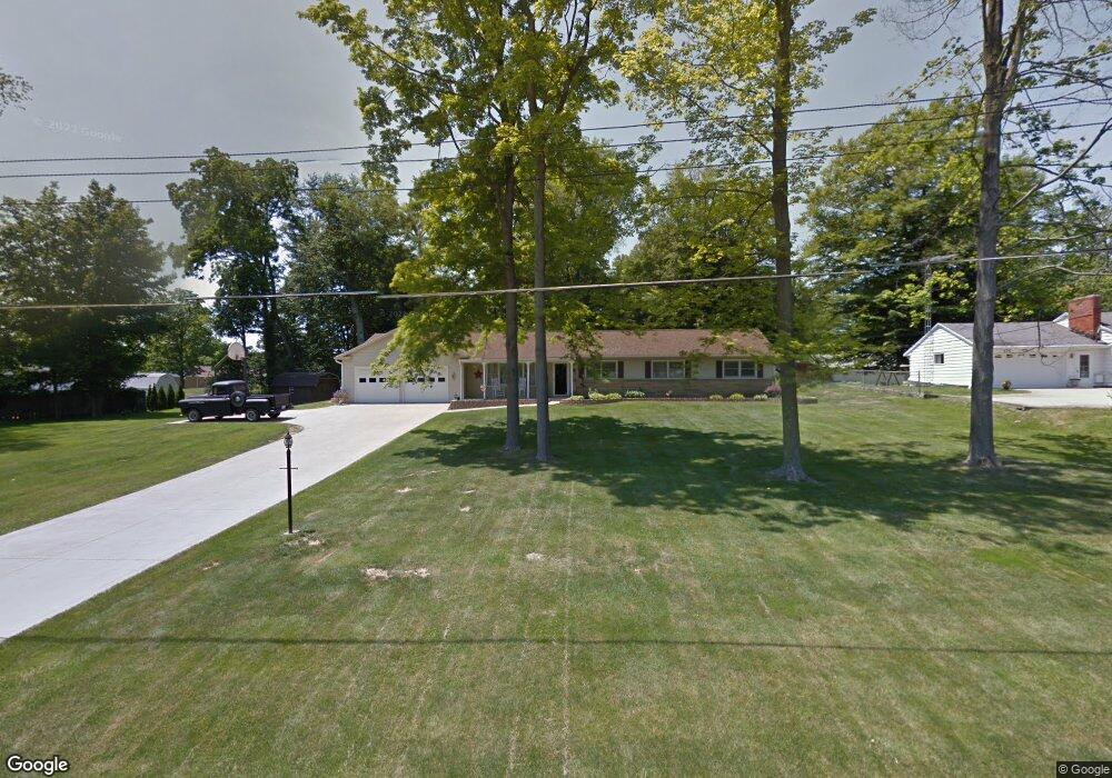
184 Woodbine Dr Ontario, OH 44906
Estimated Value: $222,000 - $252,110
4
Beds
2
Baths
1,647
Sq Ft
$145/Sq Ft
Est. Value
About This Home
This home is located at 184 Woodbine Dr, Ontario, OH 44906 and is currently estimated at $239,278, approximately $145 per square foot. 184 Woodbine Dr is a home located in Richland County with nearby schools including Stingel Elementary School, Ontario Middle School, and Ontario High School.
Ownership History
Date
Name
Owned For
Owner Type
Purchase Details
Closed on
Dec 10, 1999
Sold by
Larrabee Everett E
Bought by
Smith Gregory A and Smith April L
Current Estimated Value
Home Financials for this Owner
Home Financials are based on the most recent Mortgage that was taken out on this home.
Original Mortgage
$76,000
Outstanding Balance
$24,079
Interest Rate
8.02%
Mortgage Type
New Conventional
Estimated Equity
$215,199
Create a Home Valuation Report for This Property
The Home Valuation Report is an in-depth analysis detailing your home's value as well as a comparison with similar homes in the area
Home Values in the Area
Average Home Value in this Area
Purchase History
| Date | Buyer | Sale Price | Title Company |
|---|---|---|---|
| Smith Gregory A | $95,000 | -- |
Source: Public Records
Mortgage History
| Date | Status | Borrower | Loan Amount |
|---|---|---|---|
| Open | Smith Gregory A | $76,000 |
Source: Public Records
Tax History Compared to Growth
Tax History
| Year | Tax Paid | Tax Assessment Tax Assessment Total Assessment is a certain percentage of the fair market value that is determined by local assessors to be the total taxable value of land and additions on the property. | Land | Improvement |
|---|---|---|---|---|
| 2024 | $3,196 | $64,140 | $15,490 | $48,650 |
| 2023 | $3,197 | $64,140 | $15,490 | $48,650 |
| 2022 | $2,543 | $43,910 | $12,310 | $31,600 |
| 2021 | $2,547 | $43,910 | $12,310 | $31,600 |
| 2020 | $2,719 | $43,910 | $12,310 | $31,600 |
| 2019 | $2,546 | $37,210 | $10,430 | $26,780 |
| 2018 | $2,162 | $37,210 | $10,430 | $26,780 |
| 2017 | $1,829 | $37,210 | $10,430 | $26,780 |
| 2016 | $2,019 | $35,110 | $12,930 | $22,180 |
| 2015 | $2,017 | $35,110 | $12,930 | $22,180 |
| 2014 | $2,021 | $35,110 | $12,930 | $22,180 |
| 2012 | $1,837 | $35,110 | $13,610 | $21,500 |
Source: Public Records
Map
Nearby Homes
- 175 Maple Ln
- 99 Scotland Blvd
- 405 Maple Ln Unit 405 & 407
- 1996 Park Ave W
- 1431 Silver Ln
- 2585 Deerfield Ln
- 0 Millsboro Rd Unit 9067349
- 0 Millsboro Rd Unit 9066844
- 147 Wimbledon Dr
- 204 Lasalle St
- 142 Grasmere Ave
- 1157 Deer Run Rd
- 0 Deer Run Rd
- 143 Buckeye Ave
- 1068 Linwood Place
- 1496 W 4th St
- 2000 Matthes Dr
- 2281 Park Ave W
- 0 Old Mill Run Rd Unit 9067543
- 0 Old Mill Run Rd Unit 9067542
- 174 Woodbine Dr
- 185 Maple Ln Unit 187
- 1684 Kenmore Dr
- 1696 Kenmore Dr
- 164 Woodbine Dr
- 191 Woodbine Dr
- 183 Woodbine Dr
- 1706 Kenmore Dr
- 1668 Kenmore Dr
- 171 Woodbine Dr
- 154 Woodbine Dr
- 155 Maple Ln
- 1656 Kenmore Dr
- 157 Woodbine Dr
- 180 Maple Ln
- 180 Lynn Dr
- 176 Lynn Dr
- 170 Lynn Dr
- 145 Woodbine Dr
- 170 Maple Ln