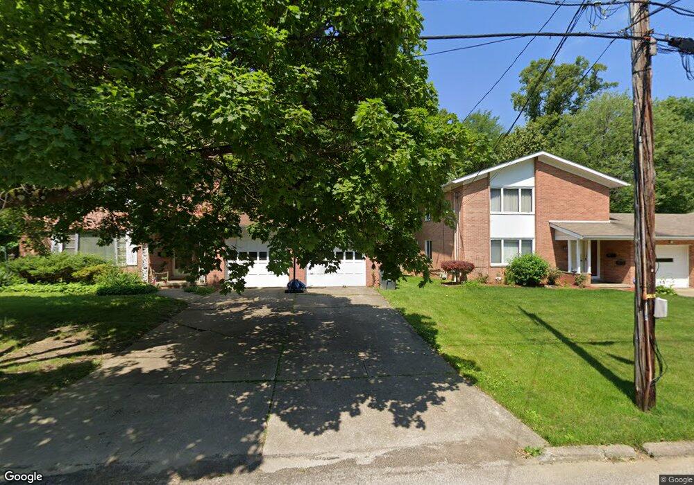
1840 1842 Cromwell Akron, OH 44313
Northwest Akron NeighborhoodEstimated Value: $187,000 - $209,406
2
Beds
1
Bath
2,688
Sq Ft
$73/Sq Ft
Est. Value
About This Home
This home is located at 1840 1842 Cromwell, Akron, OH 44313 and is currently estimated at $196,352, approximately $73 per square foot. 1840 1842 Cromwell is a home located in Summit County with nearby schools including Case Community Learning Center, Summit Academy School, and Our Lady Of The Elms Elementary School.
Ownership History
Date
Name
Owned For
Owner Type
Purchase Details
Closed on
Jun 27, 2019
Sold by
Twin Hill Properties Llc
Bought by
Shuck Brandon L
Current Estimated Value
Home Financials for this Owner
Home Financials are based on the most recent Mortgage that was taken out on this home.
Original Mortgage
$86,250
Outstanding Balance
$75,687
Interest Rate
3.9%
Mortgage Type
New Conventional
Estimated Equity
$120,665
Purchase Details
Closed on
Jun 18, 2014
Sold by
Anderson Jeffrey O
Bought by
Twin Hill Properties Llc
Home Financials for this Owner
Home Financials are based on the most recent Mortgage that was taken out on this home.
Original Mortgage
$60,400
Interest Rate
4.2%
Mortgage Type
Future Advance Clause Open End Mortgage
Purchase Details
Closed on
Jul 2, 2003
Sold by
Anderson Judith Winget and Keyser Judith W
Bought by
Anderson Jeffrey O and Anderson Judith Winget
Create a Home Valuation Report for This Property
The Home Valuation Report is an in-depth analysis detailing your home's value as well as a comparison with similar homes in the area
Home Values in the Area
Average Home Value in this Area
Purchase History
| Date | Buyer | Sale Price | Title Company |
|---|---|---|---|
| Shuck Brandon L | $115,000 | Fireland Title | |
| Twin Hill Properties Llc | $75,500 | Village Title | |
| Anderson Jeffrey O | -- | Real Estate Title |
Source: Public Records
Mortgage History
| Date | Status | Borrower | Loan Amount |
|---|---|---|---|
| Open | Shuck Brandon L | $86,250 | |
| Previous Owner | Twin Hill Properties Llc | $60,400 |
Source: Public Records
Tax History Compared to Growth
Tax History
| Year | Tax Paid | Tax Assessment Tax Assessment Total Assessment is a certain percentage of the fair market value that is determined by local assessors to be the total taxable value of land and additions on the property. | Land | Improvement |
|---|---|---|---|---|
| 2025 | $3,189 | $54,839 | $11,414 | $43,425 |
| 2024 | $3,189 | $54,839 | $11,414 | $43,425 |
| 2023 | $3,189 | $54,839 | $11,414 | $43,425 |
| 2022 | $2,474 | $32,421 | $6,713 | $25,708 |
| 2021 | $2,281 | $32,421 | $6,713 | $25,708 |
| 2020 | $2,348 | $32,420 | $6,710 | $25,710 |
| 2019 | $3,285 | $42,380 | $9,840 | $32,540 |
| 2018 | $3,244 | $42,380 | $9,840 | $32,540 |
| 2017 | $3,244 | $42,380 | $9,840 | $32,540 |
| 2016 | $3,247 | $42,380 | $9,840 | $32,540 |
| 2015 | $3,244 | $42,380 | $9,840 | $32,540 |
| 2014 | $3,219 | $42,380 | $9,840 | $32,540 |
| 2013 | $2,494 | $33,740 | $9,840 | $23,900 |
Source: Public Records
Map
Nearby Homes
- 1804-1808 Cromwell Dr
- 637 Treeside Dr
- 1785 Fairlawn Knolls Dr
- 590 N Hawkins Ave
- 2040 Thurmont Rd
- 746 Newcastle Dr
- 311 Goodhue Dr
- 736 Hampton Ridge Dr Unit 736
- 1688 Tanglewood Dr Unit 1690
- 2079 Wyndham Rd
- 1697 Liberty Dr Unit 1699
- 1725 Liberty Dr Unit 1727
- 1830 Tanglewood Dr
- 881 Hampton Ridge Dr
- 2121 Brookshire Rd
- 242 N Hawkins Ave
- 257 Sand Run Rd
- 1029 Karen Dr
- 1047 Kevin Dr
- 1057 Kevin Dr
- 1842 Cromwell Dr
- 1840 Cromwell Dr Unit 1842
- 1834 1836 Cromwell Dr
- 1848 Cromwell Dr Unit 1850
- 1856 1858 Cromwell Dr
- 1835 Cromwell Dr Unit 1835
- 1856 Cromwell Dr Unit 1858
- 1856 Cromwell Dr Unit up
- 1839 1841 Cromwell Dr
- 1822 1828 Cromwell Dr
- 1858 Cromwell Dr Unit 1856
- 1858 Cromwell Dr
- 1845 1847 Cromwell Dr
- 1839 Cromwell Dr Unit 1841
- 1845 Cromwell Dr Unit 1847
- 1833 Cromwell Dr Unit 1835
- 1851 1853 Cromwell Dr
- 1860 Cromwell Dr Unit 1864
- 1829 Cromwell Dr
- 1851 Cromwell Dr Unit 1853