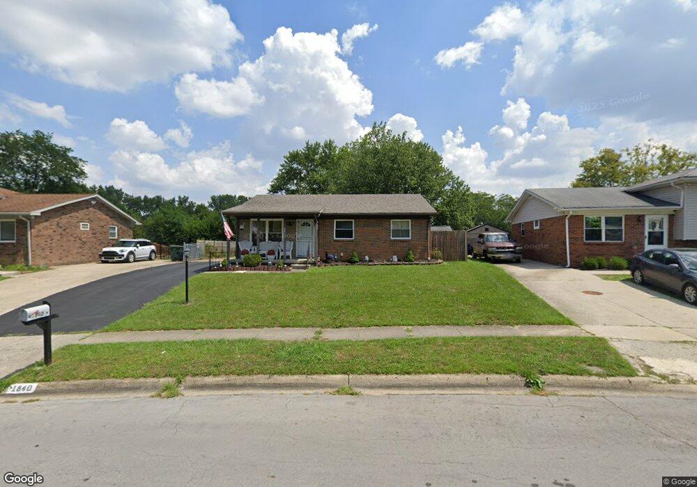
1840 Creekside Dr Columbus, OH 43223
Riverbend NeighborhoodEstimated Value: $199,000 - $241,000
3
Beds
1
Bath
1,050
Sq Ft
$212/Sq Ft
Est. Value
About This Home
This home is located at 1840 Creekside Dr, Columbus, OH 43223 and is currently estimated at $222,662, approximately $212 per square foot. 1840 Creekside Dr is a home located in Franklin County with nearby schools including James A Harmon Elementary School, Franklin Woods Intermediate School, and Finland Middle School.
Ownership History
Date
Name
Owned For
Owner Type
Purchase Details
Closed on
Jan 29, 2009
Sold by
Secretary Of Housing & Urban Development
Bought by
Lowe Frankie E
Current Estimated Value
Home Financials for this Owner
Home Financials are based on the most recent Mortgage that was taken out on this home.
Original Mortgage
$49,764
Interest Rate
5.08%
Mortgage Type
FHA
Purchase Details
Closed on
Feb 1, 2008
Sold by
Woodruff Brian M and Countrywide Home Loans Inc
Bought by
Hud
Purchase Details
Closed on
Jun 18, 2004
Sold by
Boston George F and Boston Barbara
Bought by
Woodruff Brian M and Neff Anderson Leaona Marie
Home Financials for this Owner
Home Financials are based on the most recent Mortgage that was taken out on this home.
Original Mortgage
$102,192
Interest Rate
6.46%
Mortgage Type
FHA
Purchase Details
Closed on
Mar 4, 1985
Bought by
Boston George F
Create a Home Valuation Report for This Property
The Home Valuation Report is an in-depth analysis detailing your home's value as well as a comparison with similar homes in the area
Home Values in the Area
Average Home Value in this Area
Purchase History
| Date | Buyer | Sale Price | Title Company |
|---|---|---|---|
| Lowe Frankie E | $45,000 | Lakeside Ti | |
| Hud | $68,000 | None Available | |
| Woodruff Brian M | $103,000 | Title First | |
| Boston George F | $38,500 | -- |
Source: Public Records
Mortgage History
| Date | Status | Borrower | Loan Amount |
|---|---|---|---|
| Previous Owner | Lowe Frankie E | $49,764 | |
| Previous Owner | Woodruff Brian M | $102,192 |
Source: Public Records
Tax History Compared to Growth
Tax History
| Year | Tax Paid | Tax Assessment Tax Assessment Total Assessment is a certain percentage of the fair market value that is determined by local assessors to be the total taxable value of land and additions on the property. | Land | Improvement |
|---|---|---|---|---|
| 2024 | $2,150 | $68,780 | $17,920 | $50,860 |
| 2023 | $2,135 | $68,780 | $17,920 | $50,860 |
| 2022 | $1,112 | $31,540 | $11,170 | $20,370 |
| 2021 | $1,135 | $31,540 | $11,170 | $20,370 |
| 2020 | $1,128 | $31,540 | $11,170 | $20,370 |
| 2019 | $978 | $26,180 | $9,310 | $16,870 |
| 2018 | $1,181 | $26,180 | $9,310 | $16,870 |
| 2017 | $650 | $26,180 | $9,310 | $16,870 |
| 2016 | $1,389 | $22,960 | $5,110 | $17,850 |
| 2015 | $1,389 | $22,960 | $5,110 | $17,850 |
| 2014 | $1,390 | $22,960 | $5,110 | $17,850 |
| 2013 | $473 | $15,750 | $5,670 | $10,080 |
Source: Public Records
Map
Nearby Homes
- 0 Glencreek Rd
- 2894 Creith Ct
- 2800 Alkire Rd
- 2195 Big Run Ave
- 2255 Harrisburg Pike
- 1520 Fall Brook Rd
- 2930 Alkire Rd
- 2103 Keller Place W
- 3326 Bluhm Ct
- 3206 Andy Terrace
- 2937 Rundell Dr
- 1657 Ripplebrook Rd
- 2856 Chesfield Dr
- 1465 Tall Meadows Dr
- 2500 Harrisburg Pike Unit Lot 8
- 2436 Onyx Ct
- 2364 Nedra St
- 2242 Topaz Dr
- 2272 Topaz Dr
- 3488 Rocky Rd
- 1832 Creekside Dr
- 1848 Creekside Dr
- 2984 Rivercliff Rd
- 1835 Glenmate Ct
- 1824 Creekside Dr
- 1824 Creekside Dr Unit ROCK
- 1827 Glenmate Ct
- 1821 Glenmate Ct
- 2976 Rivercliff Rd
- 3020 Rivercliff Rd
- 1816 Creekside Dr Unit ROCK
- 1816 Creekside Dr
- 1831 Creekside Dr
- 1831 Creekside Dr Unit ROCK
- 1813 Glenmate Ct
- 3005 Rivercliff Rd
- 1823 Creekside Dr
- 2997 Rivercliff Rd
- 1808 Creekside Dr
- 2985 Rivercliff Rd