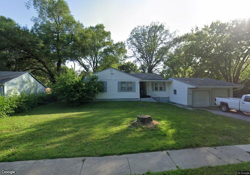
1840 Doris Ave East Saint Louis, IL 62206
Estimated Value: $92,000 - $104,568
3
Beds
1
Bath
1,502
Sq Ft
$66/Sq Ft
Est. Value
About This Home
This home is located at 1840 Doris Ave, East Saint Louis, IL 62206 and is currently estimated at $98,642, approximately $65 per square foot. 1840 Doris Ave is a home located in St. Clair County.
Ownership History
Date
Name
Owned For
Owner Type
Purchase Details
Closed on
Apr 12, 2019
Sold by
Latham Paul E
Bought by
Latham Homes Remodeling & Const Llc
Current Estimated Value
Purchase Details
Closed on
Aug 5, 2016
Sold by
Thompsons R and 1840 Doris Land Trust
Bought by
Latham Paul E
Purchase Details
Closed on
Jan 16, 2015
Sold by
Stein T and 184 Doris Land Trust
Bought by
Thompson R and 184 Doris Land Trust
Purchase Details
Closed on
Aug 17, 2010
Sold by
Craig David and Zachringer Christine
Bought by
1840 Doris Land Trust and Lechien T
Purchase Details
Closed on
Dec 30, 2009
Sold by
Craig Rose E
Bought by
Zaehringer Christine A and Craig David J
Create a Home Valuation Report for This Property
The Home Valuation Report is an in-depth analysis detailing your home's value as well as a comparison with similar homes in the area
Home Values in the Area
Average Home Value in this Area
Purchase History
| Date | Buyer | Sale Price | Title Company |
|---|---|---|---|
| Latham Homes Remodeling & Const Llc | -- | None Available | |
| Latham Paul E | $5,000 | Attorney | |
| Thompson R | -- | None Available | |
| 1840 Doris Land Trust | $2,000 | Landstar Title Company | |
| Zaehringer Christine A | -- | None Available |
Source: Public Records
Tax History Compared to Growth
Tax History
| Year | Tax Paid | Tax Assessment Tax Assessment Total Assessment is a certain percentage of the fair market value that is determined by local assessors to be the total taxable value of land and additions on the property. | Land | Improvement |
|---|---|---|---|---|
| 2024 | $3,451 | $18,140 | $2,812 | $15,328 |
| 2023 | $3,116 | $16,396 | $2,542 | $13,854 |
| 2022 | $2,852 | $14,370 | $2,228 | $12,142 |
| 2021 | $3,353 | $15,615 | $2,111 | $13,504 |
| 2020 | $2,193 | $9,411 | $2,213 | $7,198 |
| 2019 | $2,196 | $9,411 | $2,213 | $7,198 |
| 2018 | $2,186 | $9,548 | $2,245 | $7,303 |
| 2017 | $3,199 | $12,000 | $2,190 | $9,810 |
| 2016 | $3,739 | $15,239 | $2,183 | $13,056 |
| 2014 | $3,082 | $15,073 | $2,159 | $12,914 |
| 2013 | $1,242 | $14,138 | $2,025 | $12,113 |
Source: Public Records
Map
Nearby Homes
- 1426 Richard Dr
- 2025 Sandy Ridge Rd
- 1713 Loretta Ave
- 2005 Louise Ave
- 2016 Lynn St
- 1713 Theodore Ln
- 1723 Theodore Ln
- 1700 Theodore Ln
- 1326 Saint Zita Ln
- 2014 Florence St
- 20 Leonard Dr
- 111 Lazarcheff Dr
- 118 Saint Christopher Dr
- 1997 Oak Tree Ln
- 1307 Saint Zita Ln
- 1128 Saint Benedict Dr
- 2 Margie Dr
- 214 Saint John Dr
- 1106 Saint Boniface Dr
- 1710 Parklane Dr
- 1844 Doris Ave
- 1841 Sandy Ridge Rd
- 1846 Doris Ave
- 1839 Doris Ave
- 1835 Doris Ave
- 1845 Doris Ave
- 1854 Doris Ave
- 1851 Sandy Ridge Rd
- 1825 Doris Ave
- 1853 Doris Ave
- 1840 Mullens Ave
- 1900 Doris Ave
- 1817 Doris Ave
- 1832 Mullens Ave
- 1901 Sandy Ridge Rd
- 1928 Sandy Ridge Rd
- 1901 Doris Ave
- 1901 Doris Ave
- 1812 Doris Ave
- 1822 Mullens Ave