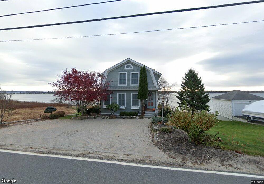
1840 Harpswell Neck Rd Harpswell, ME 04079
Harpswell Neck NeighborhoodEstimated Value: $817,000 - $916,000
4
Beds
4
Baths
2,696
Sq Ft
$322/Sq Ft
Est. Value
About This Home
This home is located at 1840 Harpswell Neck Rd, Harpswell, ME 04079 and is currently estimated at $867,438, approximately $321 per square foot. 1840 Harpswell Neck Rd is a home located in Cumberland County with nearby schools including Mt Ararat High School.
Ownership History
Date
Name
Owned For
Owner Type
Purchase Details
Closed on
Oct 16, 2013
Sold by
Macarthur Charles M
Bought by
Macarthur Charles M and Tapert Lisa M
Current Estimated Value
Home Financials for this Owner
Home Financials are based on the most recent Mortgage that was taken out on this home.
Original Mortgage
$266,000
Interest Rate
4.58%
Mortgage Type
Purchase Money Mortgage
Purchase Details
Closed on
Dec 18, 2012
Sold by
Macarthur Charles M
Bought by
Chase Helene K
Create a Home Valuation Report for This Property
The Home Valuation Report is an in-depth analysis detailing your home's value as well as a comparison with similar homes in the area
Home Values in the Area
Average Home Value in this Area
Purchase History
| Date | Buyer | Sale Price | Title Company |
|---|---|---|---|
| Macarthur Charles M | -- | -- | |
| Chase Helene K | -- | -- |
Source: Public Records
Mortgage History
| Date | Status | Borrower | Loan Amount |
|---|---|---|---|
| Closed | Macarthur Charles M | $266,000 |
Source: Public Records
Tax History Compared to Growth
Tax History
| Year | Tax Paid | Tax Assessment Tax Assessment Total Assessment is a certain percentage of the fair market value that is determined by local assessors to be the total taxable value of land and additions on the property. | Land | Improvement |
|---|---|---|---|---|
| 2024 | $3,546 | $557,600 | $148,600 | $409,000 |
| 2023 | $3,401 | $557,600 | $148,600 | $409,000 |
| 2022 | $3,290 | $557,600 | $148,600 | $409,000 |
| 2021 | $2,944 | $435,500 | $157,500 | $278,000 |
| 2020 | $2,935 | $435,500 | $157,500 | $278,000 |
| 2019 | $2,918 | $435,500 | $157,500 | $278,000 |
| 2018 | $2,822 | $435,500 | $157,500 | $278,000 |
| 2017 | $6,482 | $435,500 | $157,500 | $278,000 |
| 2016 | $6,157 | $435,500 | $157,500 | $278,000 |
| 2015 | $2,718 | $435,500 | $157,500 | $278,000 |
| 2013 | $2,517 | $435,500 | $157,500 | $278,000 |
Source: Public Records
Map
Nearby Homes
- 10 S Colony Branch Rd
- 8 & 2 Kane Ln
- 6 Kane Ln
- 10 Irene Ave
- 18 Ash Point Rd
- 16 Ash Point Rd Unit 16
- 30 Osbourne Row
- 19 Hugh Ave
- 1450 Harpswell Neck Rd
- 20 Spruce Ledge Rd
- 87 Lowells Cove Rd
- 1689 Harpswell Islands Rd
- 1 Mallard Pond Rd
- 41 Spruce Brook Dr
- 0 Bayview Rd Unit 2 1632776
- Lot 2A Allen Point Rd
- Lot 2B Allen Point Rd
- Lot 129 Harpswell Neck Rd
- 20 Long Point Island
- Lot 2 Buxhill Blvd
- 1844 Harpswell Neck Rd
- 1834 Harpswell Neck Rd
- 1848 Harpswell Neck Rd
- 1832 Harpswell Neck Rd
- 1881 Harpswell Neck Rd
- 1835 Harpswell Neck Rd
- 1839 Harpswell Neck Rd
- 1833 Harpswell Neck Rd
- 11 Well St
- 1852 Harpswell Neck Rd
- 1829 Harpswell Neck Rd
- 1826 Harpswell Neck Rd
- 1851 Harpswell Neck Rd
- 1856 Harpswell Neck Rd
- 1820 Harpswell Neck Rd
- 1860 Harpswell Neck Rd
- 1859 Harpswell Neck Rd
- 15 Well St
- 1816 Harpswell Neck Rd
- 1861 Harpswell Neck Rd