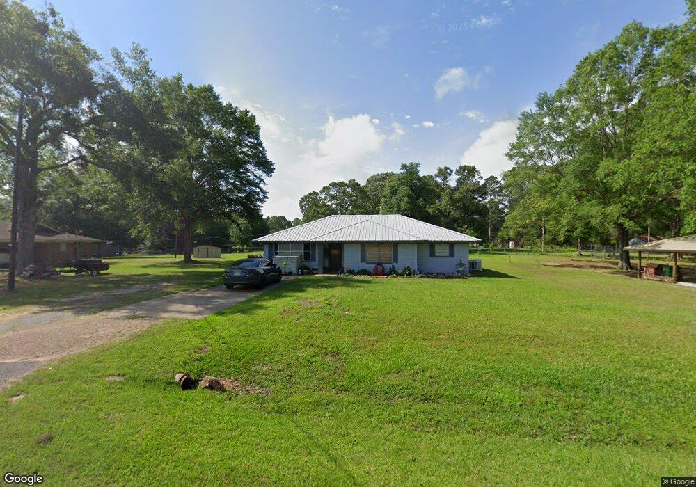
1840 Highway 1241 Dry Prong, LA 71423
Estimated Value: $182,000 - $235,000
--
Bed
--
Bath
--
Sq Ft
0.92
Acres
About This Home
This home is located at 1840 Highway 1241, Dry Prong, LA 71423 and is currently estimated at $207,654. 1840 Highway 1241 is a home located in Grant Parish with nearby schools including South Grant Elementary School, Grant Junior High School, and Grant High School.
Ownership History
Date
Name
Owned For
Owner Type
Purchase Details
Closed on
May 4, 2011
Sold by
Sandoz Dixie Lorene Hearn
Bought by
Sandoz Marshall Landon
Current Estimated Value
Home Financials for this Owner
Home Financials are based on the most recent Mortgage that was taken out on this home.
Original Mortgage
$123,700
Outstanding Balance
$85,926
Interest Rate
4.87%
Mortgage Type
FHA
Estimated Equity
$121,728
Purchase Details
Closed on
Jul 25, 2008
Sold by
Juckett Austin Wyatt and Arnold Chassidy Lane
Bought by
Sandoz Marshall Landon and Sandoz Dixie Hearn
Create a Home Valuation Report for This Property
The Home Valuation Report is an in-depth analysis detailing your home's value as well as a comparison with similar homes in the area
Home Values in the Area
Average Home Value in this Area
Purchase History
| Date | Buyer | Sale Price | Title Company |
|---|---|---|---|
| Sandoz Marshall Landon | $1,000 | -- | |
| Sandoz Marshall Landon | $129,900 | -- |
Source: Public Records
Mortgage History
| Date | Status | Borrower | Loan Amount |
|---|---|---|---|
| Open | Sandoz Marshall Landon | $123,700 |
Source: Public Records
Tax History Compared to Growth
Tax History
| Year | Tax Paid | Tax Assessment Tax Assessment Total Assessment is a certain percentage of the fair market value that is determined by local assessors to be the total taxable value of land and additions on the property. | Land | Improvement |
|---|---|---|---|---|
| 2024 | $2,166 | $14,625 | $1,800 | $12,825 |
| 2023 | $2,218 | $13,974 | $1,500 | $12,474 |
| 2022 | $2,211 | $13,974 | $1,500 | $12,474 |
| 2021 | $2,211 | $13,974 | $1,500 | $12,474 |
| 2020 | $2,200 | $13,974 | $1,500 | $12,474 |
| 2019 | $2,117 | $12,970 | $1,000 | $11,970 |
| 2018 | $2,117 | $12,970 | $1,000 | $11,970 |
| 2017 | $2,106 | $12,970 | $1,000 | $11,970 |
| 2015 | $2,142 | $12,340 | $1,000 | $11,340 |
| 2014 | $2,142 | $12,340 | $1,000 | $11,340 |
| 2013 | $2,142 | $12,340 | $1,000 | $11,340 |
Source: Public Records
Map
Nearby Homes
- 00000 Highway 167 None
- 235 Prospect Rd
- 312 Walker Gravel Pit
- 596 Grays Creek Rd
- 110 J C Harrison Rd
- 350 Walker Gravel Pit Rd
- 1000 Allison Dr
- 198 E Glenn Rd
- 416 Sophie Ln
- 515 Sophie Ln
- 507 Sophie Ln
- Lot 22 Archie Dr
- 19693 Hwy 71 N Hwy
- 299 Seals Rd
- 219 Mobley Rd
- 76 Little John Ln
- 1015 Jennifers Pl None
- 1040 Jennifer's Place
- 128 Rustic Manor Cove
- 1521 E Medalist Rd
- 1840 Highway 1241
- 1832 Highway 1241
- 1832 Highway 1241
- 1846 Highway 1241
- 1820 Louisiana 1241
- 1860 Highway 1241
- 1820 Highway 1241
- 1866 Highway 1241
- 1841 Highway 1241
- 174 Joanne Dr
- 186 Joanne Dr
- 375 Morris
- 166 Joanne Dr
- 192 Joanne Dr
- 1880 Highway 1241
- 160 Joanne Dr
- 146 Joanne Dr
- 1888 Highway 1241
- 1888 Highway 1241
- 1792 Highway 1241