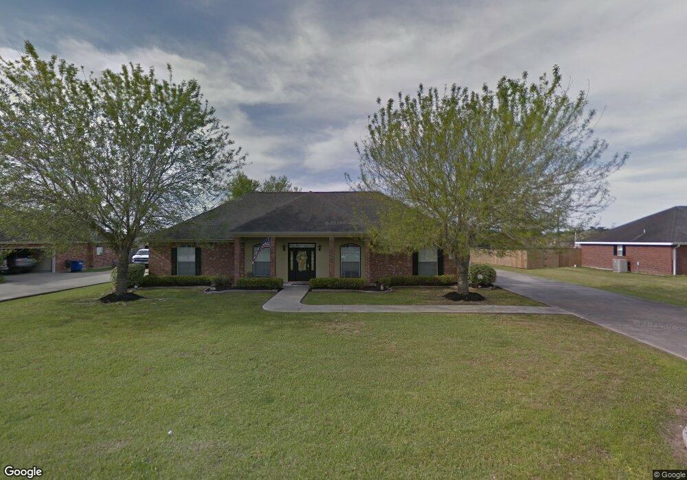
1840 N Michael Square Lake Charles, LA 70611
Estimated Value: $235,619 - $330,000
4
Beds
2
Baths
2,417
Sq Ft
$122/Sq Ft
Est. Value
About This Home
This home is located at 1840 N Michael Square, Lake Charles, LA 70611 and is currently estimated at $294,905, approximately $122 per square foot. 1840 N Michael Square is a home located in Calcasieu Parish with nearby schools including Graham & Parks Alternative Public School, Gillis Elementary School, and Putnam Avenue Upper School.
Ownership History
Date
Name
Owned For
Owner Type
Purchase Details
Closed on
Feb 10, 2005
Sold by
Relocation Resources International Inc
Bought by
Mcright Kelly Blair and Mcright Barbara
Current Estimated Value
Home Financials for this Owner
Home Financials are based on the most recent Mortgage that was taken out on this home.
Original Mortgage
$125,500
Outstanding Balance
$64,083
Interest Rate
5.82%
Mortgage Type
New Conventional
Estimated Equity
$230,822
Create a Home Valuation Report for This Property
The Home Valuation Report is an in-depth analysis detailing your home's value as well as a comparison with similar homes in the area
Home Values in the Area
Average Home Value in this Area
Purchase History
| Date | Buyer | Sale Price | Title Company |
|---|---|---|---|
| Mcright Kelly Blair | $175,500 | None Available |
Source: Public Records
Mortgage History
| Date | Status | Borrower | Loan Amount |
|---|---|---|---|
| Open | Mcright Kelly Blair | $125,500 |
Source: Public Records
Tax History Compared to Growth
Tax History
| Year | Tax Paid | Tax Assessment Tax Assessment Total Assessment is a certain percentage of the fair market value that is determined by local assessors to be the total taxable value of land and additions on the property. | Land | Improvement |
|---|---|---|---|---|
| 2024 | $1,595 | $14,840 | $1,800 | $13,040 |
| 2023 | $1,582 | $14,840 | $1,800 | $13,040 |
| 2022 | $1,568 | $14,840 | $1,800 | $13,040 |
| 2021 | $0 | $14,840 | $1,800 | $13,040 |
| 2020 | $1,467 | $13,470 | $1,730 | $11,740 |
| 2019 | $1,621 | $14,840 | $1,800 | $13,040 |
| 2018 | $1,657 | $14,840 | $1,800 | $13,040 |
| 2017 | $1,647 | $14,840 | $1,800 | $13,040 |
| 2016 | $1,657 | $14,840 | $1,800 | $13,040 |
| 2015 | $1,657 | $14,840 | $1,800 | $13,040 |
Source: Public Records
Map
Nearby Homes
- 2319 Gracie Dr
- 1734 N Gabriel Square
- 2419 Tay
- 0 Howard Dr Unit SWL25001945
- 1800 Poeyfarre Dr
- 2422 Howard Dr
- 1811 Poeyfarre Dr
- 2095 Orleans Dr
- 2092 Westbank Dr
- 2086 Westbank Dr
- Azalea IV G Plan at Orleans Run
- Birch III G Plan at Orleans Run
- Dogwood IV G Plan at Orleans Run
- Falkner III G Plan at Orleans Run
- Trillium IV H Plan at Orleans Run
- Azalea IV H Plan at Orleans Run
- Birch III H Plan at Orleans Run
- Lasalle V G Plan at Orleans Run
- Roses V H Plan at Orleans Run
- Roses V G Plan at Orleans Run
- 1832 N Michael Square
- 1908 N Michael Square
- 1841 N Michael Square
- 1824 N Michael Square
- 1833 N Michael Square
- 1849 N Michael Square
- 2311 Gracie Dr
- 2310 Tay Tay Dr
- 1825 N Michael Square
- 1909 N Michael Square
- 1916 N Michael Square
- 1816 N Michael Square
- 2309 Tay
- 2318 Tay
- 2309 Tay Tay Dr
- 2318 Tay Tay Dr
- 1817 N Michael Square
- 1917 N Michael Square
- 1932 N Gabriel Square
- 2312 Gracie Dr