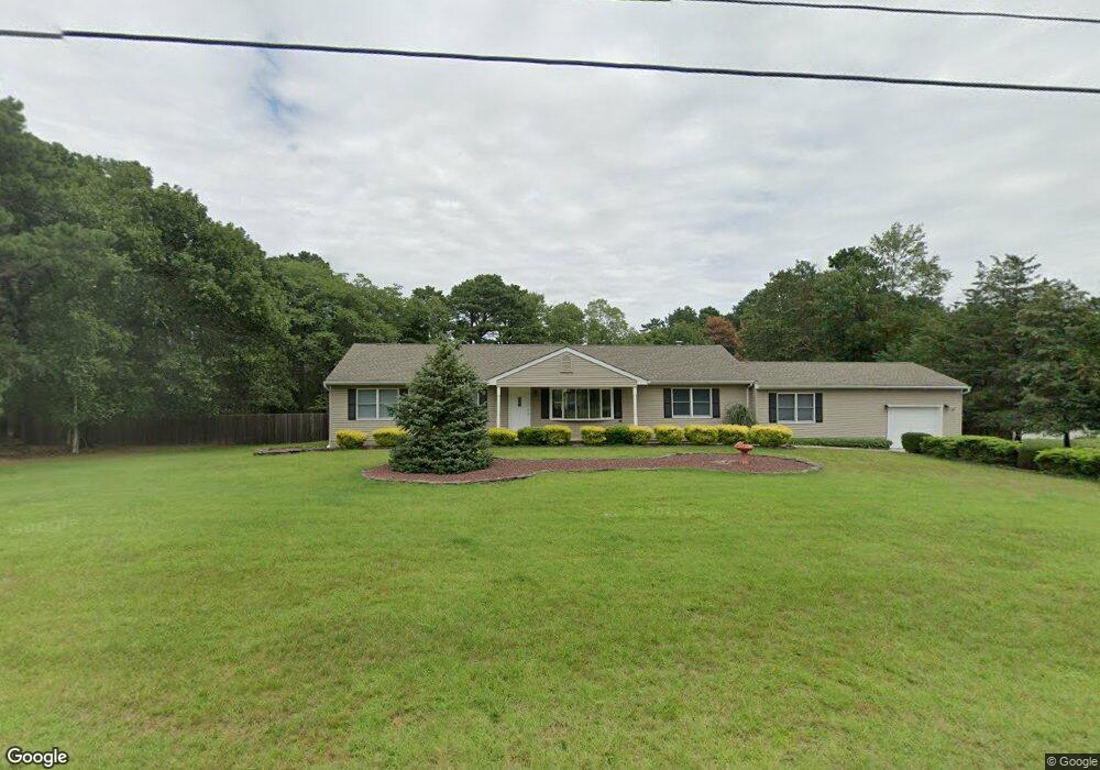
1840 New Brunswick Ave Whiting, NJ 08759
Manchester Township NeighborhoodEstimated Value: $434,000 - $590,000
4
Beds
2
Baths
2,172
Sq Ft
$243/Sq Ft
Est. Value
About This Home
This home is located at 1840 New Brunswick Ave, Whiting, NJ 08759 and is currently estimated at $527,472, approximately $242 per square foot. 1840 New Brunswick Ave is a home located in Ocean County with nearby schools including Manchester Township High School.
Ownership History
Date
Name
Owned For
Owner Type
Purchase Details
Closed on
Jan 10, 2011
Sold by
Kopanyi Thomas R and Aniboli Kopanyi Karen R
Bought by
Kopanyi Thomas R
Current Estimated Value
Home Financials for this Owner
Home Financials are based on the most recent Mortgage that was taken out on this home.
Original Mortgage
$194,000
Outstanding Balance
$131,247
Interest Rate
4.62%
Mortgage Type
New Conventional
Estimated Equity
$396,225
Purchase Details
Closed on
Nov 10, 1995
Sold by
Michura Jean
Bought by
Kopanyi Thomas and Kopanyi Karen Aniboli
Home Financials for this Owner
Home Financials are based on the most recent Mortgage that was taken out on this home.
Original Mortgage
$104,000
Interest Rate
7.44%
Create a Home Valuation Report for This Property
The Home Valuation Report is an in-depth analysis detailing your home's value as well as a comparison with similar homes in the area
Home Values in the Area
Average Home Value in this Area
Purchase History
| Date | Buyer | Sale Price | Title Company |
|---|---|---|---|
| Kopanyi Thomas R | -- | American General Title Agenc | |
| Kopanyi Thomas | $116,000 | -- |
Source: Public Records
Mortgage History
| Date | Status | Borrower | Loan Amount |
|---|---|---|---|
| Open | Kopanyi Thomas R | $194,000 | |
| Closed | Kopanyi Thomas | $104,000 |
Source: Public Records
Tax History Compared to Growth
Tax History
| Year | Tax Paid | Tax Assessment Tax Assessment Total Assessment is a certain percentage of the fair market value that is determined by local assessors to be the total taxable value of land and additions on the property. | Land | Improvement |
|---|---|---|---|---|
| 2025 | $7,097 | $503,800 | $195,000 | $308,800 |
| 2024 | $6,736 | $289,100 | $85,000 | $204,100 |
| 2023 | $6,404 | $289,100 | $85,000 | $204,100 |
| 2022 | $6,404 | $289,100 | $85,000 | $204,100 |
| 2021 | $6,265 | $289,100 | $85,000 | $204,100 |
| 2020 | $6,100 | $289,100 | $85,000 | $204,100 |
| 2019 | $6,523 | $254,300 | $85,000 | $169,300 |
| 2018 | $6,497 | $254,300 | $85,000 | $169,300 |
| 2017 | $6,523 | $254,300 | $85,000 | $169,300 |
| 2016 | $6,444 | $254,300 | $85,000 | $169,300 |
| 2015 | $6,324 | $254,300 | $85,000 | $169,300 |
| 2014 | $6,195 | $254,300 | $85,000 | $169,300 |
Source: Public Records
Map
Nearby Homes
- 58 St John Place Unit C
- 53 St John Place Unit B
- 2 Verbena Ct Unit B
- 553 Petunia Ln N
- 519 Petunia La N
- 550 Petunia Ln N
- 1 Chelsea Dr
- 70 Norwalk Ave Unit 73
- 636 Petunia Ln S
- 1901 Chilvers Ave
- 1751 Chilvers Ave
- 11 Hartford Rd Unit 70
- 8 Morning Glory Ln
- 1 Morning Glory Ln
- 1130 Monroe Ave
- 10 Wintergreen Ln Unit D
- 71 Morning Glory Ln
- 23 Brentwood St Unit 73
- 6 N Chestnut Ave
- 22 Hummingbird Ln Unit 73
- 1860 New Brunswick Ave
- 1820 New Brunswick Ave
- 1841 Bayonne Ave
- 1821 Bayonne Ave
- 1821 Bayonne Ave Unit AVE
- 1861 Bayonne Ave
- 1861 New Brunswick Ave
- 1821 New Brunswick Ave
- 551 Chilvers Ave
- 500 Coolidge Ave
- 501 Chilvers Ave
- 1881 New Brunswick Ave
- 1801 New Brunswick Ave
- 1840 Perth Amboy Ave
- 1840 Bayonne Ave
- 1860 Perth Amboy Ave
- 1820 Perth Amboy Ave
- 1820 Bayonne Ave
- 1860 Bayonne Ave
- 1880 Perth Amboy Ave