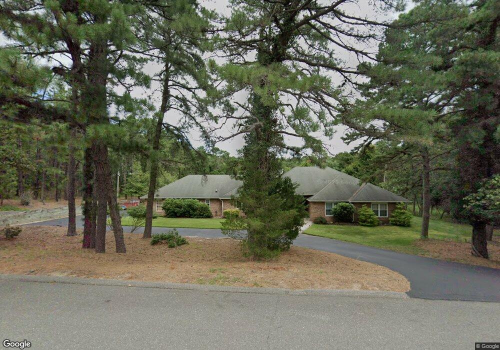
1840 Paterson Ave Whiting, NJ 08759
Manchester Township NeighborhoodEstimated Value: $695,000 - $734,000
5
Beds
4
Baths
2,984
Sq Ft
$239/Sq Ft
Est. Value
About This Home
This home is located at 1840 Paterson Ave, Whiting, NJ 08759 and is currently estimated at $712,490, approximately $238 per square foot. 1840 Paterson Ave is a home located in Ocean County with nearby schools including Manchester Township High School.
Ownership History
Date
Name
Owned For
Owner Type
Purchase Details
Closed on
Apr 1, 2003
Sold by
Culmer Jerome
Bought by
Gilman Richard and Gilman Kerrilyn
Current Estimated Value
Home Financials for this Owner
Home Financials are based on the most recent Mortgage that was taken out on this home.
Original Mortgage
$245,000
Outstanding Balance
$104,400
Interest Rate
5.64%
Estimated Equity
$608,090
Purchase Details
Closed on
Feb 29, 2000
Sold by
Stiers Bruce
Bought by
Culmer Jerome
Home Financials for this Owner
Home Financials are based on the most recent Mortgage that was taken out on this home.
Original Mortgage
$195,750
Interest Rate
8.21%
Create a Home Valuation Report for This Property
The Home Valuation Report is an in-depth analysis detailing your home's value as well as a comparison with similar homes in the area
Home Values in the Area
Average Home Value in this Area
Purchase History
| Date | Buyer | Sale Price | Title Company |
|---|---|---|---|
| Gilman Richard | $345,000 | -- | |
| Culmer Jerome | $217,500 | -- |
Source: Public Records
Mortgage History
| Date | Status | Borrower | Loan Amount |
|---|---|---|---|
| Open | Gilman Richard | $245,000 | |
| Previous Owner | Culmer Jerome | $195,750 |
Source: Public Records
Tax History Compared to Growth
Tax History
| Year | Tax Paid | Tax Assessment Tax Assessment Total Assessment is a certain percentage of the fair market value that is determined by local assessors to be the total taxable value of land and additions on the property. | Land | Improvement |
|---|---|---|---|---|
| 2025 | $9,592 | $665,900 | $195,000 | $470,900 |
| 2024 | $9,103 | $390,700 | $85,000 | $305,700 |
| 2023 | $8,654 | $390,700 | $85,000 | $305,700 |
| 2022 | $8,654 | $390,700 | $85,000 | $305,700 |
| 2021 | $8,466 | $390,700 | $85,000 | $305,700 |
| 2020 | $8,244 | $390,700 | $85,000 | $305,700 |
| 2019 | $8,588 | $334,800 | $85,000 | $249,800 |
| 2018 | $8,554 | $334,800 | $85,000 | $249,800 |
| 2017 | $8,588 | $334,800 | $85,000 | $249,800 |
| 2016 | $8,484 | $334,800 | $85,000 | $249,800 |
| 2015 | $8,326 | $334,800 | $85,000 | $249,800 |
| 2014 | $8,156 | $334,800 | $85,000 | $249,800 |
Source: Public Records
Map
Nearby Homes
- 1901 Chilvers Ave
- 1751 Chilvers Ave
- 1130 Monroe Ave
- 70 Norwalk Ave Unit 73
- 58 St John Place Unit C
- 53 St John Place Unit B
- 2 Verbena Ct Unit B
- 1 Chelsea Dr
- 11 Hartford Rd Unit 70
- 22 Hummingbird Ln Unit 73
- 23 Brentwood St Unit 73
- 519 Petunia La N
- 553 Petunia Ln N
- 85 Falmouth Ave Unit 72
- 550 Petunia Ln N
- 81 Falmouth Ave Unit 72
- 81 Falmouth Ave
- 69 Chelsea Dr Unit 72
- 1901 Baltimore Ave
- 43 S Chestnut Ave Unit 72
- 1860 Paterson Ave
- 1820 Paterson Ave
- 1841 Elizabeth Ave
- 1841 Paterson Ave
- 1861 Elizabeth Ave
- 1861 Paterson Ave
- 1821 Paterson Ave
- 850 Coolidge Ave
- 1800 Paterson Ave
- 1801 Elizabeth Ave
- 1881 Elizabeth Ave
- 900 Coolidge Ave
- 1840 Elizabeth Ave
- 1820 Elizabeth Ave
- 1860 Newark Ave
- 1860 Elizabeth Ave
- 1820 Newark Ave
- 1800 Elizabeth Ave
- 1880 Elizabeth Ave
- 950 Coolidge Ave