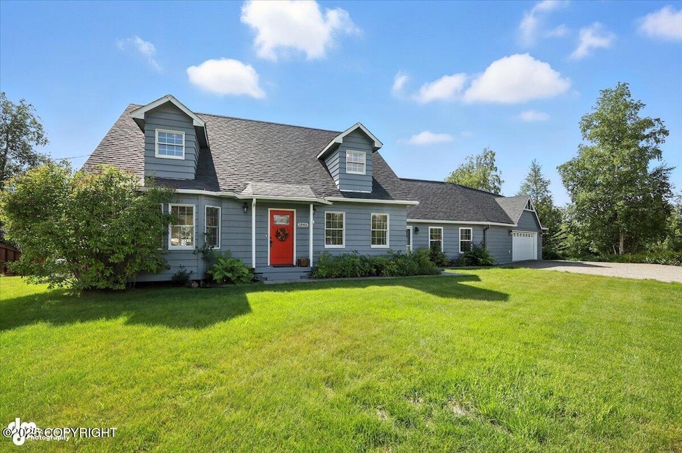

1840 W Harvest Loop Wasilla, AK 99654
Estimated payment $2,665/month
Highlights
- Private Yard
- Fireplace
- Shed
- Den
- 2 Car Attached Garage
- Attached Carport
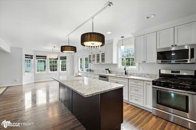
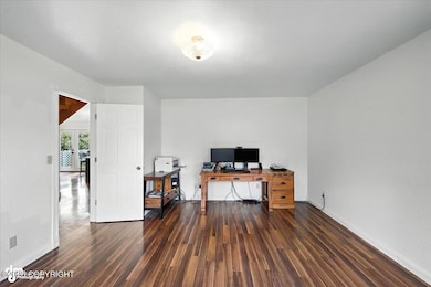
About This Home
Many upgrades in this charming Cape Cod style family home just minutes from city center! Perfect for a large family or avid entertainer, this home boasts a spacious, modern interior with a large, open great room ideal for gatherings and activities. The expansive fenced-in backyard provides plenty of space for outdoor fun and relaxation. Conveniently located for an easy commute! Come see today!
Home Details
Home Type
- Single Family
Est. Annual Taxes
- $676
Year Built
- Built in 1981
Lot Details
- 0.92 Acre Lot
- Fenced
- Private Yard
- Property is zoned R1, Single Family or Duplex
Parking
- 2 Car Attached Garage
- Attached Carport
Home Design
- Block Foundation
- Shingle Roof
- Composition Roof
- Asphalt Roof
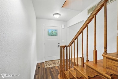
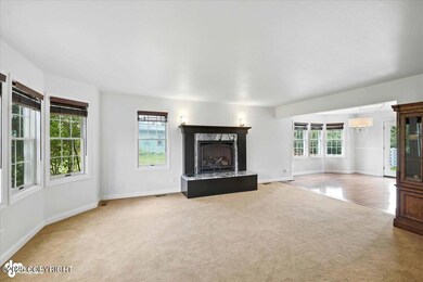
Interior Spaces
- 2,755 Sq Ft Home
- 2-Story Property
- Fireplace
- Family Room
- Den
- Fire and Smoke Detector
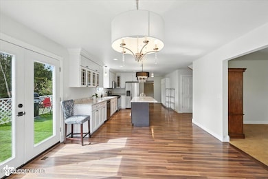
Kitchen
- Oven or Range
- Gas Cooktop
- Dishwasher
Bedrooms and Bathrooms
- 3 Bedrooms
Outdoor Features
- Fire Pit
- Shed
Schools
- Snowshoe Elementary School
- Wasilla Middle School
- Wasilla High School
Utilities
- Forced Air Heating System
- Private Water Source
- Septic Tank
Map
Home Values in the Area
Average Home Value in this Area
Tax History
| Year | Tax Paid | Tax Assessment Tax Assessment Total Assessment is a certain percentage of the fair market value that is determined by local assessors to be the total taxable value of land and additions on the property. | Land | Improvement |
|---|---|---|---|---|
| 2025 | $676 | $341,200 | $40,000 | $301,200 |
| 2024 | $676 | $334,500 | $40,000 | $294,500 |
| 2023 | $3,337 | $324,100 | $40,000 | $284,100 |
| 2022 | $3,210 | $295,800 | $40,000 | $255,800 |
| 2021 | $3,202 | $264,800 | $40,000 | $224,800 |
| 2020 | $3,122 | $250,300 | $40,000 | $210,300 |
| 2019 | $2,715 | $216,600 | $40,000 | $176,600 |
| 2018 | $2,988 | $239,400 | $40,000 | $199,400 |
| 2017 | $2,815 | $225,500 | $40,000 | $185,500 |
| 2016 | $2,767 | $228,000 | $40,000 | $188,000 |
| 2015 | $2,542 | $220,500 | $32,000 | $188,500 |
| 2014 | $2,542 | $215,800 | $32,000 | $183,800 |
Property History
| Date | Event | Price | List to Sale | Price per Sq Ft |
|---|---|---|---|---|
| 10/07/2025 10/07/25 | Pending | -- | -- | -- |
| 09/07/2025 09/07/25 | Price Changed | $495,000 | -0.8% | $180 / Sq Ft |
| 08/07/2025 08/07/25 | For Sale | $499,000 | -- | $181 / Sq Ft |
Purchase History
| Date | Type | Sale Price | Title Company |
|---|---|---|---|
| Interfamily Deed Transfer | -- | Accommodation |
Mortgage History
| Date | Status | Loan Amount | Loan Type |
|---|---|---|---|
| Closed | $195,000 | New Conventional |
Source: Alaska Multiple Listing Service
MLS Number: 25-10174
APN: 1628B04L004
Disclaimer: Certain information contained herein is derived from information provided by parties other than Homes.com. All information provided is deemed reliable, but is not guaranteed to be accurate and should be independently verified.
![]() The listing content relating to real estate for sale on this web site comes in part from the IDX Program of Alaska Multiple Listing Service, Inc. (AK MLS). Real estate listings held by brokerage firms other than Ten-X are marked with either the listing brokerage’s logo or the AK MLS logo and information about them includes the name of the listing brokerage. All information is deemed reliable but is not guaranteed and should be independently verified for accuracy. Copyright 2025 Alaska Multiple Listing Service, Inc. All rights reserved.
The listing content relating to real estate for sale on this web site comes in part from the IDX Program of Alaska Multiple Listing Service, Inc. (AK MLS). Real estate listings held by brokerage firms other than Ten-X are marked with either the listing brokerage’s logo or the AK MLS logo and information about them includes the name of the listing brokerage. All information is deemed reliable but is not guaranteed and should be independently verified for accuracy. Copyright 2025 Alaska Multiple Listing Service, Inc. All rights reserved.
- 1735 Harvest Loop
- 1740 W Pipestone Dr
- 1780 S Alliance Country Dr
- 1815 S Alliance Country Dr
- 1745 W Riffle St
- 1690 W Valley Ridge Dr
- L1 B1 S Corwin Ln
- L2 B1 S Corwin Ln
- 1701 S Corwin Ln
- 1610 W Valley Ridge Dr
- 1550 W Valley Ridge Dr
- 2150 S Endeavor St
- 1869 W Cashatt Ave
- 2450 S Knik Goose Bay Rd
- 1890 S Endeavor St
- 1880 S Endeavor St
- 2073 W Cashatt Dr
- 2025 W Cashhatt Ave
- 7503 S Knik Goose Bay Rd
- 1929 W Cashatt Ave
