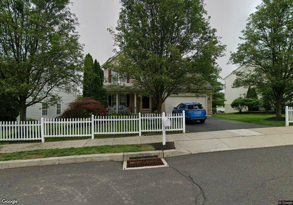
1841 Adams Way Jamison, PA 18929
Estimated Value: $616,000 - $692,000
3
Beds
3
Baths
1,616
Sq Ft
$405/Sq Ft
Est. Value
About This Home
This home is located at 1841 Adams Way, Jamison, PA 18929 and is currently estimated at $654,149, approximately $404 per square foot. 1841 Adams Way is a home located in Bucks County with nearby schools including Warwick Elementary School, Holicong Middle School, and Central Bucks High School - East.
Ownership History
Date
Name
Owned For
Owner Type
Purchase Details
Closed on
Feb 4, 2003
Sold by
Novelli Paul and Novelli Carrie B
Bought by
Novelli Carrie B
Current Estimated Value
Home Financials for this Owner
Home Financials are based on the most recent Mortgage that was taken out on this home.
Original Mortgage
$250,000
Interest Rate
5.25%
Mortgage Type
Purchase Money Mortgage
Purchase Details
Closed on
Mar 28, 2002
Sold by
Nvr Inc
Bought by
Novelli Paul and Novelli Carrie B
Home Financials for this Owner
Home Financials are based on the most recent Mortgage that was taken out on this home.
Original Mortgage
$250,000
Interest Rate
6.85%
Purchase Details
Closed on
Dec 6, 2001
Sold by
Country Club Knoll Associates Lp
Bought by
Nvr Inc and Ryan Homes
Create a Home Valuation Report for This Property
The Home Valuation Report is an in-depth analysis detailing your home's value as well as a comparison with similar homes in the area
Home Values in the Area
Average Home Value in this Area
Purchase History
| Date | Buyer | Sale Price | Title Company |
|---|---|---|---|
| Novelli Carrie B | -- | -- | |
| Novelli Paul | $276,465 | -- | |
| Nvr Inc | $84,000 | -- |
Source: Public Records
Mortgage History
| Date | Status | Borrower | Loan Amount |
|---|---|---|---|
| Previous Owner | Novelli Carrie B | $250,000 | |
| Previous Owner | Novelli Paul | $250,000 |
Source: Public Records
Tax History Compared to Growth
Tax History
| Year | Tax Paid | Tax Assessment Tax Assessment Total Assessment is a certain percentage of the fair market value that is determined by local assessors to be the total taxable value of land and additions on the property. | Land | Improvement |
|---|---|---|---|---|
| 2025 | $7,464 | $42,880 | $5,840 | $37,040 |
| 2024 | $7,464 | $42,880 | $5,840 | $37,040 |
| 2023 | $7,227 | $42,880 | $5,840 | $37,040 |
| 2022 | $7,146 | $42,880 | $5,840 | $37,040 |
| 2021 | $7,067 | $42,880 | $5,840 | $37,040 |
| 2020 | $7,067 | $42,880 | $5,840 | $37,040 |
| 2019 | $7,024 | $42,880 | $5,840 | $37,040 |
| 2018 | $7,024 | $42,880 | $5,840 | $37,040 |
| 2017 | $6,970 | $42,880 | $5,840 | $37,040 |
| 2016 | $6,970 | $42,880 | $5,840 | $37,040 |
| 2015 | -- | $42,880 | $5,840 | $37,040 |
| 2014 | -- | $42,880 | $5,840 | $37,040 |
Source: Public Records
Map
Nearby Homes
- 108 Eagle Ct Unit 105
- 1501 Deborah Ct Unit 2102
- 1834 Augusta Dr
- 2113 Redbud Ln
- 2807 Mountain Laurel Dr
- 1416 Angela Ct Unit 1004
- 3017 Dorchester St E Unit 125
- 1530 Spruce Ct
- 1515 Sugar Bottom Rd
- 2310 S Whittmore St
- 3138 E Brighton St Unit 37
- 2227 Sand Trap Rd
- 547 Mccarty Dr
- 2443 Sugar Bottom Rd
- 1249 Pebble Hill Rd
- 2080 Bedfordshire Rd
- 2127 York Rd
- 1554 Park Dr
- 1536 Park Dr
- 2294 Staffordshire Rd