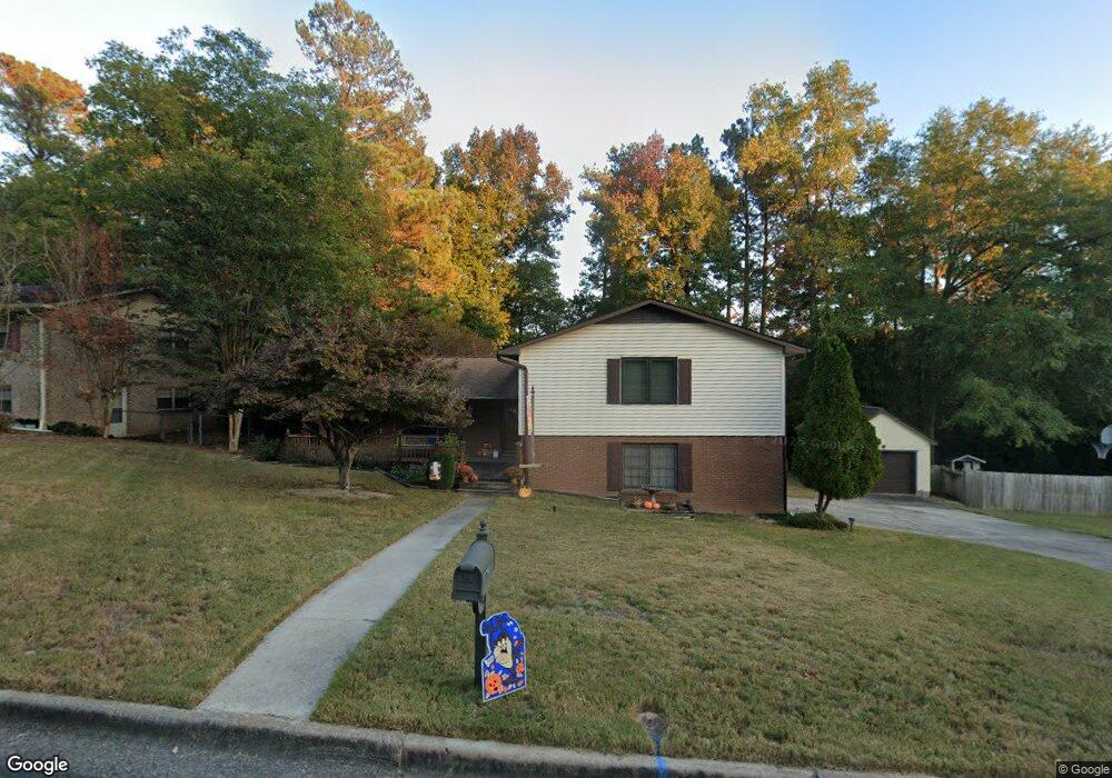
1841 Mountside Dr North Augusta, SC 29841
Estimated Value: $253,365 - $378,000
Studio
3
Baths
1,765
Sq Ft
$176/Sq Ft
Est. Value
About This Home
This home is located at 1841 Mountside Dr, North Augusta, SC 29841 and is currently estimated at $310,341, approximately $175 per square foot. 1841 Mountside Dr is a home located in Aiken County with nearby schools including Hammond Hill Elementary School, Paul Knox Middle School, and North Augusta High School.
Ownership History
Date
Name
Owned For
Owner Type
Purchase Details
Closed on
Apr 12, 2022
Sold by
Marsh James R
Bought by
James Robert Marsh And Katherine Anne Marsh F
Current Estimated Value
Home Financials for this Owner
Home Financials are based on the most recent Mortgage that was taken out on this home.
Original Mortgage
$50,000
Outstanding Balance
$47,043
Interest Rate
4.72%
Mortgage Type
Credit Line Revolving
Estimated Equity
$263,298
Purchase Details
Closed on
Apr 7, 2022
Sold by
Marsh James Robert and Ma Katherine
Bought by
Marsh James R and Marsh Katherine A
Home Financials for this Owner
Home Financials are based on the most recent Mortgage that was taken out on this home.
Original Mortgage
$50,000
Outstanding Balance
$47,043
Interest Rate
4.72%
Mortgage Type
Credit Line Revolving
Estimated Equity
$263,298
Purchase Details
Closed on
Dec 5, 2020
Sold by
Marsh James R and Marsh Katherine A
Bought by
Marsh James R and Marsh Katherine A
Create a Home Valuation Report for This Property
The Home Valuation Report is an in-depth analysis detailing your home's value as well as a comparison with similar homes in the area
Purchase History
| Date | Buyer | Sale Price | Title Company |
|---|---|---|---|
| James Robert Marsh And Katherine Anne Marsh F | -- | None Listed On Document | |
| Marsh James R | -- | None Listed On Document | |
| Marsh James R | -- | None Available |
Source: Public Records
Mortgage History
| Date | Status | Borrower | Loan Amount |
|---|---|---|---|
| Open | Marsh James R | $50,000 |
Source: Public Records
Tax History
| Year | Tax Paid | Tax Assessment Tax Assessment Total Assessment is a certain percentage of the fair market value that is determined by local assessors to be the total taxable value of land and additions on the property. | Land | Improvement |
|---|---|---|---|---|
| 2025 | $558 | $7,570 | -- | -- |
| 2023 | $559 | $7,570 | $1,596 | $157,160 |
| 2022 | $544 | $7,570 | $0 | $0 |
| 2021 | $545 | $7,570 | $0 | $0 |
| 2020 | $653 | $6,580 | $0 | $0 |
| 2019 | $653 | $6,580 | $0 | $0 |
| 2018 | $654 | $6,580 | $900 | $5,680 |
| 2017 | $621 | $0 | $0 | $0 |
| 2016 | $622 | $0 | $0 | $0 |
| 2015 | $566 | $0 | $0 | $0 |
| 2014 | $567 | $0 | $0 | $0 |
| 2013 | -- | $0 | $0 | $0 |
Source: Public Records
Map
Nearby Homes
- 1836 Mountside Dr
- 201 Cadada Ct
- 1883 Green Forest Dr
- 1969 Green Forest Dr
- 5065 Anna Creek Way Unit FB25
- 4027 Jane Ln Unit 10B
- 5085 Anna Creek Way Unit FB28
- 569 W Hugh St
- 5250 Anna Creek Way Unit Fb95
- 5236 Anna Creek Way Unit Fb96
- 5228 Anna Creek Way Unit Fb97
- 611 Caroline Ct Unit 8a
- 613 Caroline Ct Unit 8b
- 617 Caroline Ct Unit 8c
- 1818 Mountside Dr
- 623 Caroline Ct Unit 8d
- 5145 Anna Creek Way Unit Fb32
- 633 Caroline Ct Unit 7b
- 5153 Anna Creek Way Unit Fb33
- 639 Caroline Ct Unit 7c
- 1843 Mountside Dr
- 1839 Mountside Dr
- 1842 Mountside Dr
- 1845 Mountside Dr
- 1844 Mountside Dr
- 1837 Mountside Dr
- 168 Springwood Dr
- 1847 Mountside Dr
- 162 Springwood Dr
- 156 Springwood Dr
- 1839 Pisgah Rd
- 1846 Mountside Dr
- 1837 Pisgah Rd
- 1841 Pisgah Rd
- 148 Springwood Dr
- 1849 Mountside Dr
- 1848 Mountside Dr
- 176 Springwood Dr
- 1843 Pisgah Rd
- 1835 Mountside Dr
Your Personal Tour Guide
Ask me questions while you tour the home.