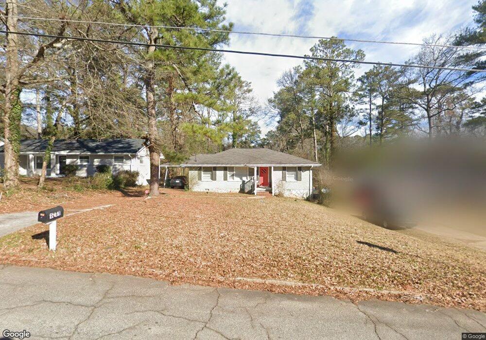
1841 Rosewood Rd Unit 1 Decatur, GA 30032
Estimated Value: $186,915 - $263,000
3
Beds
1
Bath
1,174
Sq Ft
$181/Sq Ft
Est. Value
About This Home
This home is located at 1841 Rosewood Rd Unit 1, Decatur, GA 30032 and is currently estimated at $212,479, approximately $180 per square foot. 1841 Rosewood Rd Unit 1 is a home located in DeKalb County with nearby schools including Snapfinger Elementary School, Columbia Middle School, and Columbia High School.
Ownership History
Date
Name
Owned For
Owner Type
Purchase Details
Closed on
Sep 2, 2014
Sold by
Garcia Hector
Bought by
Downie Alfreda
Current Estimated Value
Purchase Details
Closed on
Aug 30, 2005
Sold by
Atlantahousebuyer Inc
Bought by
Garcia Hector
Purchase Details
Closed on
Jul 5, 2005
Sold by
Hill Toshica
Bought by
Novastar Mtg
Purchase Details
Closed on
Dec 8, 2004
Sold by
Lofton Anita
Bought by
Hill Toshica
Home Financials for this Owner
Home Financials are based on the most recent Mortgage that was taken out on this home.
Original Mortgage
$145,000
Interest Rate
5.66%
Mortgage Type
New Conventional
Create a Home Valuation Report for This Property
The Home Valuation Report is an in-depth analysis detailing your home's value as well as a comparison with similar homes in the area
Home Values in the Area
Average Home Value in this Area
Purchase History
| Date | Buyer | Sale Price | Title Company |
|---|---|---|---|
| Downie Alfreda | $11,000 | -- | |
| Garcia Hector | -- | -- | |
| Atl House Buyer Inc | $95,000 | -- | |
| Garcia Hector | $96,100 | -- | |
| Novastar Mtg | $84,635 | -- | |
| Hill Toshica | $145,000 | -- |
Source: Public Records
Mortgage History
| Date | Status | Borrower | Loan Amount |
|---|---|---|---|
| Previous Owner | Hill Toshica | $145,000 |
Source: Public Records
Tax History Compared to Growth
Tax History
| Year | Tax Paid | Tax Assessment Tax Assessment Total Assessment is a certain percentage of the fair market value that is determined by local assessors to be the total taxable value of land and additions on the property. | Land | Improvement |
|---|---|---|---|---|
| 2025 | $3,493 | $69,560 | $24,346 | $45,214 |
| 2024 | $3,619 | $72,560 | $24,560 | $48,000 |
| 2023 | $3,619 | $67,440 | $24,560 | $42,880 |
| 2022 | $2,753 | $55,000 | $14,040 | $40,960 |
| 2021 | $2,372 | $46,320 | $14,040 | $32,280 |
| 2020 | $2,153 | $41,320 | $12,000 | $29,320 |
| 2019 | $1,984 | $37,480 | $12,000 | $25,480 |
| 2018 | $1,402 | $29,440 | $12,000 | $17,440 |
| 2017 | $1,392 | $20,920 | $3,200 | $17,720 |
| 2016 | $1,196 | $19,400 | $3,200 | $16,200 |
| 2014 | $964 | $13,800 | $3,200 | $10,600 |
Source: Public Records
Map
Nearby Homes
- 1884 Derrill Dr
- 1819 Rosewood Rd
- 1879 Rosewood Rd
- 3260 Glenco Dr
- 1882 Rosewood Rd
- 1852 Shamrock Dr
- 1857 Derrill Dr
- 1846 Shamrock Dr
- 1911 Rosewood Rd
- 1779 Rosewood Rd
- 1923 Rosewood Rd
- 3314 Glenco Dr
- 1986 Bandera Dr
- 1908 S Columbia Place
- 1990 Shamrock Dr
- 1932 Rosewood Rd
- 2361 Lynn Lris Dr
- 1870 S Columbia Place
- 3235 Glenwood Rd
- 1837 Rosewood Rd
- 1847 Rosewood Rd
- 1853 Rosewood Rd
- 1909 Shamrock Dr
- 1857 Rosewood Rd Unit 1
- 1827 Rosewood Rd
- 1840 Rosewood Rd Unit 1
- 1903 Shamrock Dr
- 1846 Rosewood Rd
- 1836 Rosewood Rd
- 1852 Rosewood Rd
- 1863 Rosewood Rd Unit 5
- 1863 Rosewood Rd
- 1856 Rosewood Rd
- 1826 Rosewood Rd
- 1914 Derrill Dr
- 1899 Shamrock Dr
- 1867 Rosewood Rd Unit 1
- 1913 Amesbury Dr
- 1908 Derrill Dr